-
2:13

Sunny today, but expect a wetter and warmer weekend
-
0:54

Goodwill ’Little Black Dress’ event raises funds for community...
-
1:45

Cheers Bar and Grill liquor license renewed following controversy
-
2:40

Kyle Rudolph weighs in on fellow Irish, Joe Alt, ahead of NFL...
-
0:58

Contractors prepare bids for multi-million-dollar Four Winds...
-
3:11

Caleb Williams and Marvin Harrison Jr. weigh in on upcoming draft
-
3:18

New settlement with Indiana allows Landmark to apply for recertification
-
2:32

NFL Analysts break down Joe Alt’s stock
-
1:21

Fair Thursday wet / windy weekend
-
2:52

Union Township sues UNAS over ambulance stripped for parts
-
1:32

Bridging the healthcare gap in Michiana
-
1:44

Drier but cooler weather returns for Wednesday

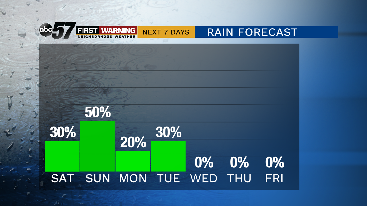
Isolated showers and thunderstorms are possible starting Friday evening. Severe weather and heavy rain are possible but that threat is also isolated.
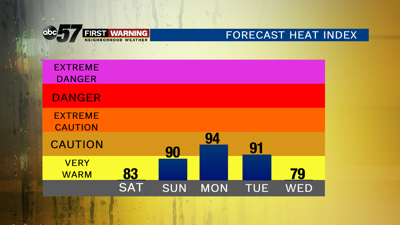
A steamy and stormy pattern will last through the weekend with a chance of showers and thunderstorms Saturday and Sunday, Sunday looking to be the more likely day for rain. The overall severe threat is low but downpours are possible as are some isolated wind gusts. Temperatures rise through the weekend, peaking near 90 on Monday. The heat breaks by the middle of next week.
Tonight: Mostly cloudy, isolated showers and storms, low of 64.
Saturday: Scattered showers and storms, high of 82.
Sunday: Scattered showers and storms, high of 86.
Monday: Partly cloudy, isolated showers and storms, high of 88.