Some sunshine Saturday; snow returns Sunday evening


Other than a few more light lake effect flurries this morning, it’s a fair start to the weekend. We picked up just enough lake effect snow overnight that you’ll need to dust off your car this morning, but there are minor impacts on the roads.
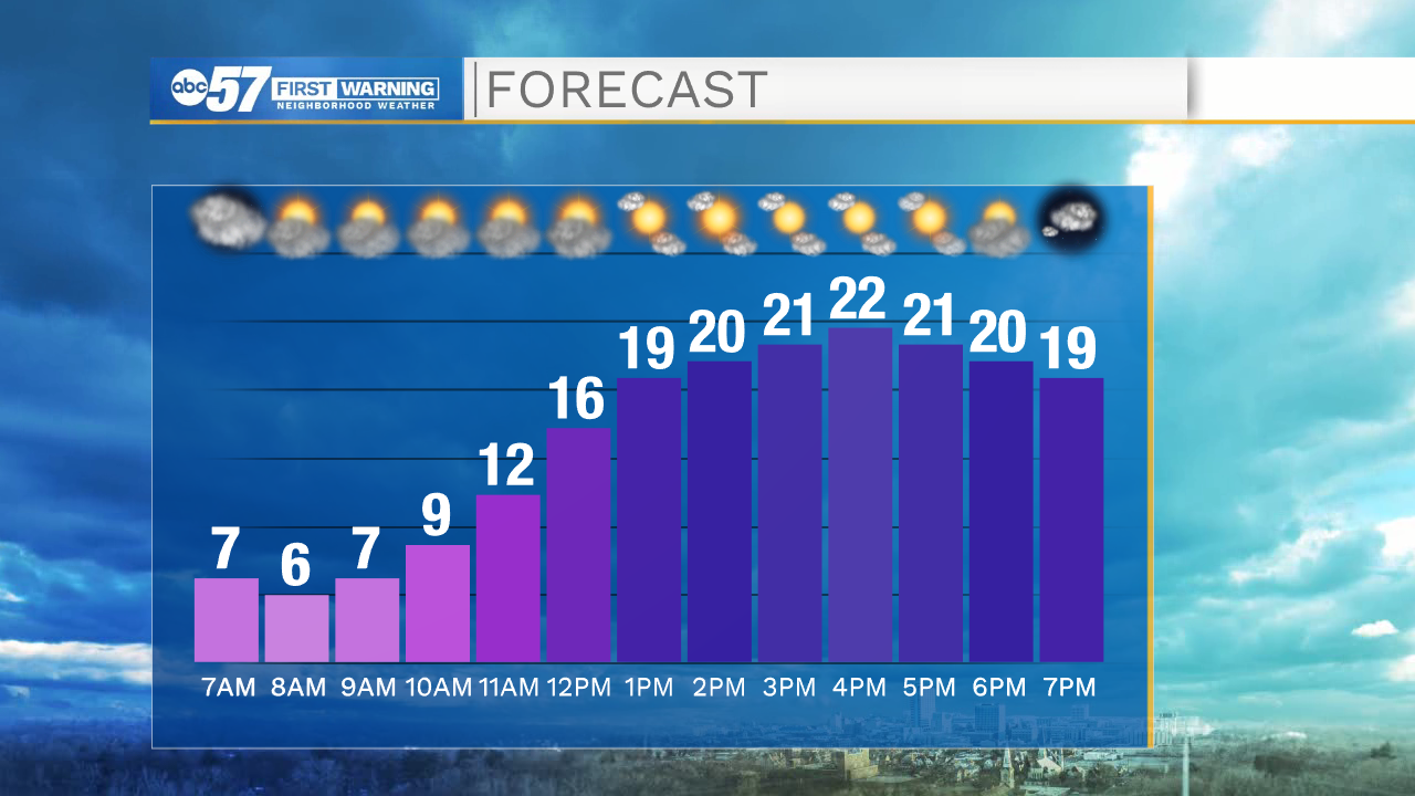
Skies clear through today, and you can enjoy a mix of clouds and sunshine by the afternoon. Temperatures are still below normal – the high is just 22. Overnight skies stay partly cloudy early, so temperatures drop back into the low teens.
There’s a big difference in temperature tomorrow, with a high in the mid 30s.
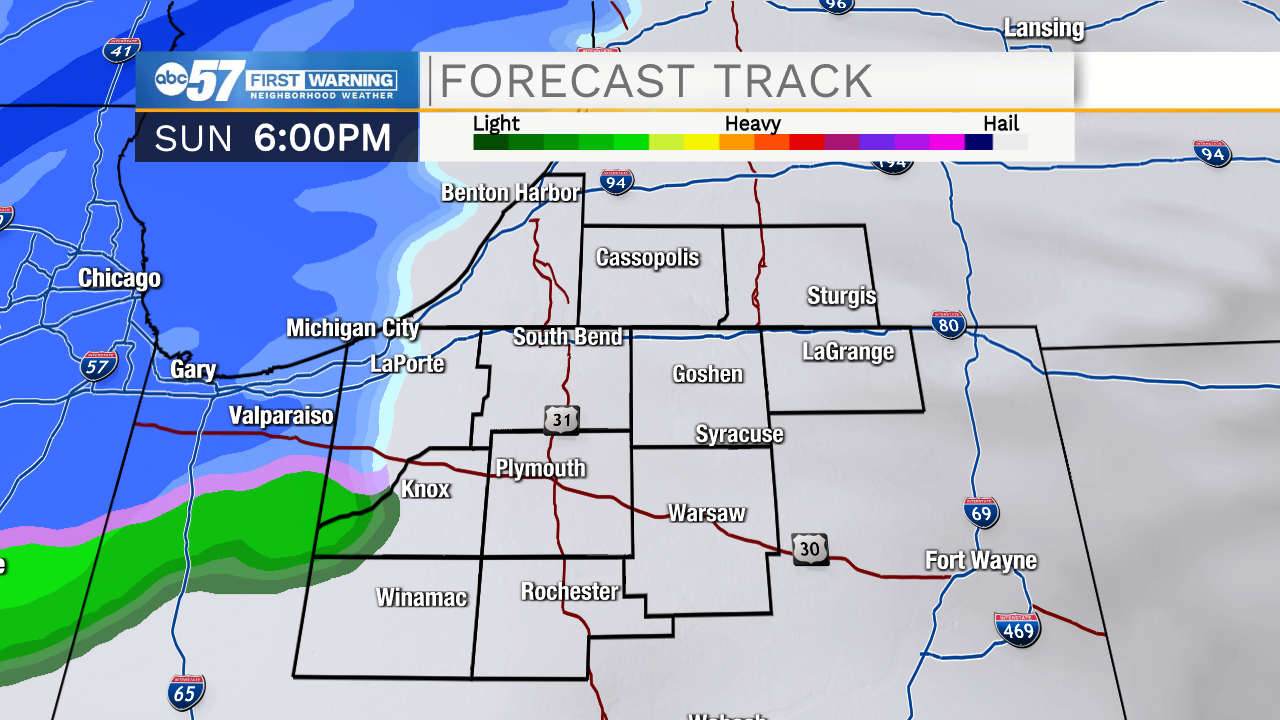
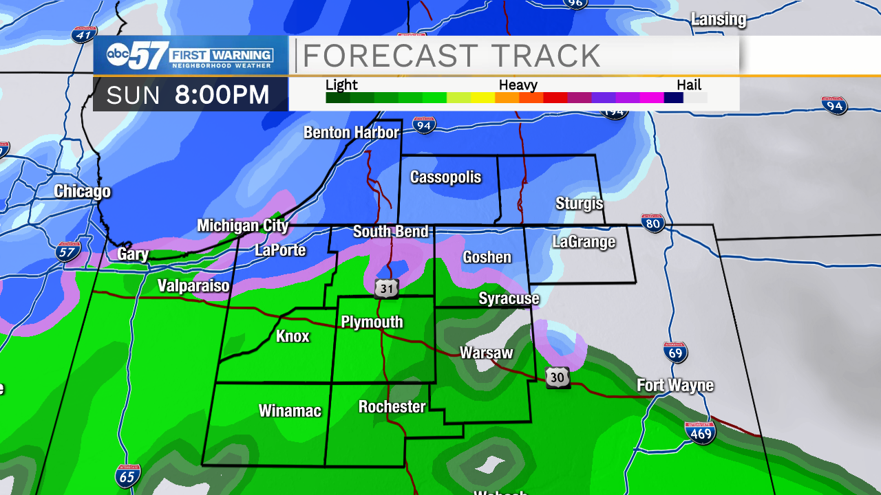
Precipitation starts tomorrow evening, possibly as a wintry mix / sleet before turning to snow overnight.
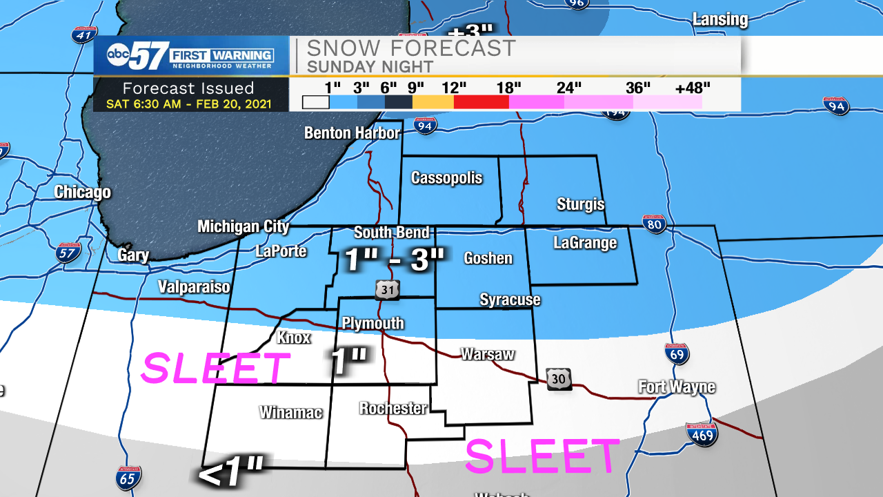
Parts of Michiana could see up to 3” of snow Sunday night, but most will see lower totals.
Monday morning there are a few snow showers early, but the commute will likely be a bit slick.
Temperatures are more reasonable for February this work week. Most days will be in the mid 30s, but a few climb near 40 degrees. Another welcome change – for the most part, the week should stay quiet.
Today: Flurries early. Mostly sunny afternoon. High 22.
Tonight: Partly cloudy. Low 14.
Sunday: Mostly cloudy, windy. PM snow. High 34.
Monday: Few AM snow showers, slick. Mostly cloudy day. High 34.