
-
0:54

Goodwill ’Little Black Dress’ event raises funds for community...
-
1:45

Cheers Bar and Grill liquor license renewed following controversy
-
2:40

Kyle Rudolph weighs in on fellow Irish Joe Alt ahead of the NFL...
-
0:58

Contractors prepare bids for multi-million-dollar Four Winds...
-
3:11

Caleb Williams and Marvin Harrison Jr. weigh in on upcoming draft
-
3:18

New settlement with Indiana allows Landmark to apply for recertification
-
2:32

NFL Analysts break down Joe Alt’s stock
-
1:21

Fair Thursday wet / windy weekend
-
2:52

Union Township sues UNAS over ambulance stripped for parts
-
1:32

Bridging the healthcare gap in Michiana
-
1:44

Drier but cooler weather returns for Wednesday
-
2:32

County Council asks questions on 900-acre Granger rezoning and...

More winter weather Tuesday evening through Wednesday morning. Steady light snow, a range of 1” to 3” in combination with already slick conditions and wind gusts up to 45 mph will continue to make travel hazardous.
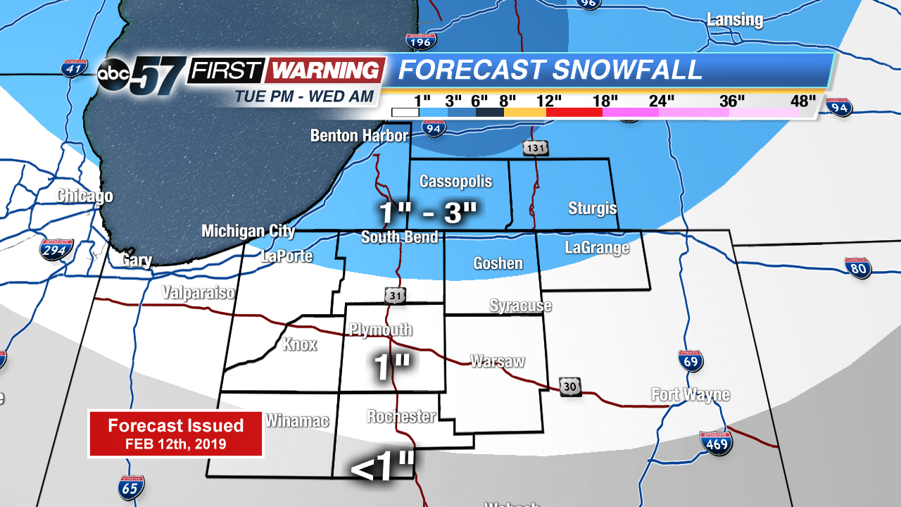
Snow comes to an end Wednesday morning, blustery conditions will continue as temperatures struggle to reach 30. Temperatures take a swing upwards Thursday into the 40s as rain returns, changing back to snow Friday. Icing is less of a concern Friday morning as pavement temperatures will have warmed above freezing.
Tonight: Snow showers, low of 22.
Wednesday: AM lake effect snow, cold and breezy, high of 30.
Thursday: Mostly cloudy, rain likely by the evening, high of 44.
Friday: Morning snow showers, temperatures fall from 30.
Sign up for the ABC 57Newsletter