Snow to wintry mix and then turning bitter cold

-
2:28

Public forum hosted by John Glenn High School students
-
3:34

Kickoff preview with ABC57’s Allison Hayes
-
0:57

Completion of Martin Luther King Jr. Dream Center one step closer
-
0:36

Niles High School students network with local professionals
-
3:59

Political group asks Indiana Democrats to vote in Republican...
-
3:01

New Buffalo Area Schools to build workforce housing
-
2:37

City seeks feedback for final Potawatomi Park plan
-
7:27

Center for the Homeless hosting Dancing With Our Stars
-
2:10

More wet weather arriving later tonight, but sunnier skies after
-
3:16

Public input on the proposal to restart the Palisades Nuclear...
-
1:35

Dari Fair opened Wednesday for 2024 season, temperatures cool...
-
1:22

Another round of rain, then a cool weekend

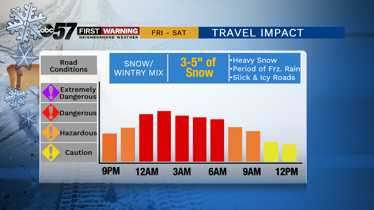
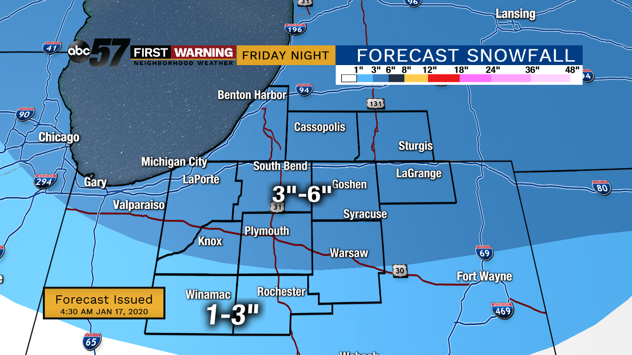
Friday, January 17th, 2020
Today starts out quiet but starting around 9 pm, snow showers will move in across the area. Snow could be heavy at times with a quick 3-4" of snow for most. Around 3 AM, snow will turn to sleet then freezing rain. Around 8-9 am Saturday, it should all turn to rain as temperatures rise. This will help melt any snow and ice on the roads and will compact the snow on the grassy surfaces. The sharp drop in temperatures starts Saturday night which will generate lake effect snow. This could lead to slick spots Sunday morning as lake effect snow continues through Monday. You'll need to pack on the layers too, daytime highs are in the teens Sunday!
Today: Mostly cloudy, snow late. High of 30.
Tonight: Snow showers, heavy at times. Temperatures rising from 30.
Saturday: Wintry mix. High of 40.
Sunday: Lake effect snow showers. High of 16.