Snow showers and falling temperatures tonight

-
3:34

Kickoff preview with ABC57’s Allison Hayes
-
0:57

Completion of Martin Luther King Jr. Dream Center one step closer
-
0:36

Niles High School students network with local professionals
-
3:59

Political group asks Indiana Democrats to vote in Republican...
-
3:01

New Buffalo Area Schools to build workforce housing
-
2:37

City seeks feedback for final Potawatomi Park plan
-
7:27

Center for the Homeless hosting Dancing With Our Stars
-
2:10

More wet weather arriving later tonight, but sunnier skies after
-
3:16

Public input on the proposal to restart the Palisades Nuclear...
-
1:35

Dari Fair opened Wednesday for 2024 season, temperatures cool...
-
1:22

Another round of rain, then a cool weekend
-
4:33

Should Indiana’s abortion records be public?

This afternoon temperatures will warm into the mid 30s under mostly cloudy skies. Wind gusts this afternoon will range from 30-35mph. Around 3pm this afternoon rain showers will move into our western counties. Rain will turn over to snow by late afternoon and evening. We could see 1-3inches accumulate into tomorrow morning. The bigger concern will be the falling temperatures during the overnight hours. Temperatures will quickly drop into the teens, causing any wet roadways to flash freeze. Leave extra time for your Friday morning commute. Lake effect snow showers are possible tomorrow and Saturday, primarily in our northern Michiana counties. More snow will develop and move into Michiana Sunday and Monday night. Low temperatures next week look to stay in the single digits with high temperatures only hitting the teens.
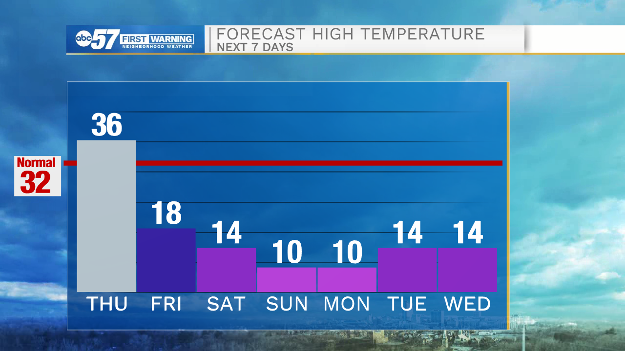
Today: Afternoon mixed wintry precip/snow. High 36.
Tonight: Snow showers/flash freeze. Low 14.
Tomorrow: Mostly cloudy/snow showers north. High 18.
Saturday: Lake effect snow showers. High 14.