Heavy rain and flood threat overnight.

-
0:25

Humane Society of St. Joseph County holds microchip clinic
-
2:58

Pulaski County Community Foundation provides support for childcare...
-
3:14

Green wave of economic growth in Michigan from marijuana dispensaries
-
1:28

Brisk, breezy but beautiful weekend
-
1:52

While the rain is over, the cooling temperatures are not
-
2:28

Public forum hosted by John Glenn High School students
-
3:34

Kickoff preview with ABC57’s Allison Hayes
-
0:57

Completion of Martin Luther King Jr. Dream Center one step closer
-
0:36

Niles High School students network with local professionals
-
3:59

Political group asks Indiana Democrats to vote in Republican...
-
3:01

New Buffalo Area Schools to build workforce housing
-
2:37

City seeks feedback for final Potawatomi Park plan

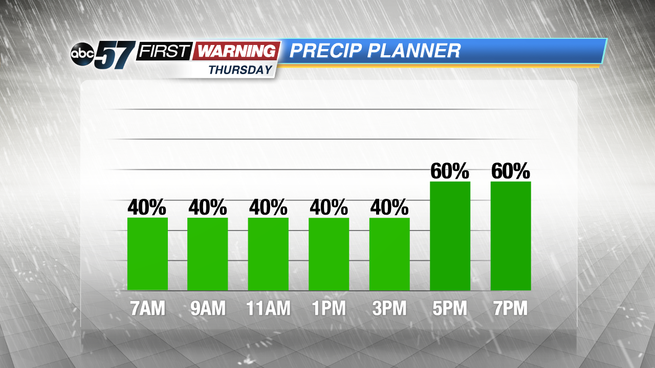
Update 10 PM -- After strong storms, heavy rain continues overnight. Storms could be loud but are unlikely to be severe. Be aware of flooded roads or downed limbs in the morning.
The chance of showers and thunderstorms increases overnight through Thursday morning. A few cells could produce strong wind gusts or hail.
Showers and thunderstorms are likely through Thursday and into Friday morning. This is much needed rain that could bring more than an inch in total with higher amounts under thunder cells. The forecast stays muggy through Friday morning, before a front clears skies and drops the humidity Friday afternoon. The weekend looks mostly fair with a small chance of rain Sunday.
Tonight: Chance of showers and storms, low of 64.
Thursday: Showers and thunderstorms likely, high of 76.
Friday: Showers likely through noon, high of 70.
Saturday: Sunny, high of 70.