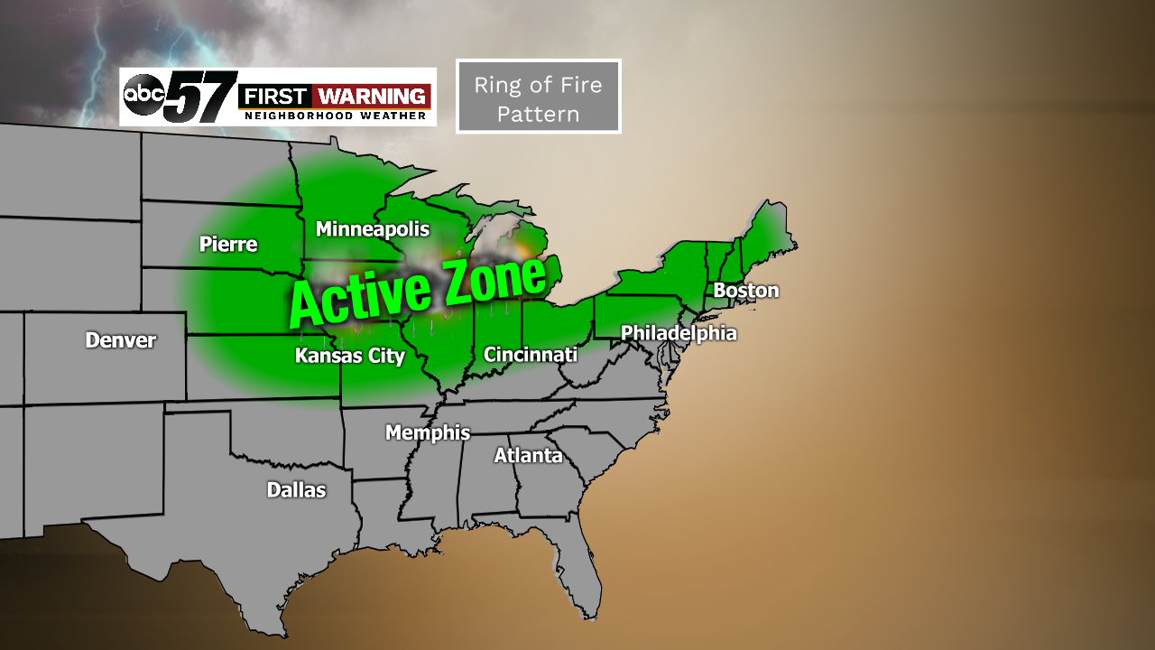
"Ring of fire" pattern to bring waves of storms, intense heat
The pattern is about to get very summer-like here in the Midwest and Great Lakes. So if you're a fan of heat, humidity and multiple thunderstorm chances, this is for you.
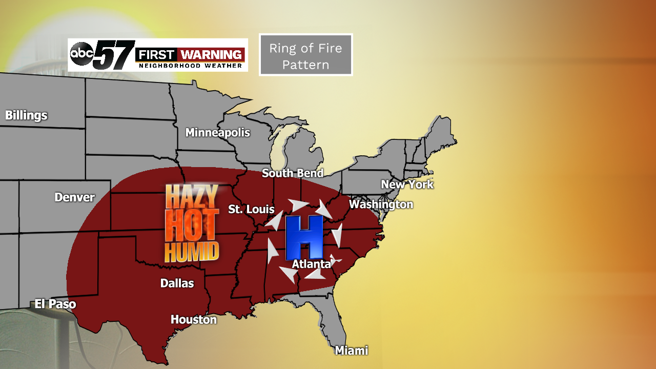
In short, it's a pattern that allows a typically very large area to experience intense heat for a period of at least 2-3 days. In this case, an area of high pressure will anchor itself near Charlotte, North Carolina, allowing most locations east of the Rocky Mountains and south of I-90 to see big-time heat and humidity this weekend into next week.
 Feels like temperatures thru next Tuesday.
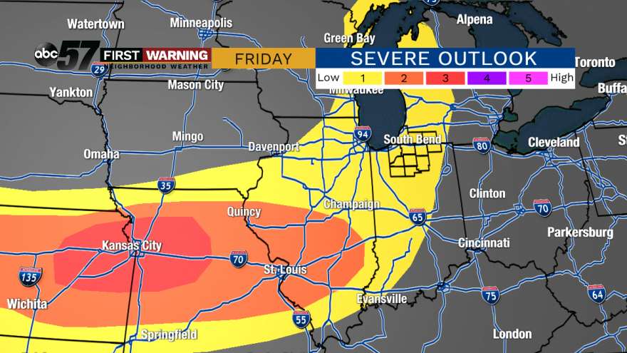
It's often difficult to pinpoint the exact timing and intensity of rain and storms in this type of pattern, so be sure to keep an eye to the sky and check the radar often. Just know that it's possible to see storms at any point.
By the time we get to next Wednesday, somebody could wind up seeing 2-3" of rain. There's also a low severe weather risk with any thunderstorms that move through. Strong, gusty winds, small hail, lightning, and heavy rain are all potential hazards with any storms.
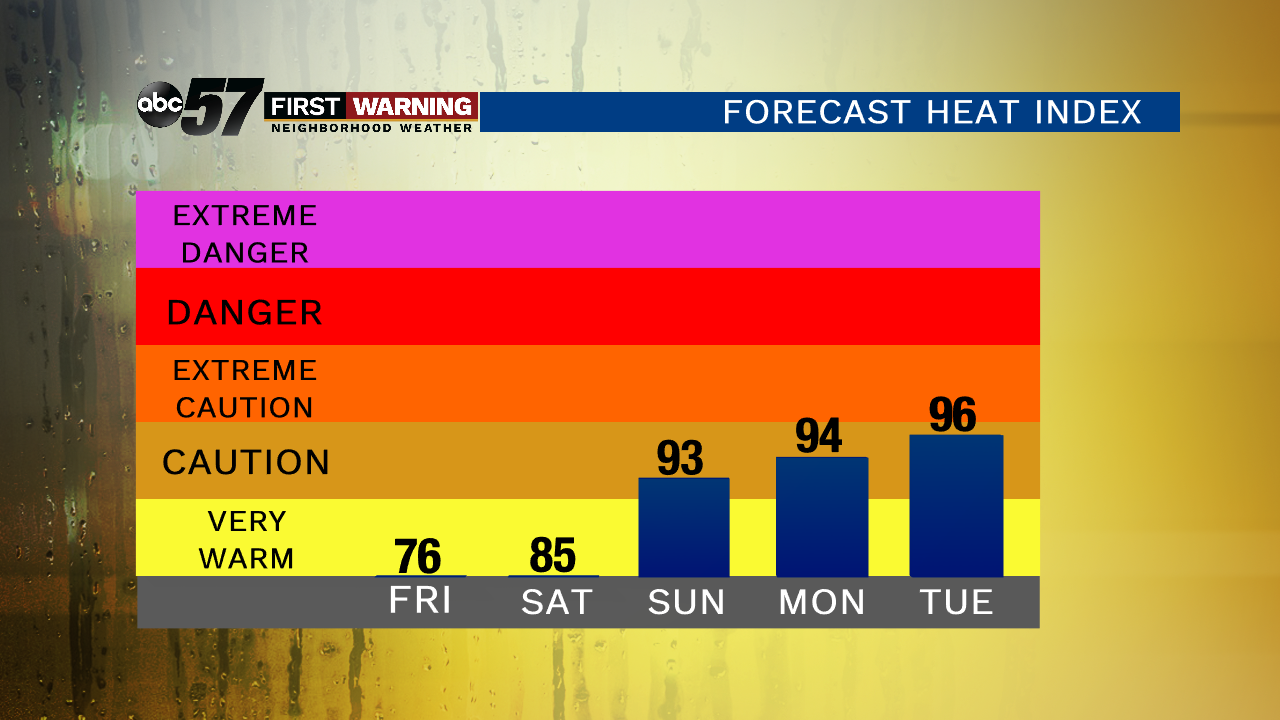
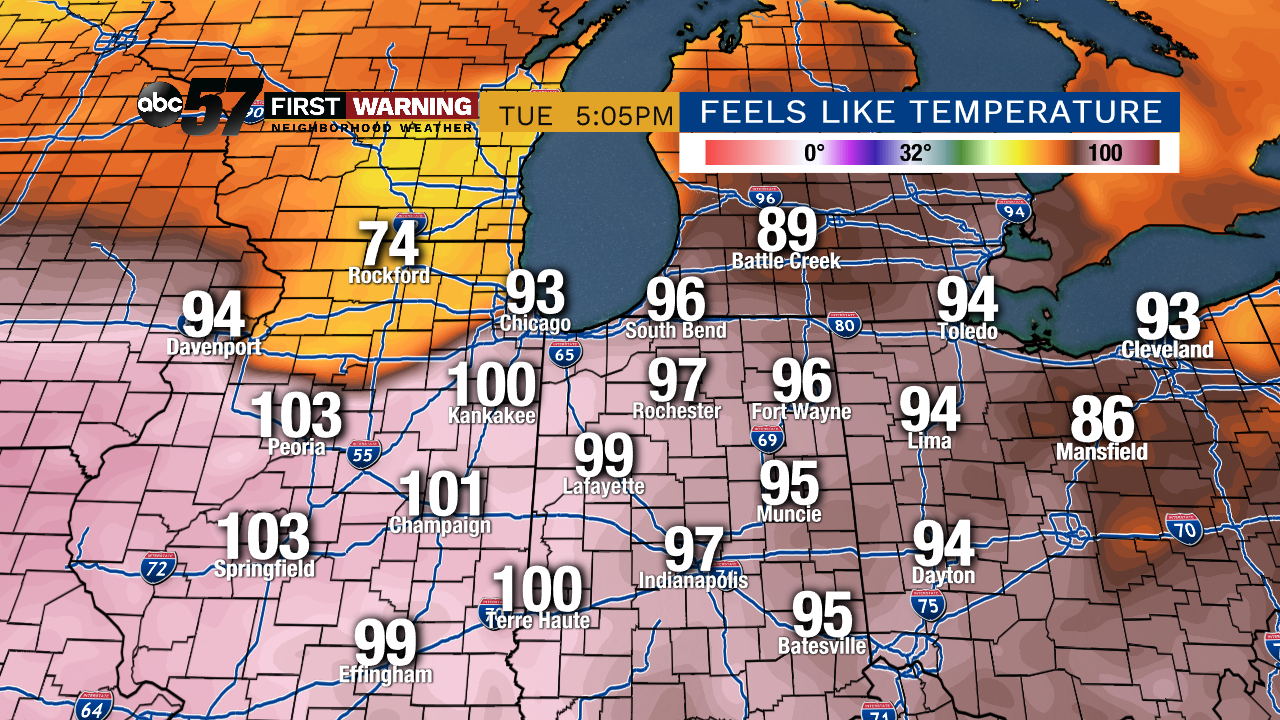 Potential heat index temperatures next Tuesday. Sunday and Monday will have similar values.
Adding in the humidity, it will feel like it's in the low and middle 90s Sunday, Monday and Tuesday. If we see enough sun on any of those afternoons, it's possible we see heat index values rise into the upper 90s.
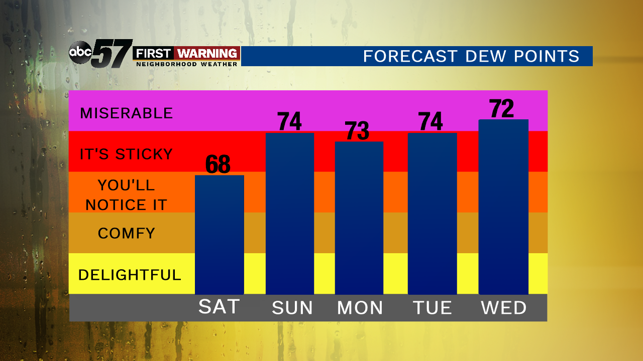 Maximum dew points thru next Wednesday.
If you have plans to be out and about over the next several days, be sure to not only watch for storms, but stay hydrated and safe in the heat!