Remnants of Gordon bringing a wet weekend


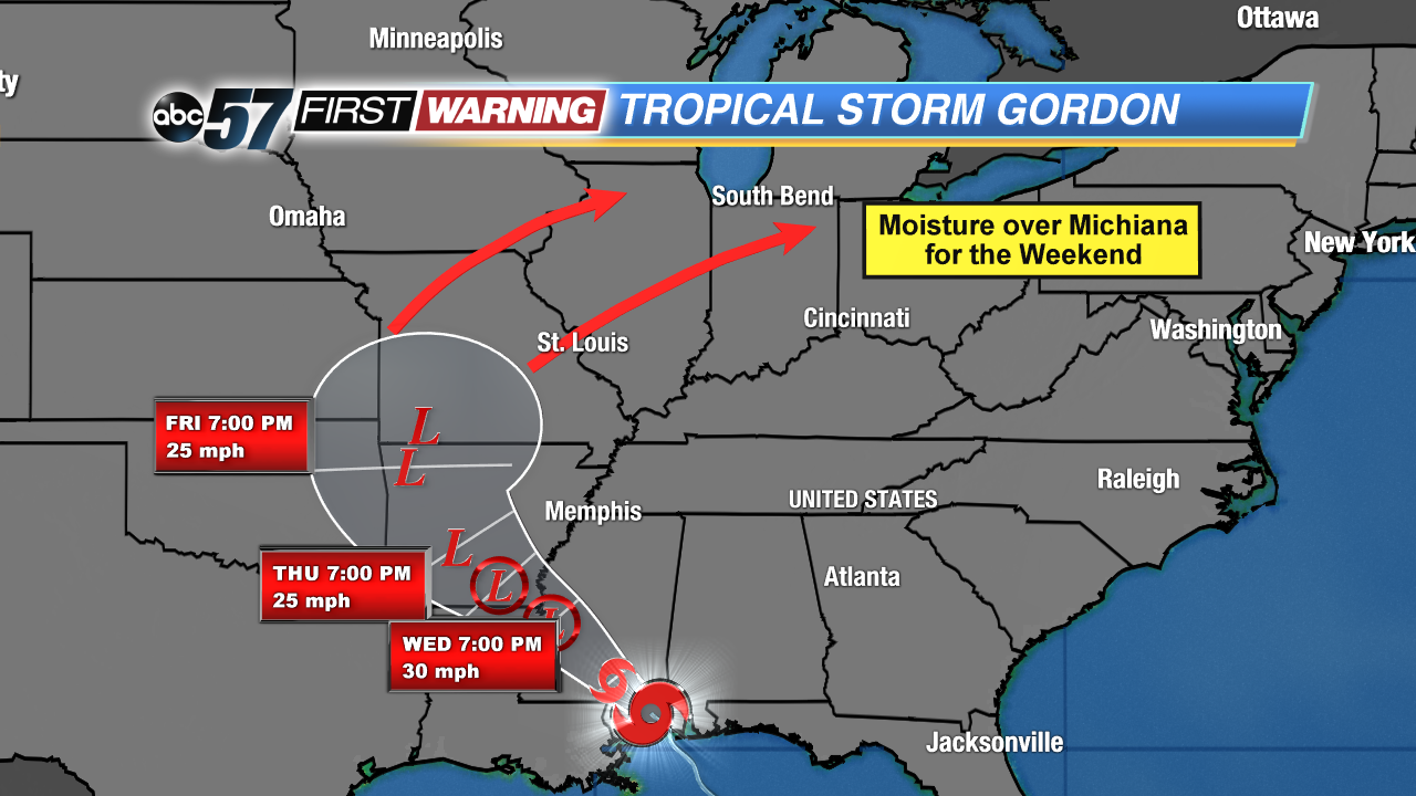
Tropical Depression Gordon continues to move towards the north and west, but it has slowed down quite a bit since making landfall around 8 pm eastern last night. It never became a hurricane, but the Gulf Coast has been experiencing tropical storm-force wind speeds and dangerous storm surge. And early this morning, Gordon is still bringing those high winds farther inland. A current look at the storm shows the wind speed around 35 mph, but that is expected to drop throughout the day. It's expected to become a post-tropical depression by Thursday evening. For today and beyond, hurricane and tropical storm warnings are fading away and are being replaced by flash flood watches and warnings.
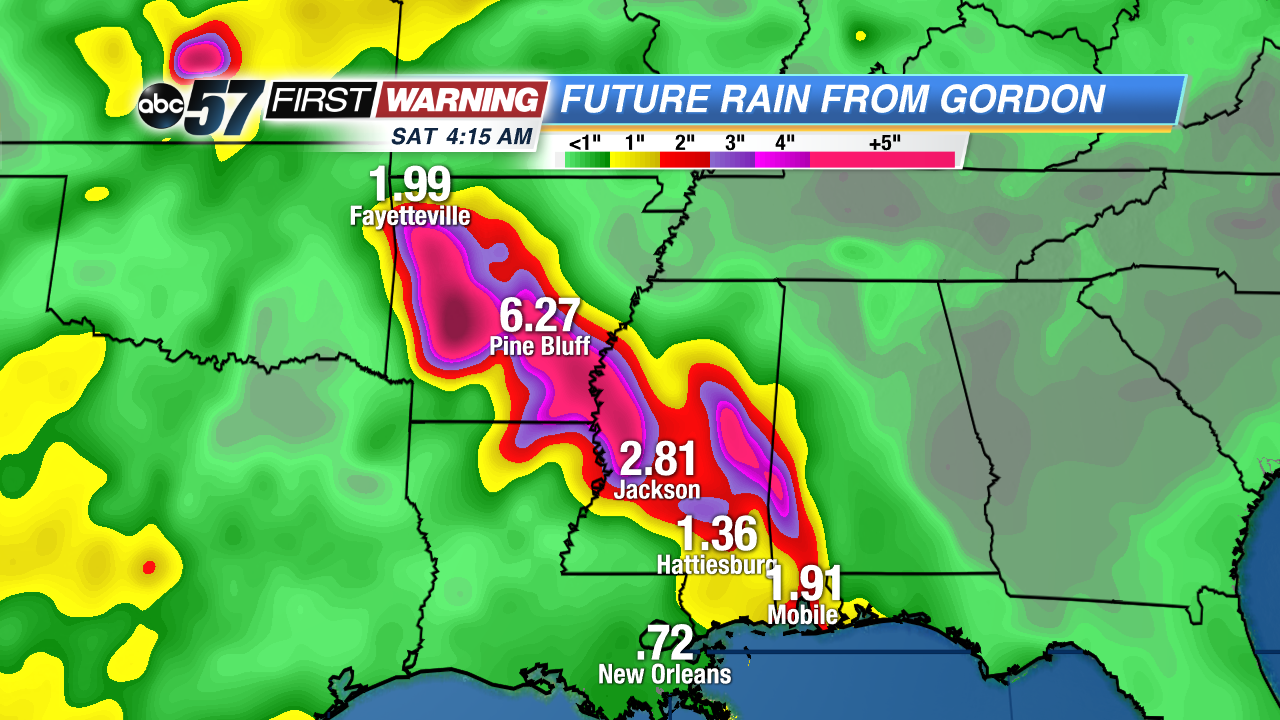
As the storm continues to slow down and weaken, the focus will be shifting to the likelihood of flash flooding. Just take a look at these rainfall totals for the southern states over the next couple of days! Flash flooding is likely with totals around 4 to 6 inches in Arkansas.
Gordon is still a tropical storm but it'll run out of steam quickly over the next couple of days.Gordon will continue to slide northwest until it loses all tropical characteristics and becomes a remnant low Thursday evening. But notice the direction it takes. High pressure to our north and east will help steer the system our way for the weekend. We'll get tons of tropical moisture sweeping up from the south as a result and rain chances will go up.
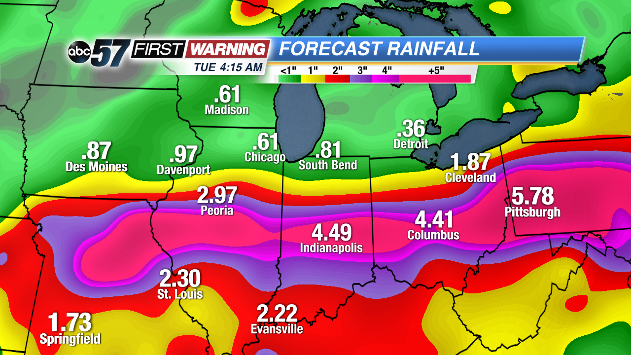
At this point, it is still tough to say exactly who will see the rain and how much. Both of our most frequently used long-range models shows two completely different outcomes for Michiana. The GFS, at this point, keeps the heaviest of the rain well south of our southern counties, coating the Ohio River Valley in 3 or more inches by early Monday.
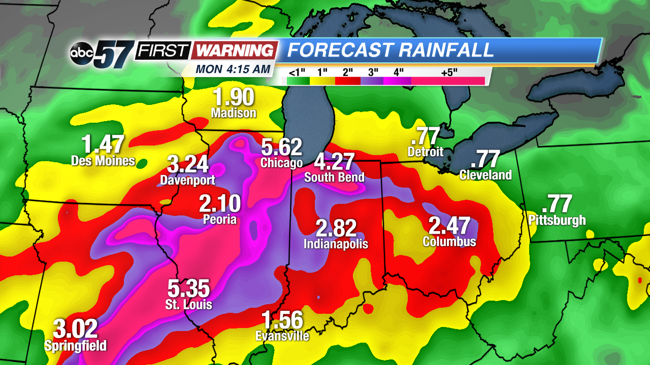
The European model on the other hand dumps that heavy rain right over us and areas to the south around the same time frame.
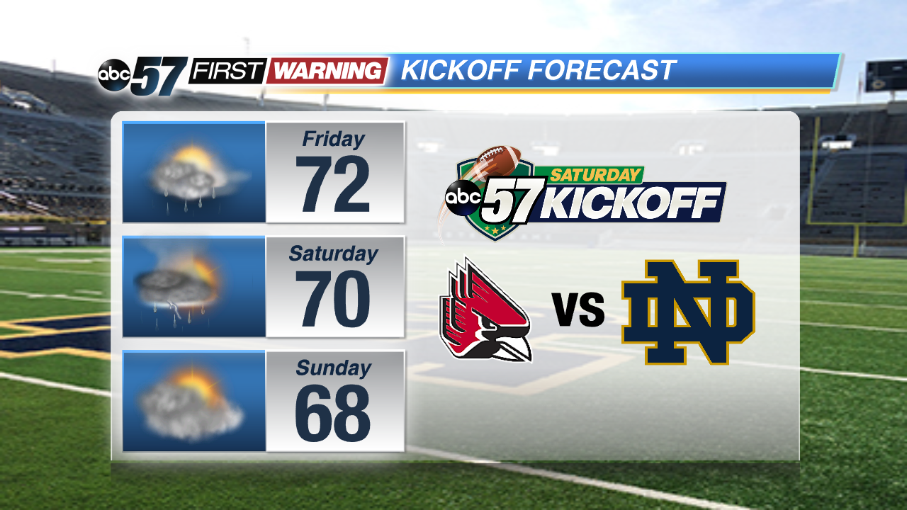
While the details are being ironed out, one thing is clear: Expect on-and-off rain showers this weekend. That means the forecast for the Notre Dame vs. Ball State game continues to look wet. So have that poncho if you're planning on heading to campus this Saturday.