Rain continues through Tuesday, minor flooding possible

-
2:32

County Council asks questions on 900-acre Granger rezoning and...
-
0:56

Notre Dame women’s basketball team holds end-of-season awards...
-
0:45

Idea Week kicks off with networking at launch party
-
2:59

SBPD officer takes in six puppies while SBARC remains on Parvo...
-
1:45

How rain is hampering planting progress
-
2:43

From classrooms to rental units in Chikaming Township
-
1:47

Cooler and drier midweek, milder and wetter weekend
-
2:36

Aspiring chefs are cultivating their dreams at Ivy Tech
-
1:40

Rainy and breezy Tuesday
-
0:58

Hockey team hosts ’Rally for Rudy’ car wash
-
1:06

South Bend School Board of Trustees reviewing the code of conduct
-
2:33

Newly annexed land in Mishawaka could see a Gurley Leep auto...

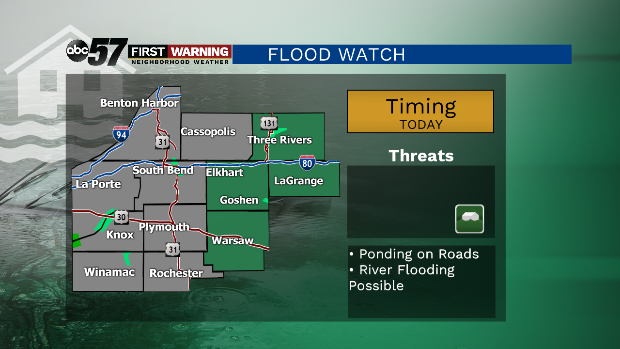
Monday, May 18th, 2020
A Flood Watch continues through this evening as scattered rain showers add up through today. Minor flooding is possible, especially along river beds and low lying areas. This low pressure system gets stuck over our area for Tuesday as well all due to Tropical Storm Arthur halting it's movement east. We should finally start to see clouds break on Wednesday with more sunshine Thursday.
As we head into Memorial Day Weekend, there is a chance of isolated storms Friday night. Otherwise the weekend looks fairly bright with daytime highs reaching the low 80s by Sunday. Memorial Day itself is damp as scattered showers and storms roll through the area.
Today: Rain early, turning to lighter showers later. High of 68.
Tonight: Scattered light rain. Low of 58.
Tuesday: Scattered showers. Mostly cloudy. High of 65.
Wednesday: Partly to mostly cloudy. High 68.