Quiet Wednesday; timing of snow earlier on Thursday


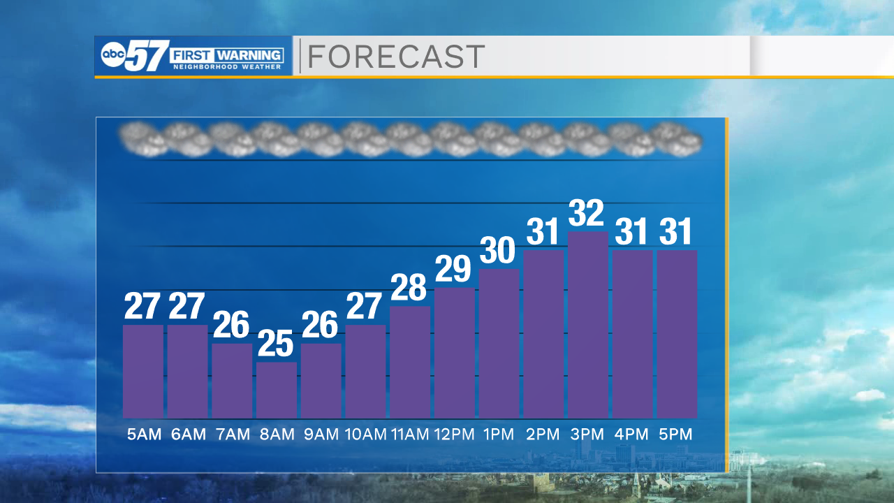
Wednesday is a cloudy day with temperatures in the lower 30s. If you need to stock up on groceries or make any last minute holiday errands, do them today.
Winter weather moves into the area to end the week. Thursday precipitation starts as a rain/snow mix. A bit of freezing rain is possible, but little to no ice accumulation is expected.
By Thursday evening, precipitation changes to all snow, which starts to accumulate. Snow continues Thursday night into Friday.
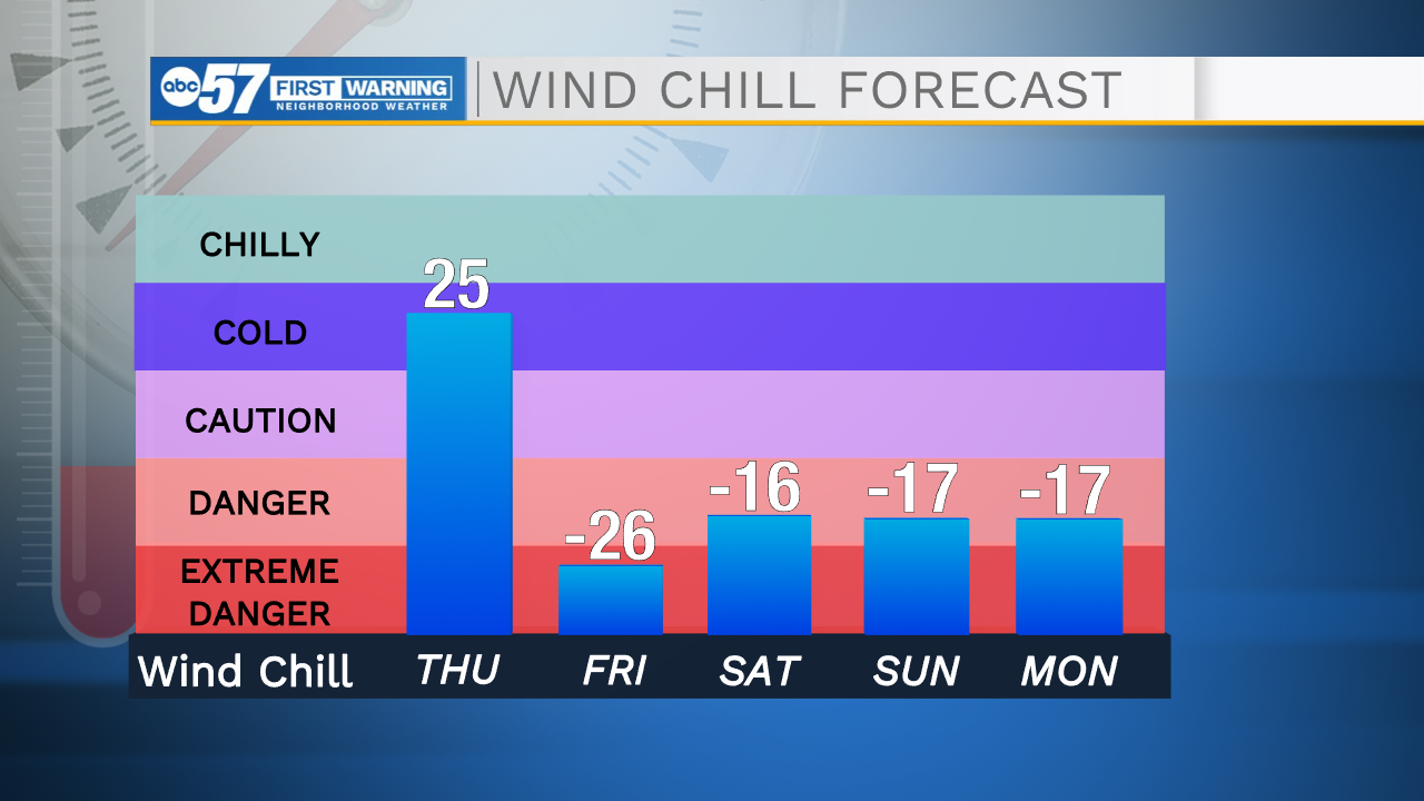
On Friday, the combination of heavy snow and wind (gusts over 50 mph) will create dangerous roads with whiteout conditions at times. It's best to avoid travel Friday.
Wind chills Friday will remain below zero the entire day, and at some points could dip as low as -25F.
Saturday the system snow moves out, but lake effect snow showers continue.
The cold (wind chills below zero) remains for the entire weekend.
The snow should stop by Christmas on Sunday.
A few more showers are possible Monday morning, then temperatures begin to regulate a bit each day next week.
Wednesday: Cloudy. High 32.
Tonight: Cloudy. Low 29.
Thursday: Rain/snow. Flash freeze overnight, with all precip changing to snow late. High 36.
Friday: Heavy snow and strong winds. Dangerous travel likely. Wind chills below zero. High 12.