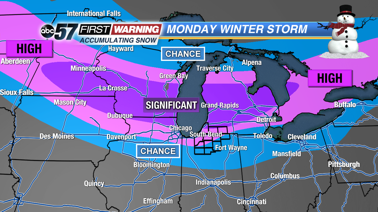
While there are a few chances of minor snowfall this weekend, the main event is set to arrive Monday morning. A strong area of low pressure will tap into moisture from the Gulf of Mexico and have the potential to drop a significant amount of snow across parts of the Northern Plains, Midwest and Great Lakes between Sunday and Tuesday morning. As is the case with all winter storms, the exact path of the low pressure will determine who sees the heaviest snow totals.
As of Friday afternoon, Michiana sits in a precarious spot. Go figure. We will be riding a fine line between a significant snowfall and much less snow. It all depends on how much warmth gets pulled into Northern Indiana. If the low tracks along I-94, we will be just warm enough to see temperatures rise into the lower 30s. That could mean mixing issues and less snow. If the low tracks along or south of U.S. 6, most of Michiana would stay in the cold sector of the system and see much more snow.
It is with medium-high confidence that at least 2-4" of snow will fall throughout the day Monday north of U.S. 30. However, the zone with the absolute best chance of seeing a big-time impactful snowfall sits along and north of a line from Rockford, Illinois, to Flint, Michigan. In other words, north of the Indiana-Michigan border.
3 different forecast models' snowfall projections thru Tuesday morning.
When looking at our three main forecast models, there is an obvious outlier. Scenario 3 (the European model) has the heavy axis of snow impacting Michiana. The other two scenarios (the NAM and GFS models) show much less in the snowfall department. There's a lot more that goes into snow forecasting then simply looking at snowfall projections. That's why the map shown at the top of this article may not look exactly like any one forecast model. Things can and will change over the next 1-2 days, but this is a good first outlook as we gear up for yet another winter storm.


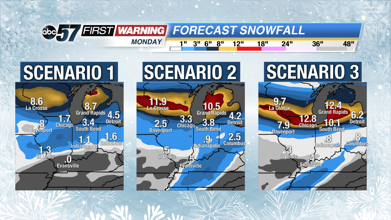 3 different forecast models' snowfall projections thru Tuesday morning.