Much needed rain tonight, low severe threat

-
3:16

Public input on the proposal to restart the Palisades Nuclear...
-
1:35

Dari Fair opened Wednesday for 2024 season, temperatures cool...
-
1:22

Another round of rain, then a cool weekend
-
4:33

Should Indiana’s abortion records be public?
-
2:52

Trailblazing promotions at the South Bend Fire Department
-
1:30

Downtown South Bend and Notre Dame to see improved connectivity
-
1:44

Storm threat today holds relatively low severe risk
-
0:30

Officials share opioid settlement funding plan
-
1:04

Bonneyville Mill opens for the 2024 season
-
0:32

Increase in federal funding coming to improve local hiking and...
-
3:07

Gun violence on the decline in South Bend
-
1:18

Severe weather could visit Midwest again Wednesday

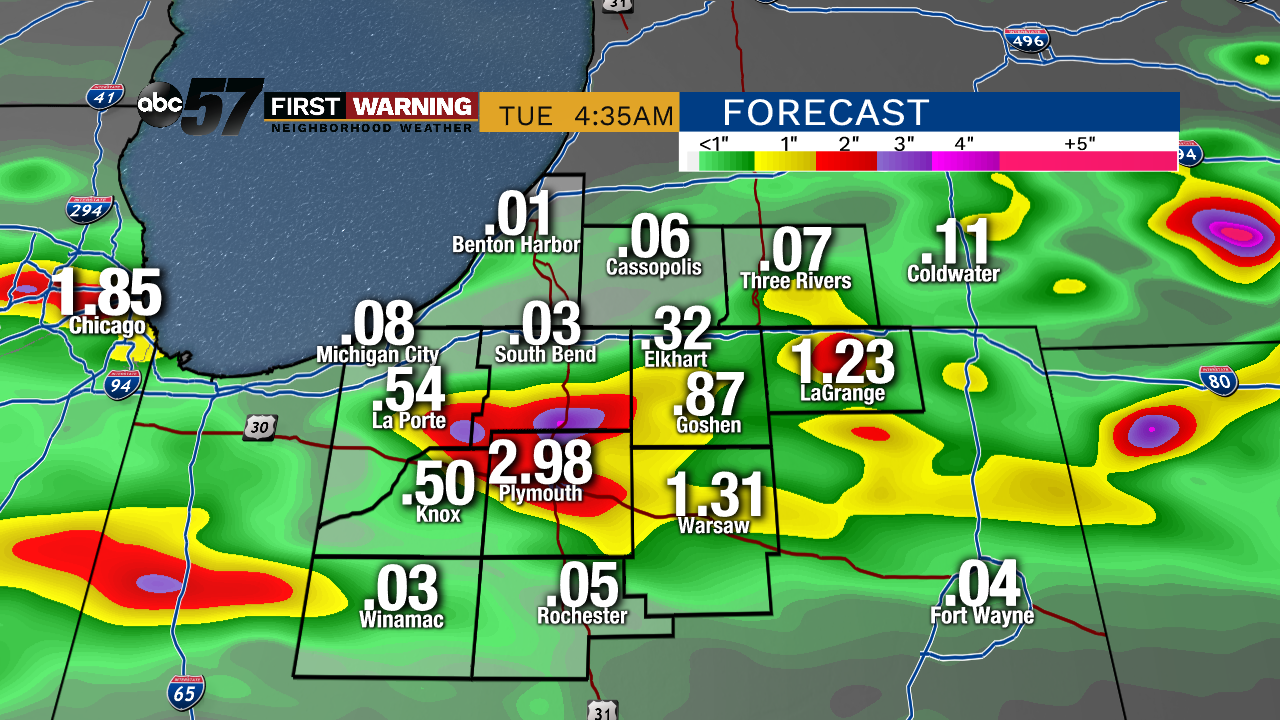
Showers and thunderstorms are likely Monday night through Tuesday morning. There is a low threat for severe weather with a higher likelihood of heavy, widespread rain. Much of Michiana could see over an inch by Tuesday morning. Minor flooding is also possible under localized downpours. The timeframe for the heaviest rain is around midnight.

Showers come to an end Tuesday morning as skies slowly clear and the humidity drops through the afternoon. An isolated storm could re-fire late in the day. The trend the rest of the week is dry with lower humidity, before another surge this weekend. Saturday could bring another round of storms ahead of a warm-up next week.
Tonight: Showers and storms likely, heavy rain possible, low of 68.
Tuesday: Mostly cloudy with leftover AM showers, then clearing skies. High of 78.
Wednesday: Partly cloudy, high of 78.
Thursday: Mostly sunny, high of 78.