More warm temperatures in store for Monday

-
7:27

Center for the Homeless hosting Dancing With Our Stars
-
2:10

More wet weather arriving later tonight, but sunnier skies after
-
3:16

Public input on the proposal to restart the Palisades Nuclear...
-
1:35

Dari Fair opened Wednesday for 2024 season, temperatures cool...
-
1:22

Another round of rain, then a cool weekend
-
4:33

Should Indiana’s abortion records be public?
-
2:52

Trailblazing promotions at the South Bend Fire Department
-
1:30

Downtown South Bend and Notre Dame to see improved connectivity
-
1:44

Storm threat today holds relatively low severe risk
-
0:30

Officials share opioid settlement funding plan
-
1:04

Bonneyville Mill opens for the 2024 season
-
0:32

Increase in federal funding coming to improve local hiking and...

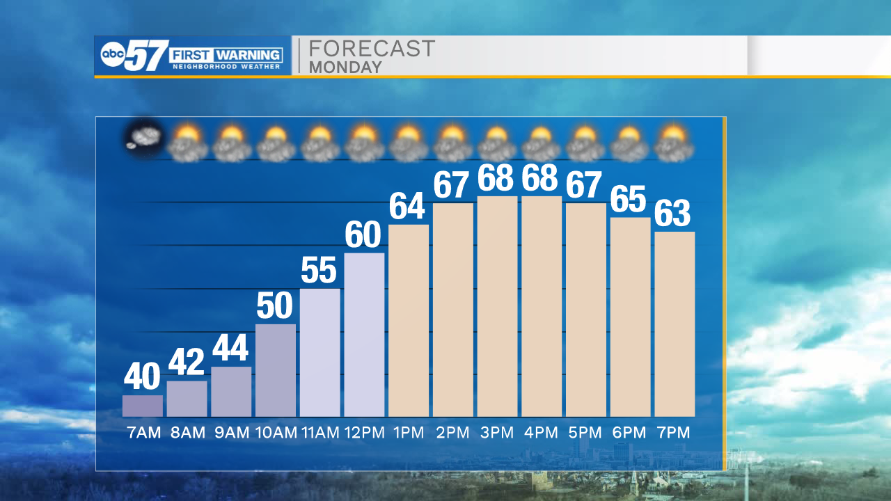
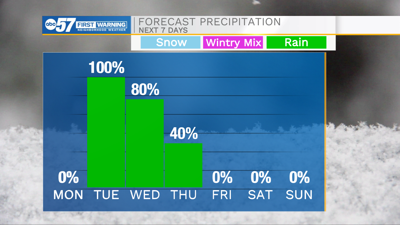
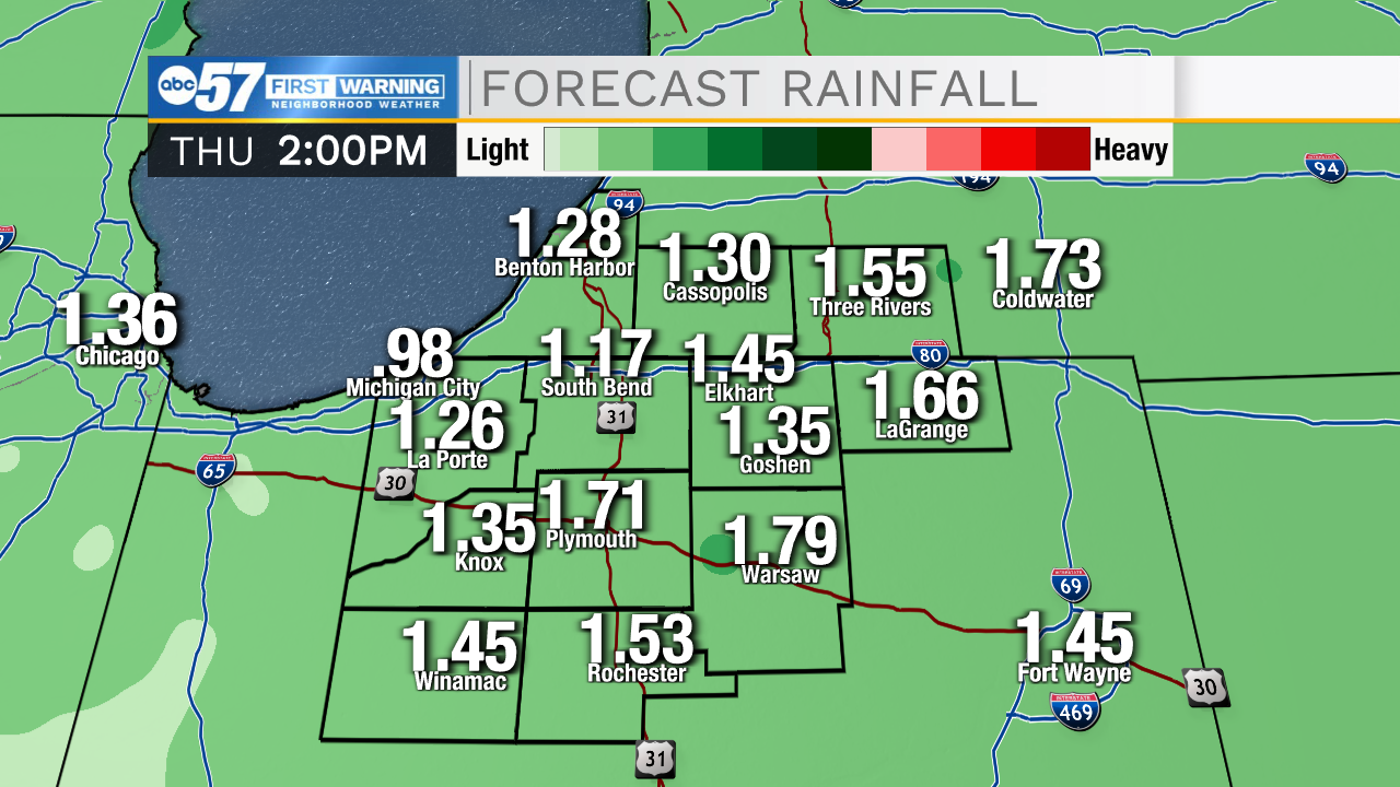
It has been beautiful day throughout Michiana, hopefully you were able to get outside to enjoy the nice weather. If you didn’t get the chance to be outdoors today, you will have another chance tomorrow. We are tracking partly cloudy skies and high temperatures to push into the upper 60s for Monday afternoon. Our next chance for rain arrives during the mid-morning hours Tuesday. This system looks to stall out as it arrives, leading to off and on showers through Thursday afternoon. Right now rainfall totals through Thursday afternoon could be around 1”-1.5”. High temperatures this week will slowly fall into the 40s Thursday and Friday. Next weekend looks mostly dry with highs holding in the 40s.
Tonight: Partly cloudy. Low 40.
Tomorrow: Partly cloudy. High 68.
Tuesday: Scattered showers. High 52.
Wednesday: Scattered showers. High 58.