More record cold Tuesday and lake effect snow
Posted: Mar 4, 2019 4:46 PM EDT

-
2:28

Public forum hosted by John Glenn High School students
-
3:34

Kickoff preview with ABC57’s Allison Hayes
-
0:57

Completion of Martin Luther King Jr. Dream Center one step closer
-
0:36

Niles High School students network with local professionals
-
3:59

Political group asks Indiana Democrats to vote in Republican...
-
3:01

New Buffalo Area Schools to build workforce housing
-
2:37

City seeks feedback for final Potawatomi Park plan
-
7:27

Center for the Homeless hosting Dancing With Our Stars
-
2:10

More wet weather arriving later tonight, but sunnier skies after
-
3:16

Public input on the proposal to restart the Palisades Nuclear...
-
1:35

Dari Fair opened Wednesday for 2024 season, temperatures cool...
-
1:22

Another round of rain, then a cool weekend

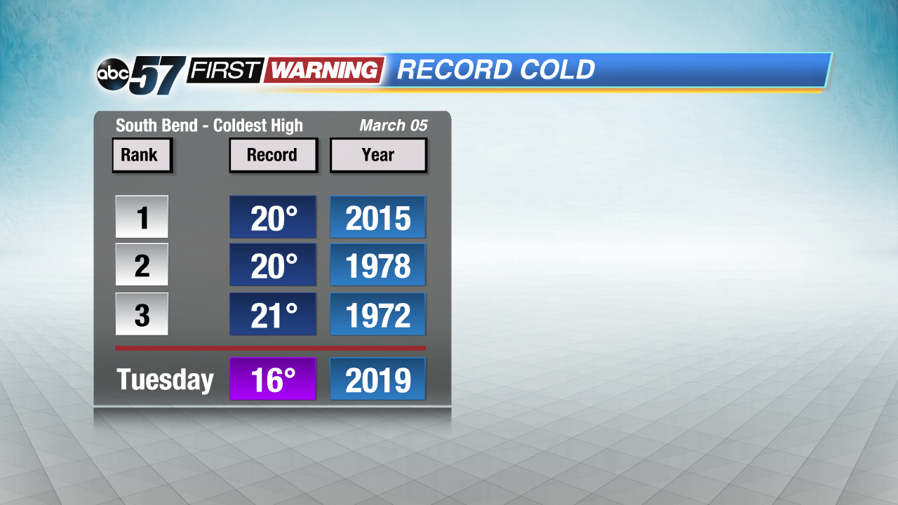
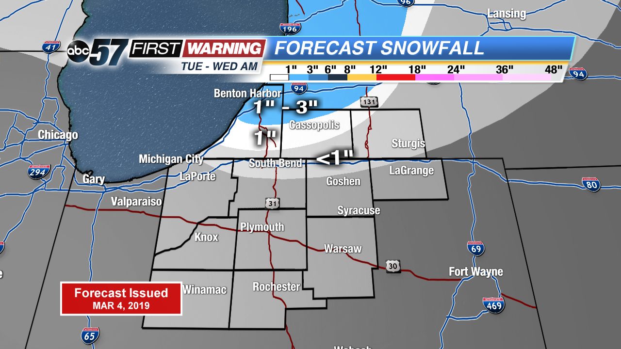
Record cold continues Tuesday along with lake effect snow showers. Highs in the teens would make for another coldest high for March 5th. Lake effect snow showers up to three inches possible north of the state line through Wednesday morning. Northern Indiana will see mostly flurries. There’s a slow warm-up the rest of the week. A very March-like weekend with highs in the 40s, rain and then snow Sunday into Monday.
Tonight: Partly cloudy, chance of snow, low 4.
Tuesday: Mostly cloudy, light snow showers, high of 16. Breezy.
Wednesday: Partly to mostly sunny, high of 24.
Thursday: Partly cloudy, high of 29.
Sign up for the ABC 57Newsletter