More rain and storms chances on the way for the week ahead

-
2:10

More wet weather arriving later tonight, but sunnier skies after
-
3:16

Public input on the proposal to restart the Palisades Nuclear...
-
1:35

Dari Fair opened Wednesday for 2024 season, temperatures cool...
-
1:22

Another round of rain, then a cool weekend
-
4:33

Should Indiana’s abortion records be public?
-
2:52

Trailblazing promotions at the South Bend Fire Department
-
1:30

Downtown South Bend and Notre Dame to see improved connectivity
-
1:44

Storm threat today holds relatively low severe risk
-
0:30

Officials share opioid settlement funding plan
-
1:04

Bonneyville Mill opens for the 2024 season
-
0:32

Increase in federal funding coming to improve local hiking and...
-
3:07

Gun violence on the decline in South Bend

Isolated showers and storms are possible this evening and during the overnight. A few storms could be on the stronger side, but overall severe activity looks very minimal. Rain and storm chances will continue through most of the week as moisture looks to hang around. The flooding threat will remain in place as high rainfall accumulation has already led to very saturated soils. Make sure to watch for water over the roadways throughout the week. Temperatures this week will hold in the 80s through Wednesday, but then drop into the 70s Thursday and Friday. Fourth of July weekend, temperatures will be in the mid to upper 70s with low rain chances.
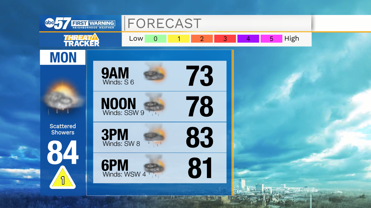
Tonight: Isolated showers/storms. Low 68.
Tomorrow: Scattered showers/storms. High 84.
Tuesday: Isolated showers/storms. High 84.
Wednesday: Isolated showers/storms. High 82.