
-
2:11

Students gearing up for local careers in Manufacturing
-
2:13

Sunny today, but expect a wetter and warmer weekend
-
0:54

Goodwill ’Little Black Dress’ event raises funds for community...
-
1:45

Cheers Bar and Grill liquor license renewed following controversy
-
2:40

Kyle Rudolph weighs in on fellow Irish, Joe Alt, ahead of NFL...
-
0:58

Contractors prepare bids for multi-million-dollar Four Winds...
-
3:11

Caleb Williams and Marvin Harrison Jr. weigh in on upcoming draft
-
3:18

New settlement with Indiana allows Landmark to apply for recertification
-
2:32

NFL Analysts break down Joe Alt’s stock
-
1:21

Fair Thursday wet / windy weekend
-
2:52

Union Township sues UNAS over ambulance stripped for parts
-
1:32

Bridging the healthcare gap in Michiana

Winter weather returns, snow showers are likely through Wednesday. The cold northwesterly flow will set up lake effect snow showers during the early morning, when temperatures fall into the 20s. Snow showers wane each afternoon as temperature warm above freezing. Total accumulation of one to three inches is possible over the next three days, the brunt of which is likely Tuesday. Skies clear and temperatures warm to end the week, 50s possible by the weekend.
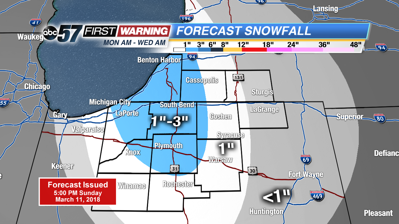
Tonight: Mostly clear, snow by morning, low of 24.
Monday: Mostly cloudy with a chance of scattered snow showers, breezy, high of 36.
Tuesday: Lake effect snow showers, high of 32.
Wednesday: Morning snow showers, highs in the mid-30s.
Sign up for the ABC 57Newsletter