Lake effect snow and a bitter cold weekend
Posted: Feb 11, 2022 5:53 PM EDT

-
1:28

Brisk, breezy but beautiful weekend
-
1:52

While the rain is over, the cooling temperatures are not
-
2:28

Public forum hosted by John Glenn High School students
-
3:34

Kickoff preview with ABC57’s Allison Hayes
-
0:57

Completion of Martin Luther King Jr. Dream Center one step closer
-
0:36

Niles High School students network with local professionals
-
3:59

Political group asks Indiana Democrats to vote in Republican...
-
3:01

New Buffalo Area Schools to build workforce housing
-
2:37

City seeks feedback for final Potawatomi Park plan
-
7:27

Center for the Homeless hosting Dancing With Our Stars
-
2:10

More wet weather arriving later tonight, but sunnier skies after
-
3:16

Public input on the proposal to restart the Palisades Nuclear...

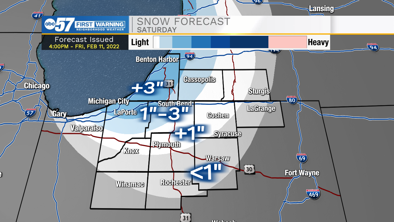
A cold weekend, with light snowfall. Lake effect snow ends Saturday morning, the highest totals are closer to Lake Michigan. The temperature struggles to stay above 20 this weekend and lows near the single digits. There is a second round of snow Sunday afternoon, but that looks to be rather light and low impact for the area. Next week, temperatures warm to 50 Wednesday and as temperatures fall Thursday heavy rain is possible before a change-over to snow. Stay tuned for a possible (minor) flood threat.
Tonight: Lake effect snow Low 18.
Saturday: AM snow showers. Mostly cloudy and cold. High 22.
Sunday: Mostly cloudy, PM light snow. High 22.
Monday: Partly cloudy. High 28.
Sign up for the ABC 57Newsletter