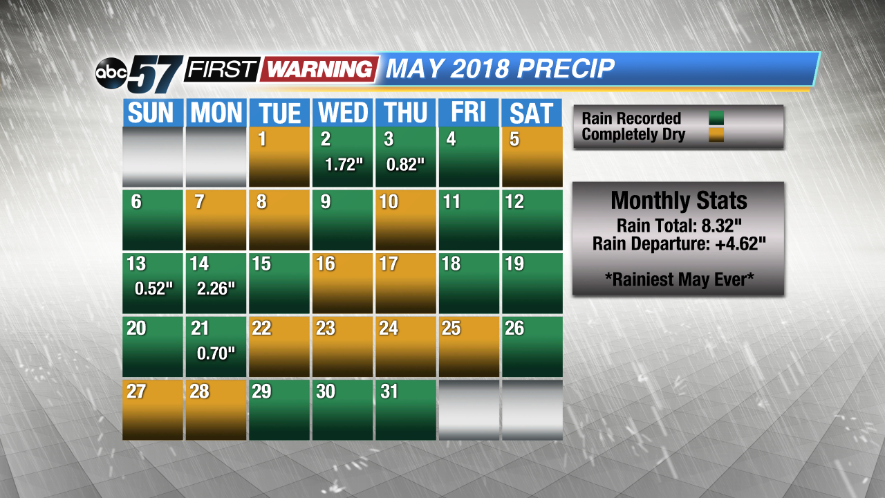
Saying it has been hot, humid and rainy since the middle of May would be an understatement. South Bend saw its rainiest month of May ever, one of the hottest Memorial Day weekends in history and the hottest daytime high temperatures in several years. A whopping 8.32" of rain fell through May 30th, but that total will be slightly higher as isolated thunderstorms roll through Michiana Thursday. Nearly half of May's rain fell in two days thanks to a couple of very heavy rain events that impacted Michiana. That is something that has been and will likely continue to be the norm. Heavy rain events will impact not only Michiana, but the United States as a whole more often due to the warming atmosphere.
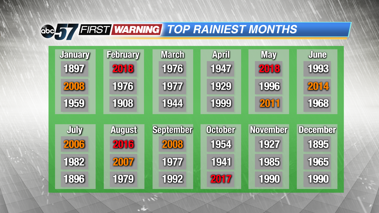
Each month's top three precipitation totals using the year in which those totals were observed.
Looking at recent monthly precipitation totals in South Bend, one would observe a subtle trend since 2000. It may not be glaring or overly obvious, but we have seen higher precipitation amounts since the turn of the century. For example, May and August have seen two of their top three precipitation totals in recorded history occur since 2007. Moreover, all but four months have at least one of their top-3 highest precipitation totals occurring since the year 2000. All of this has to do at least somewhat with the warming climate. As the atmosphere warms, the probability of significant rainfall events increases.
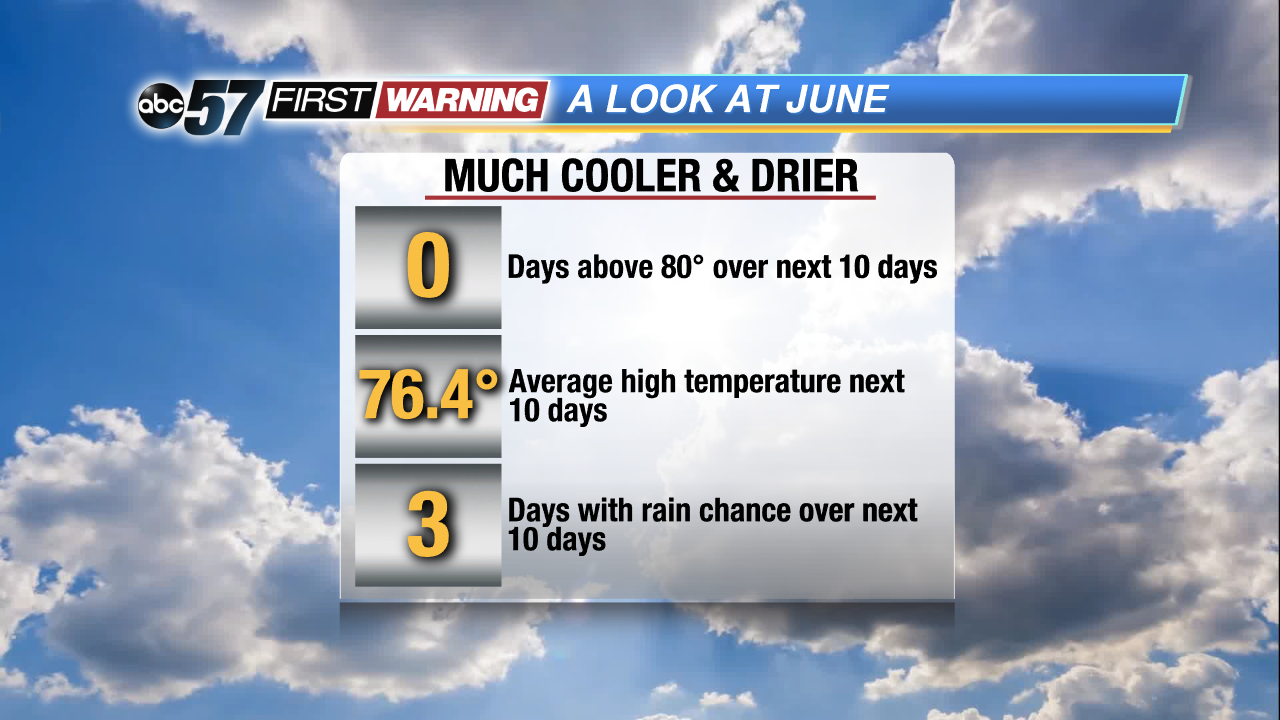
But what about June? Looking ahead, the sixth month of 2018 will likely start drier than normal with just three days featuring a rain chance higher than 20% through June 9th. June will also start much cooler than where May left off. The average high temperature through the first nine days of June is currently forecast to be just 76.4°. Even more significant will be the lack of any big-time heat. There are currently no days in the forecast through June 9th with a high temperature above the 80-degree mark! Beyond the first nine days, the Climate Prediction Center points to at or slightly above average temperatures and near-normal precipitation. Overall, June is shaping up to be near average with many days in the 70s and low 80s with your typical rain chances every 3-4 days. This does not mean we won't see a heavy rain event or day with highs in the 90s, but the overall pattern looks roughly normal.


 Each month's top three precipitation totals using the year in which those totals were observed.