Isolated showers today turn scattered into the start of the weekend

-
1:52

While the rain is over, the cooling temperatures are not
-
2:28

Public forum hosted by John Glenn High School students
-
3:34

Kickoff preview with ABC57’s Allison Hayes
-
0:57

Completion of Martin Luther King Jr. Dream Center one step closer
-
0:36

Niles High School students network with local professionals
-
3:59

Political group asks Indiana Democrats to vote in Republican...
-
3:01

New Buffalo Area Schools to build workforce housing
-
2:37

City seeks feedback for final Potawatomi Park plan
-
7:27

Center for the Homeless hosting Dancing With Our Stars
-
2:10

More wet weather arriving later tonight, but sunnier skies after
-
3:16

Public input on the proposal to restart the Palisades Nuclear...
-
1:35

Dari Fair opened Wednesday for 2024 season, temperatures cool...

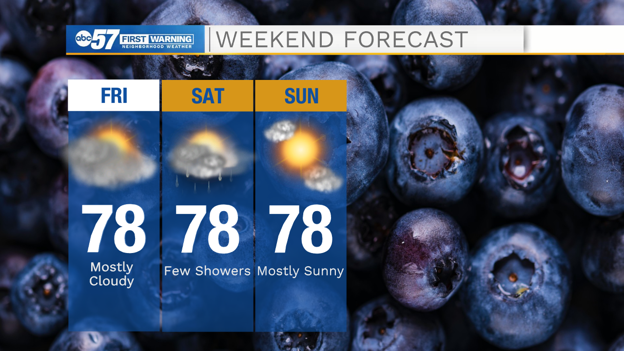
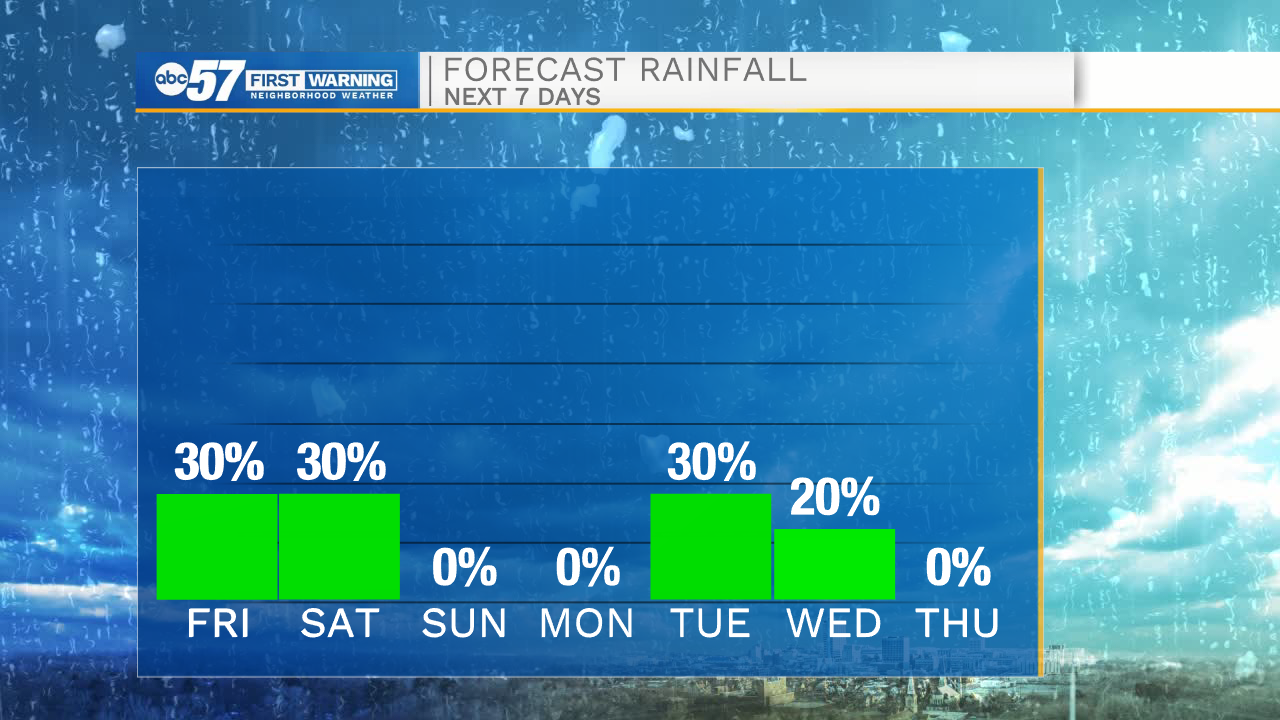
It will be another chilly start to the day with temperatures dropping into the mid 50s this morning. This afternoon cloud cover will increase, and a few isolated showers will move in out of the west. Isolated showers will stick around through the overnight and most of the day tomorrow. It won’t be a wash out, but off and on light rain is expected. Make sure to have the umbrella packed with you if you head out to the Marshall County Blueberry Festival. High temperatures this weekend will hold in the upper 70s. Labor Day looks mostly dry with highs in the upper 70s. More rain chances return for the middle part of next week. High temperatures look to stay around average throughout the rest of the 10-day forecast.
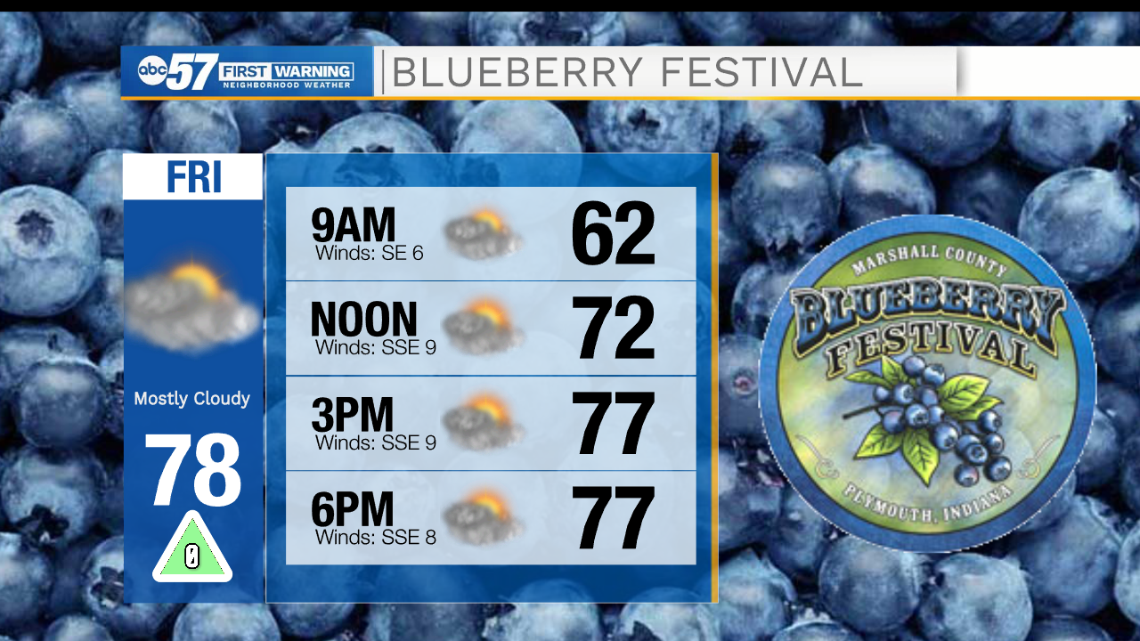
Today: Partly cloudy/isolated showers. High 78.
Tonight: Mostly cloudy/isolated showers. Low 62.
Tomorrow: Scattered showers. High 78.
Sunday: Mostly sunny. High 78.