I'm dreaming of a white...Halloween?! Here's the latest on our wintry day ahead
Halloween may be a scary day with different ghosts, ghouls and goblins, but Mother Nature may be the scariest thing of all as we round out October and begin November.
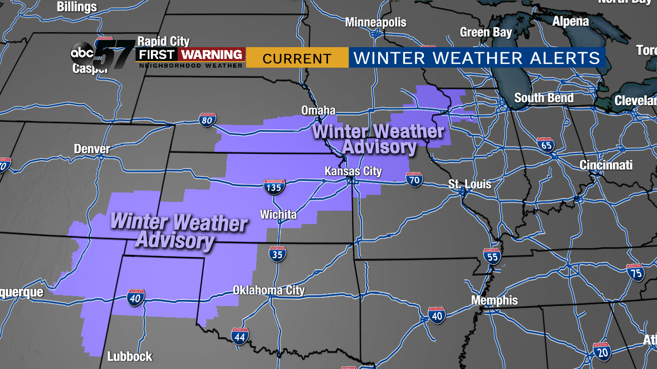 Winter Weather Advisories for wintry precipitation (mainly snow) stretch from Texas to Illinois as of 2 p.m. EDT Wednesday.
But there's more on the way for the Wednesday evening to Thursday night period. And this time, we here in Michiana will get in on the wintry fun.
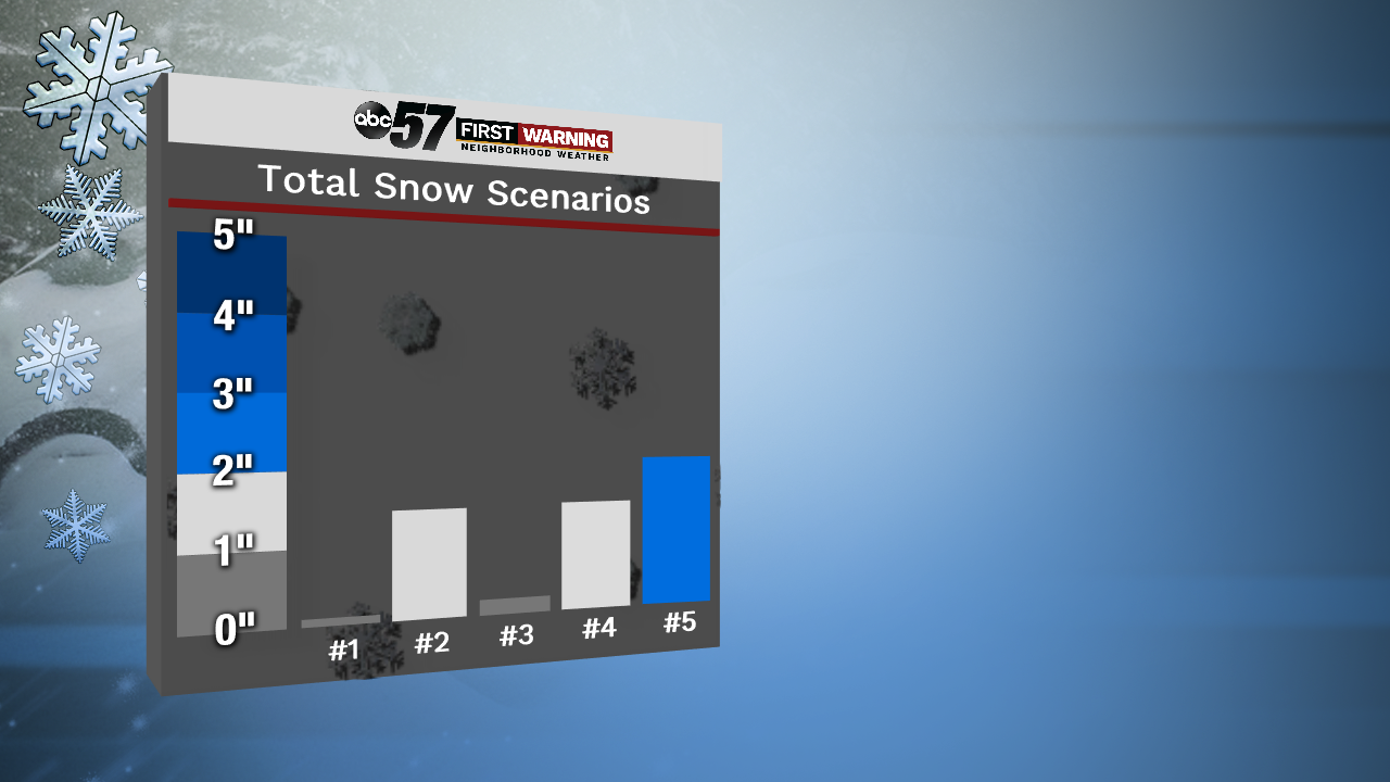 Total snowfall for South Bend according to 5 different models.
It comes down to a few factors...
- How heavy the snow falls
- Exact temperatures at your location
- Will it be too windy?
- Will the wet and warm ground prevent everything from sticking?
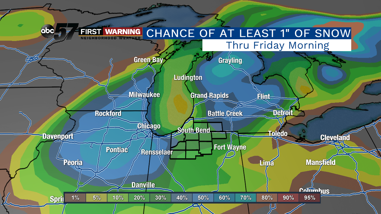 Probability of at least 1
Regardless of accumulation amounts, we are expecting snow to fly for many at some point late in the day Thursday.
That changeover is likely in the 2-5 p.m. window with precipitation falling as a rain-snow mix or entirely snow for most by 5 p.m.
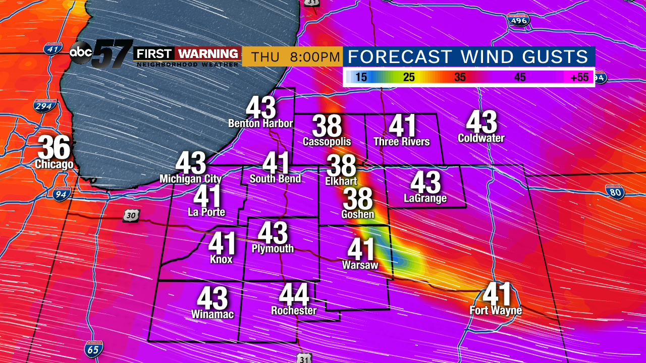 Wind gust potential Halloween afternoon and evening.
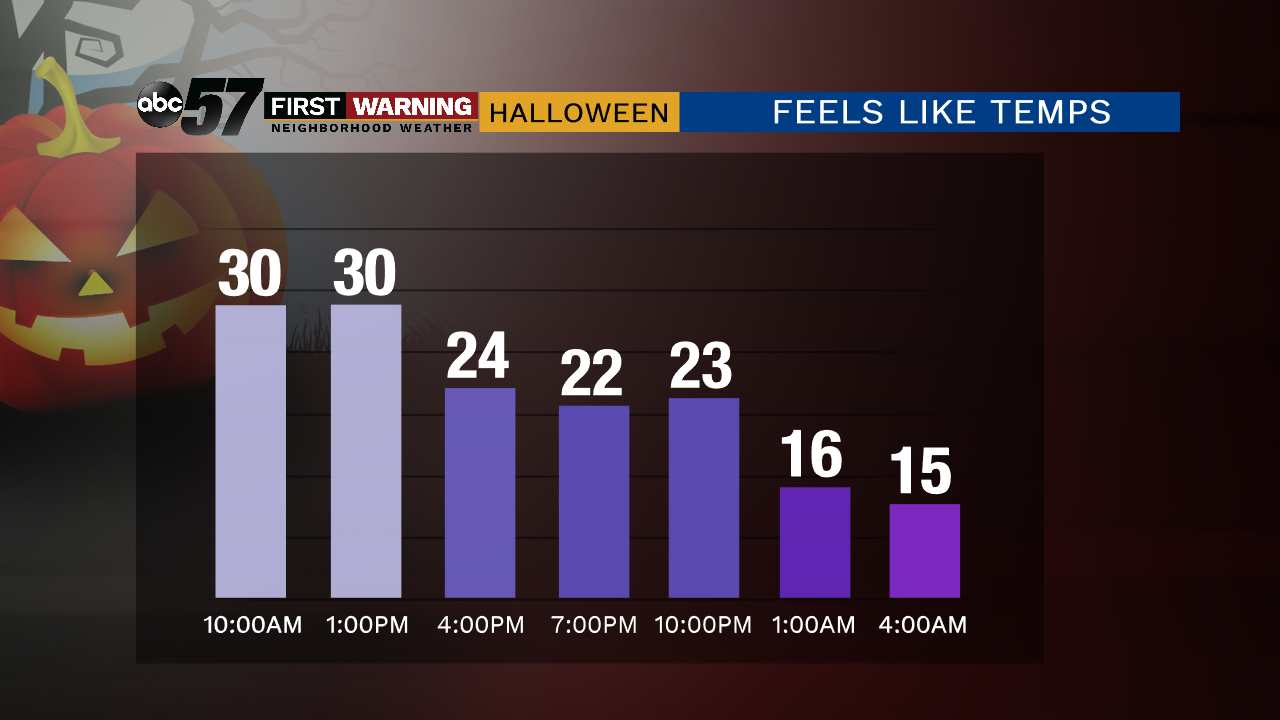
Gusts could reach 35-45 mph late in the afternoon and evening, making for a simply awful Trick-or-Treat experience when you combine the precipitation with the wind and cold.
 Possible
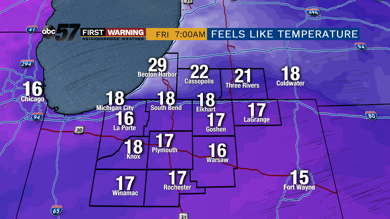
It'll be the coldest air mass we've seen since last Spring without question.
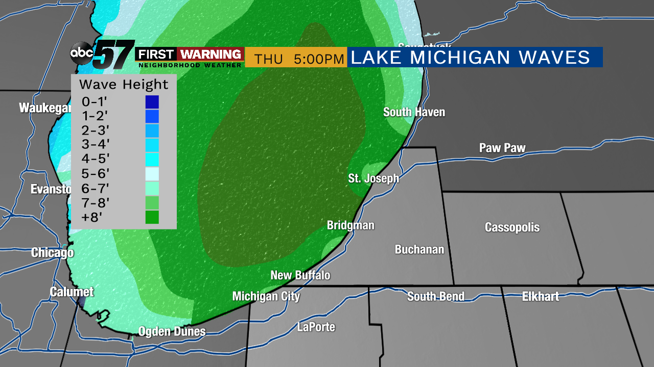 A period of large waves of 7-14' is expected from Porter County to Allegan County.
Maximum wave heights of 10-14' are likely across the southern half of Lake Michigan Thursday afternoon into Thursday night with most waves around 8-11'.
This will add to shoreline erosion, dune erosion and coastal flooding concerns before waves relax by Friday morning.