Category 4 Hurricane Laura makes landfall Thursday morning
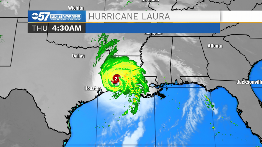
Early Thursday morning, Hurricane Laura made landfall in Louisiana and parts of Texas as a Category 4 storm.
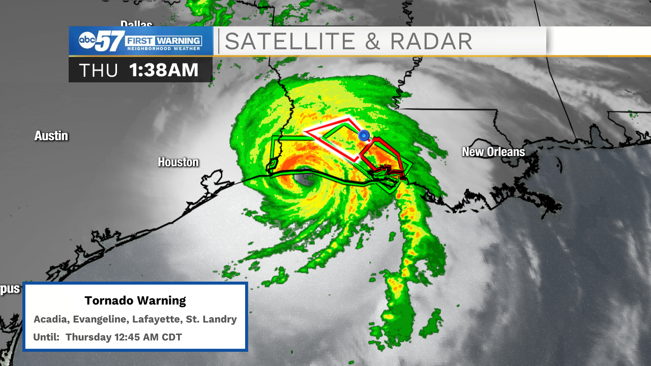
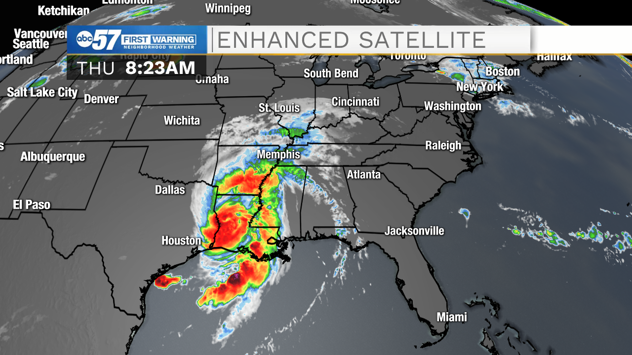
Satellite and RADAR imagery from 1:38 Thursday morning show the hurricane making landfall. There were several tornado warnings in surrounding counties.
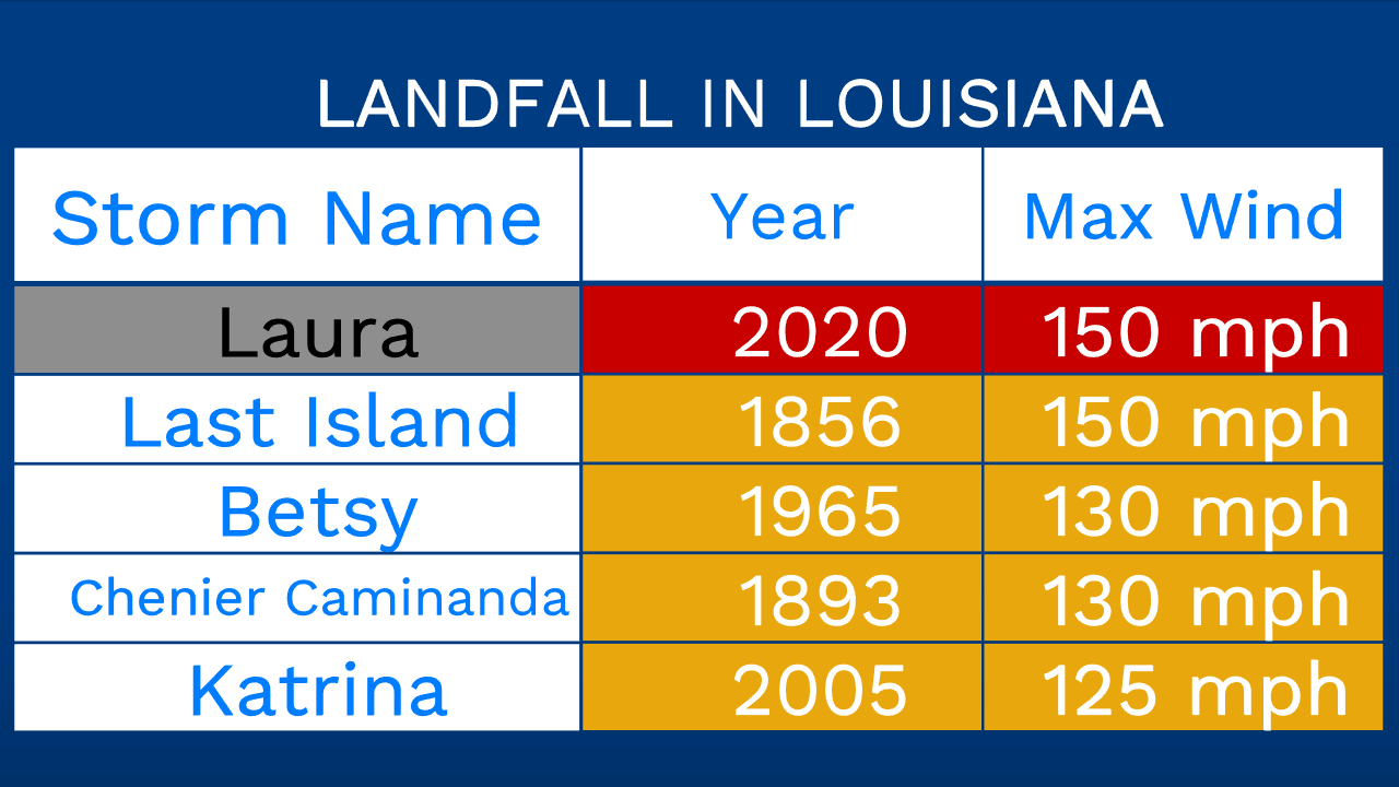
Maximum sustained winds of 150 miles per hour were recorded this morning. In Louisiana, this is the fastest wind speed recorded in a hurricane making landfall. This ties the previous record, set in 1856 with the "Last Island" hurricane.
Hurricanes are categorized based on sustained wind speed, using the Saffir-Simpson Scale. Categories 3-5 are considered Major Hurricanes.
Category 5: 157+ mph winds
Category 4: 130-156 mph winds
Category 3: 111-129 mph winds
Category 2: 96-110 mph winds
Category 1: 74-95 mph winds
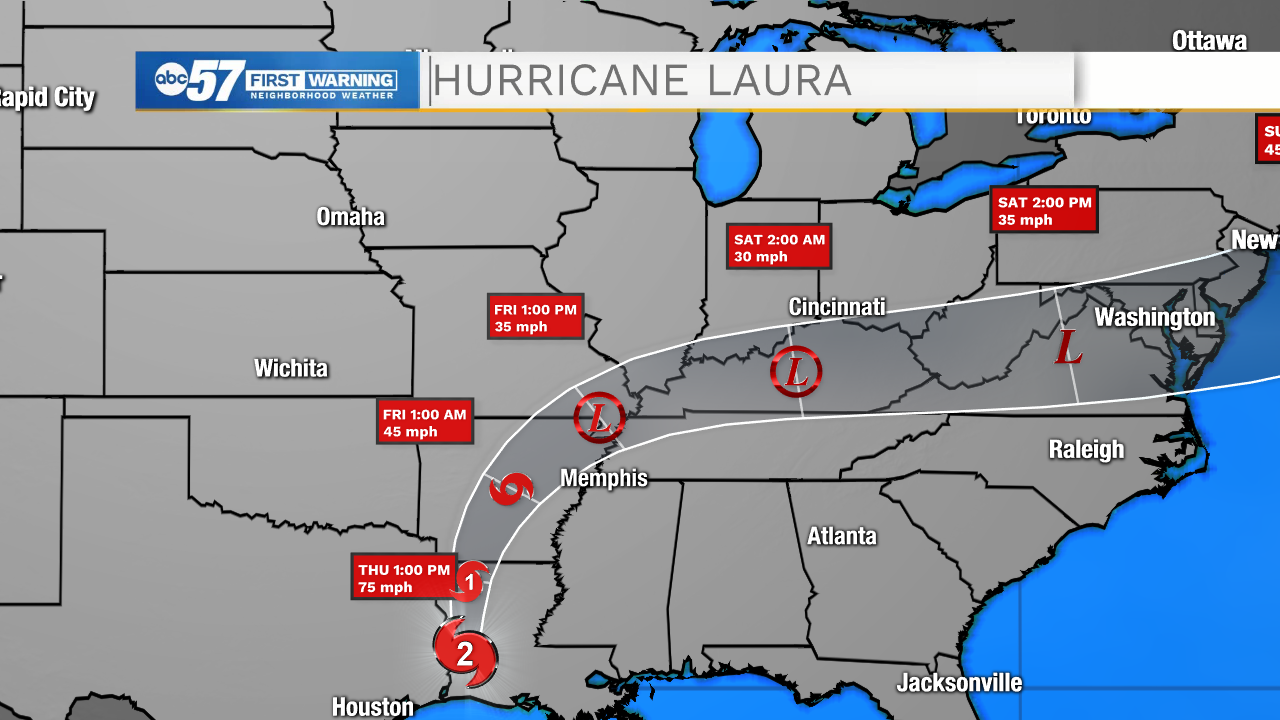
Hurricanes need a large, warm body of water as their energy source. As the storm moves from water to land, it loses momentum and wind speed decreases. While initially a Category 4, the storm lost momentum and diminished to a Category 3, then Category 2 storm as it tracks northward over land.
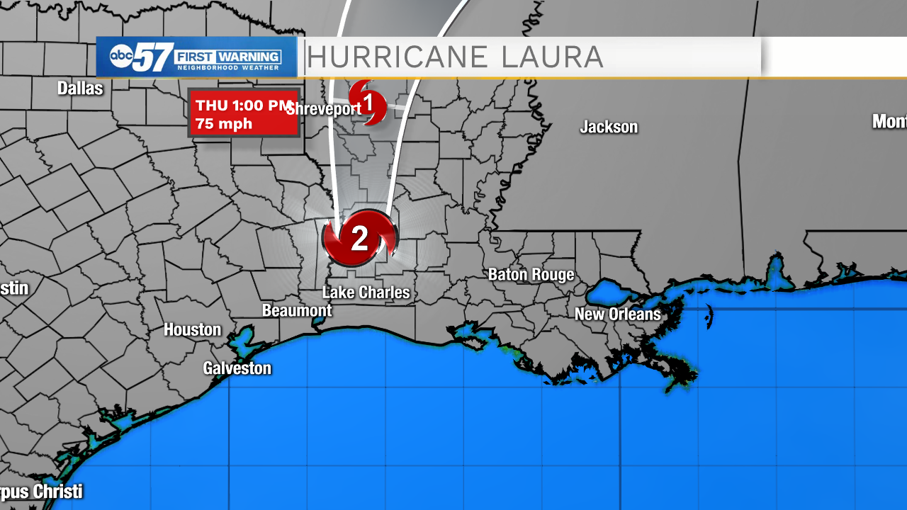
It is expected to become a Category 1 hurricane by Thursday afternoon. Remnants of the storm will continue to move across the United States Thursday and Friday. We will see clouds develop in Michiana Thursday and Friday from the storm.
By 8:20 a.m. Thursday, clouds from the storm were extending into parts of southern Indiana on Enhanced Satellite.
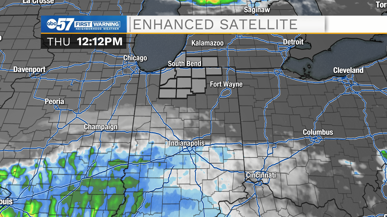
By noon, clouds from the hurricane had moved to Central Indiana. These are currently just south of Michiana.
As the day continues, we will begin to assess damage from the hurricane and its storm surge.