Humidity and better rain chances return this weekend

-
2:24

Suspect arrested for allegedly sexually assaulting two girls...
-
0:25

Humane Society of St. Joseph County holds microchip clinic
-
2:58

Pulaski County Community Foundation provides support for childcare...
-
3:14

Green wave of economic growth in Michigan from marijuana dispensaries
-
1:28

Brisk, breezy but beautiful weekend
-
0:48

University Park Mall holding parking-lot carnival this week
-
1:52

While the rain is over, the cooling temperatures are not
-
2:28

Public forum hosted by John Glenn High School students
-
3:34

Kickoff preview with ABC57’s Allison Hayes
-
0:57

Completion of Martin Luther King Jr. Dream Center one step closer
-
0:36

Niles High School students network with local professionals
-
3:59

Political group asks Indiana Democrats to vote in Republican...

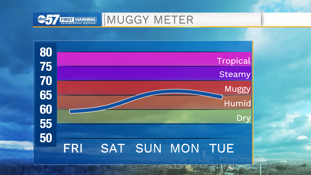
Winds will remain on the stronger side today, but then begin to subside later this afternoon and evening. If you had plans to head out to the beach today, refrain from getting into the water as there is a high swim risk with wave heights ranging 3-5ft. This afternoon expect low humidity, partly to mostly cloudy skies, and highs to top out in the mid 70s. This weekend humidity returns and temperatures begin to warm into the upper 70s. Isolated showers are possible Saturday night, and then turn scattered Sunday. Next week will start another wet pattern with rain and storm chances every day. Highs next week will range from the low to mid 80s.
Today: Mostly cloudy/isolated shower south. High 76.
Tonight: Mostly cloudy. Low 59.
Tomorrow: Mostly cloudy/isolated PM shower. High 77.
Sunday: Scattered showers. High 78.