Hot, humid and a severe threat
By: Emily Kennedy
Posted: Sep 14, 2021 3:18 AM EDT

-
1:52

While the rain is over, the cooling temperatures are not
-
2:28

Public forum hosted by John Glenn High School students
-
3:34

Kickoff preview with ABC57’s Allison Hayes
-
0:57

Completion of Martin Luther King Jr. Dream Center one step closer
-
0:36

Niles High School students network with local professionals
-
3:59

Political group asks Indiana Democrats to vote in Republican...
-
3:01

New Buffalo Area Schools to build workforce housing
-
2:37

City seeks feedback for final Potawatomi Park plan
-
7:27

Center for the Homeless hosting Dancing With Our Stars
-
2:10

More wet weather arriving later tonight, but sunnier skies after
-
3:16

Public input on the proposal to restart the Palisades Nuclear...
-
1:35

Dari Fair opened Wednesday for 2024 season, temperatures cool...

ABC57 First Warning Neighborhood Weather Forecast
Tuesday, September 14th, 2021
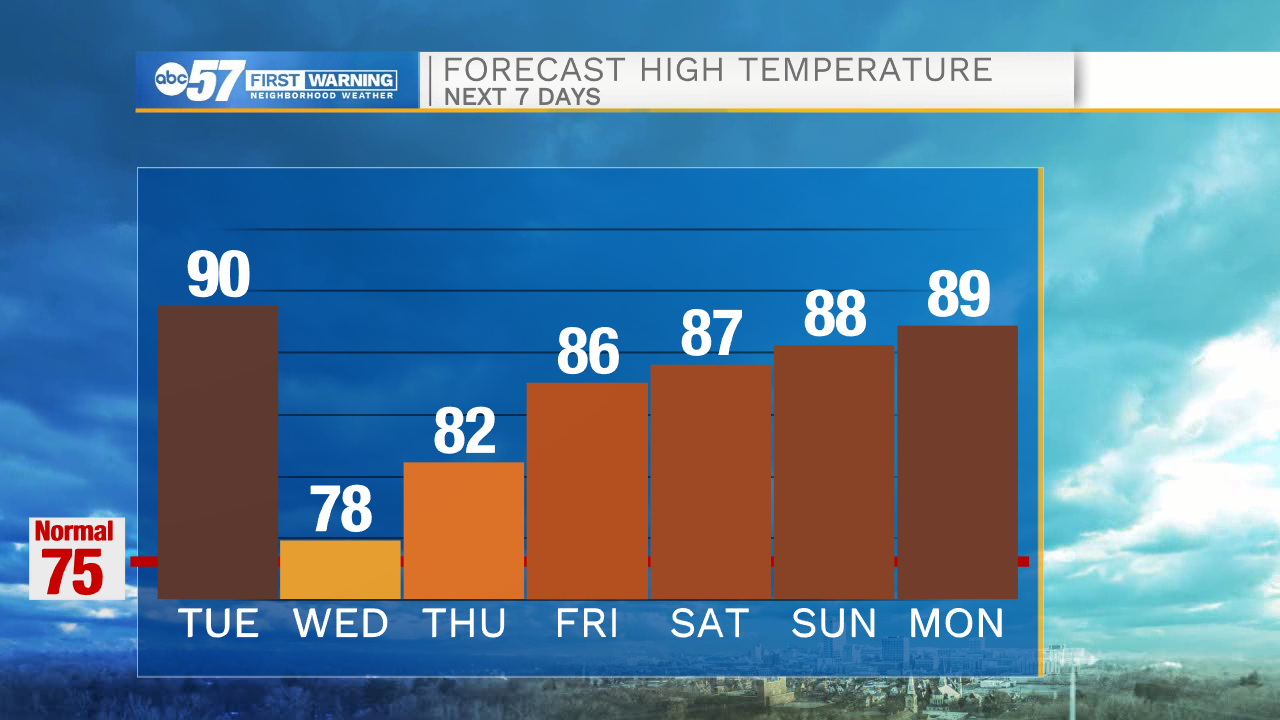
It's hot and humid once again today. A round of storms moves in this evening, ahead of a cold front. These storms could be strong to severe with gusty wind and heavy rain. Timing looks to be from 5-10pm from west to east. A couple of showers could linger into early Wednesday morning then we will have clearing for the afternoon. Temperatures cool into the upper 70s but rise again heading into the weekend. A stretch of sunshine will last into early next week.
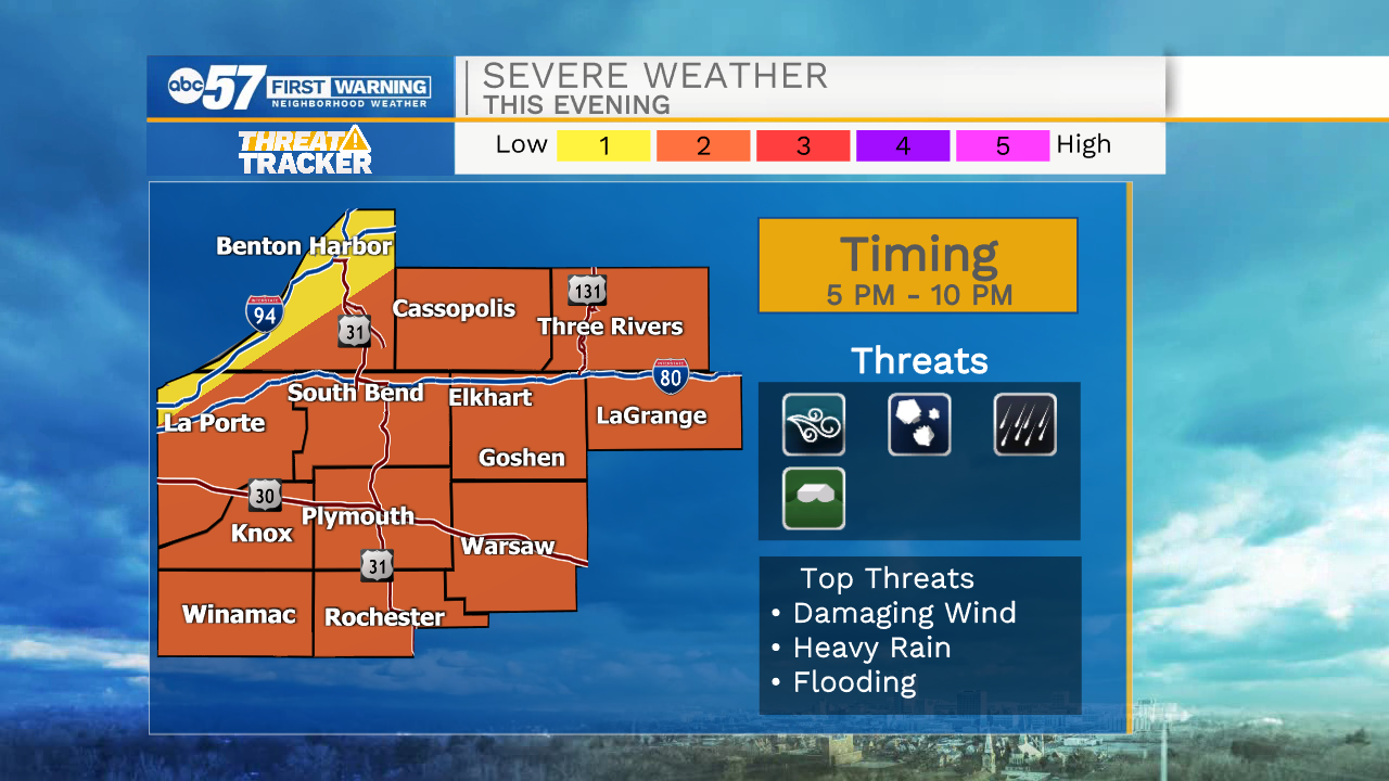
Today: Evening thunderstorms, severe possible. High 90.
Tonight: Chance of thunderstorms, mostly cloudy. Low 64.
Wednesday: Partly cloudy. High 78.
Thursday: Mostly sunny. High 82.
Sign up for the ABC 57Newsletter