Heavy rain threat returns Wednesday night
Posted: Jun 18, 2019 4:46 PM EDT

-
0:25

Humane Society of St. Joseph County holds microchip clinic
-
2:58

Pulaski County Community Foundation provides support for childcare...
-
3:14

Green wave of economic growth in Michigan from marijuana dispensaries
-
1:28

Brisk, breezy but beautiful weekend
-
1:52

While the rain is over, the cooling temperatures are not
-
2:28

Public forum hosted by John Glenn High School students
-
3:34

Kickoff preview with ABC57’s Allison Hayes
-
0:57

Completion of Martin Luther King Jr. Dream Center one step closer
-
0:36

Niles High School students network with local professionals
-
3:59

Political group asks Indiana Democrats to vote in Republican...
-
3:01

New Buffalo Area Schools to build workforce housing
-
2:37

City seeks feedback for final Potawatomi Park plan

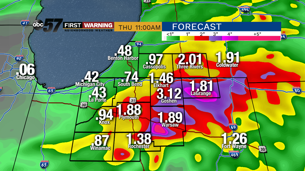
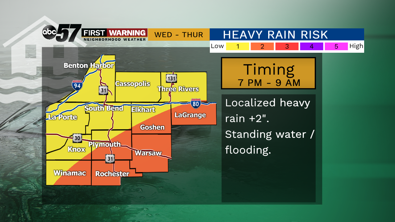
The weather stays dry for most of Wednesday but showers and storms become more likely by evening and overnight. Continuing the trend of late, heavy rain and flooding will be the top concern due our saturated atmosphere and soil. Localized downpours of more than two inches are possible with many seeing nearly one inch by Thursday afternoon. Warmer weather arrives with the Summer Solstice Friday, as highs look to stay near 80 for the foreseeable future. Warmer temps will also make pop-up showers and storms also more likely.
Tonight: Partly cloudy, low of 62.
Wednesday: Increasing clouds, chance of showers and storms, high of 78.
Thursday: AM showers, mostly cloudy, high of 68.
Friday: Mostly sunny, high of 78.
Sign up for the ABC 57Newsletter