Heavy rain early Saturday | Storms Saturday evening

-
1:52

While the rain is over, the cooling temperatures are not
-
2:28

Public forum hosted by John Glenn High School students
-
3:34

Kickoff preview with ABC57’s Allison Hayes
-
0:57

Completion of Martin Luther King Jr. Dream Center one step closer
-
0:36

Niles High School students network with local professionals
-
3:59

Political group asks Indiana Democrats to vote in Republican...
-
3:01

New Buffalo Area Schools to build workforce housing
-
2:37

City seeks feedback for final Potawatomi Park plan
-
7:27

Center for the Homeless hosting Dancing With Our Stars
-
2:10

More wet weather arriving later tonight, but sunnier skies after
-
3:16

Public input on the proposal to restart the Palisades Nuclear...
-
1:35

Dari Fair opened Wednesday for 2024 season, temperatures cool...

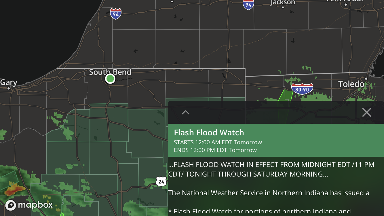
Heavy, widespread rain is likely after midnight and could last through noon Saturday. More than a half inch could fall north of U.S. Highway 30, that includes South Bend, Elkhart and our Michigan counties. More than an inch is likely in areas that include Plymouth and Warsaw southward. A Flash Flood watch has been issued for the area.
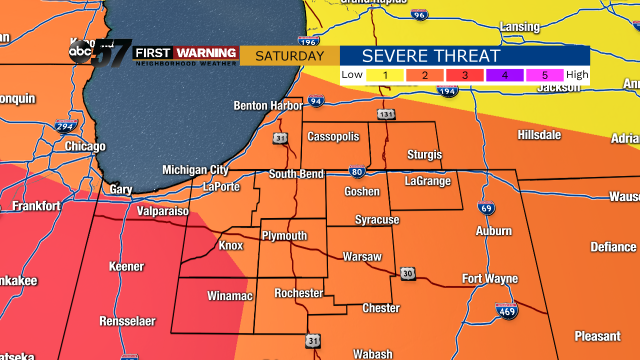
Saturday starts with rain, then an afternoon lull as temps surge into the 60s, followed by scattered thunderstorms through the evening. A line of storm will push through after 7:00 PM ahead of the cold front. This is the greatest threat for severe weather. The later the arrival time of this line the lower the threat gets. Strong wind gusts and hail are the greatest threat but tornadoes are also possible. Stay weather aware and have a way to get your First Warning.
Sunday is windy, gust top 40 mph and temperatures fall from 50 in the morning. Next week looks mainly dry, with high temperatures around 50 each day.
Tonight: Rainy, heaviest after midnight. Low 48.
Saturday: Rain then evening scattered thunderstorms. High 64.
Sunday: Few AM showers, cloudy and windy. High 50.
Monday: Partly cloudy. High of 50.