Heavy rain and flood threat overnight

-
2:28

Public forum hosted by John Glenn High School students
-
3:34

Kickoff preview with ABC57’s Allison Hayes
-
0:57

Completion of Martin Luther King Jr. Dream Center one step closer
-
0:36

Niles High School students network with local professionals
-
3:59

Political group asks Indiana Democrats to vote in Republican...
-
3:01

New Buffalo Area Schools to build workforce housing
-
2:37

City seeks feedback for final Potawatomi Park plan
-
7:27

Center for the Homeless hosting Dancing With Our Stars
-
2:10

More wet weather arriving later tonight, but sunnier skies after
-
3:16

Public input on the proposal to restart the Palisades Nuclear...
-
1:35

Dari Fair opened Wednesday for 2024 season, temperatures cool...
-
1:22

Another round of rain, then a cool weekend

Heavy rain and flood threat Wednesday night through Thursday. Slow moving heavy downpours could drop more than two inches of rain. Flooding is possible due to the already saturated ground. The heaviest rain is likely from midnight to 7:00 AM.
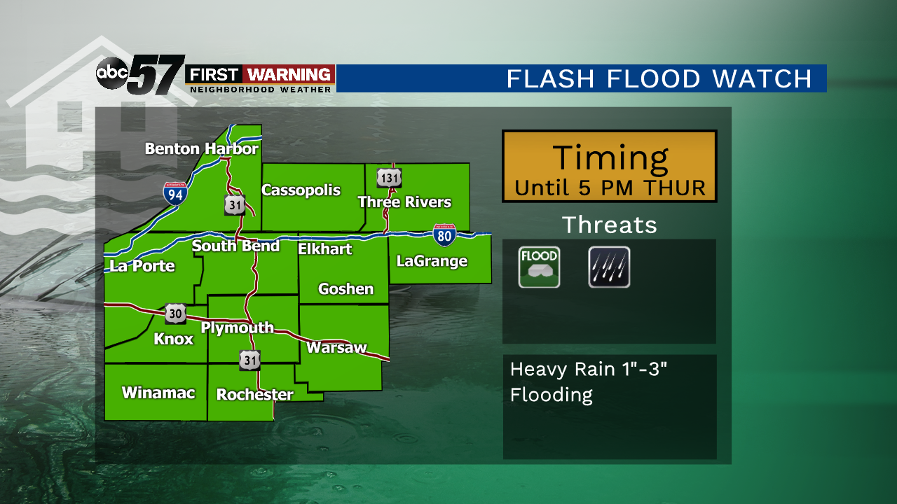
Thursday will start wet, with the possibility of standing water and flooding in the area. Rain ends Thursday afternoon but temperatures will struggle to reach 70. The beginning of summer is dry Friday but the weekend turns wet once again with showers and storms likely Saturday through Monday. Temperatures are trending warmer with highs at or above 80.
Tonight: Showers and storms, heavy rain likely, low of 62.
Thursday: AM showers, mostly cloudy, high of 68.
Friday: Mostly sunny, high of 78.
Saturday: Scattered showers and storms, high of 80.