Heating up Thursday with thunderstorms on Friday

-
7:27

Center for the Homeless hosting Dancing With Our Stars
-
2:10

More wet weather arriving later tonight, but sunnier skies after
-
3:16

Public input on the proposal to restart the Palisades Nuclear...
-
1:35

Dari Fair opened Wednesday for 2024 season, temperatures cool...
-
1:22

Another round of rain, then a cool weekend
-
4:33

Should Indiana’s abortion records be public?
-
2:52

Trailblazing promotions at the South Bend Fire Department
-
1:30

Downtown South Bend and Notre Dame to see improved connectivity
-
1:44

Storm threat today holds relatively low severe risk
-
0:30

Officials share opioid settlement funding plan
-
1:04

Bonneyville Mill opens for the 2024 season
-
0:32

Increase in federal funding coming to improve local hiking and...

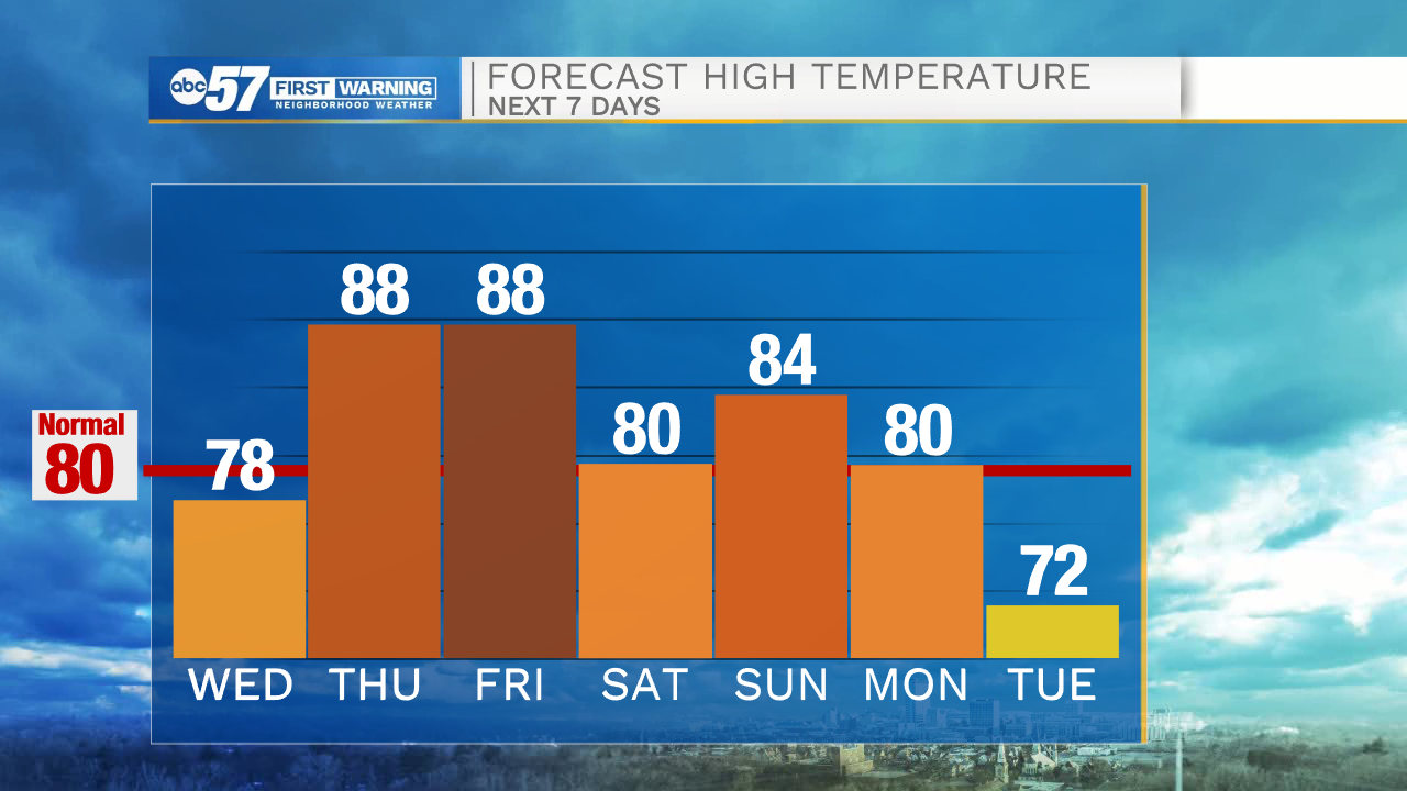
ABC57 First Warning Neighborhood Weather Forecast
Wednesday, June 16th, 2021
The sunshine and comfortable weather continues through midweek. Temperatures climb back into the upper 80s by Thursday and stay there for Friday. The next chance of rain arrives late Thursday night as scattered thunderstorms move into the area. It lasts through Friday morning and could linger into the afternoon. It looks like another line of storms will develop along a cold front Friday evening. Storms could be strong with heavy rain and gusty wind. Brighter and comfortable over Father's Day weekend. Much needed rain is possible again on Monday.
Today: Sunny. High 78.
Tonight: Mostly clear. Low 52.
Thursday: Mostly sunny. High 88.
Friday: Morning thunderstorms. High 88.