Frost possible early Tuesday, then a warm-up

-
1:52

While the rain is over, the cooling temperatures are not
-
2:28

Public forum hosted by John Glenn High School students
-
3:34

Kickoff preview with ABC57’s Allison Hayes
-
0:57

Completion of Martin Luther King Jr. Dream Center one step closer
-
0:36

Niles High School students network with local professionals
-
3:59

Political group asks Indiana Democrats to vote in Republican...
-
3:01

New Buffalo Area Schools to build workforce housing
-
2:37

City seeks feedback for final Potawatomi Park plan
-
7:27

Center for the Homeless hosting Dancing With Our Stars
-
2:10

More wet weather arriving later tonight, but sunnier skies after
-
3:16

Public input on the proposal to restart the Palisades Nuclear...
-
1:35

Dari Fair opened Wednesday for 2024 season, temperatures cool...

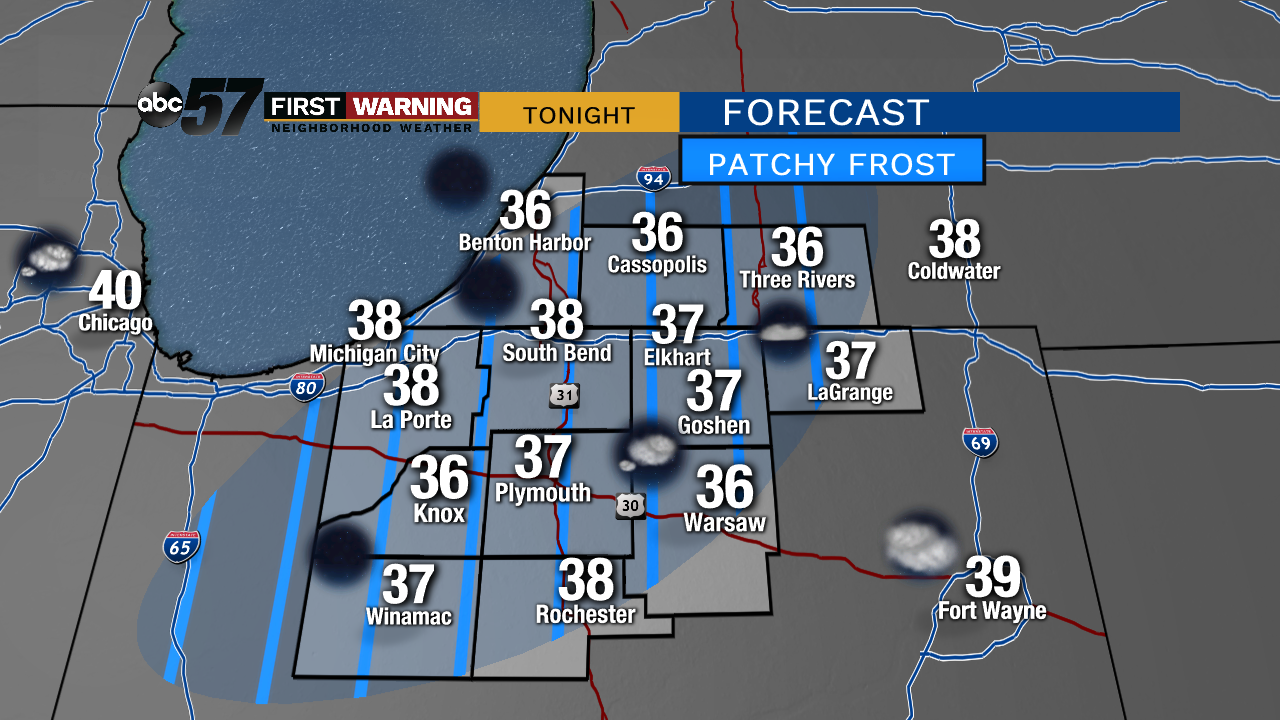
Clear skies overnight will allow temperatures to dip into the 30s. Patch frost is possible but a damaging freeze is unlikely. Only the most sensitive of plants should be covered.
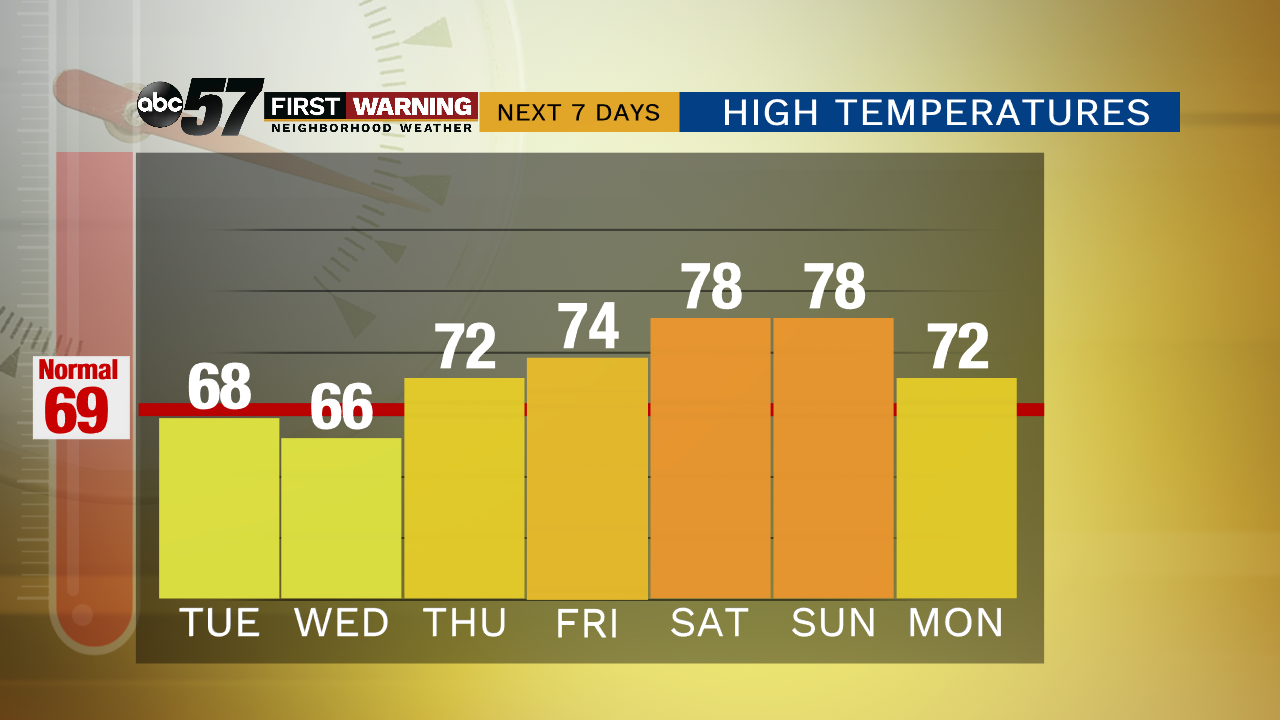
The forecast this week is finally turning milder. Tuesday is sunny with highs nearing 70 and 70s stay in the forecast the rest of the week. There are a few chances of rain but overall this week is not as rainy and drier than the past two weeks. Friday right now seems to be a toss-up as to whether a warm front can move through or not. That could change the forecast from the low 70s to closer to 80. This weekend could be our first 80 degree high of 2019.
Tonight: Mostly clear, low of 38.
Tuesday: Sunny, high of 68.
Wednesday: A chance of showers early, high of 66.
Thursday: Partly cloudy, high of 72, chance of storms late.