Friday to bring heavy rain, flood, severe threat to the region
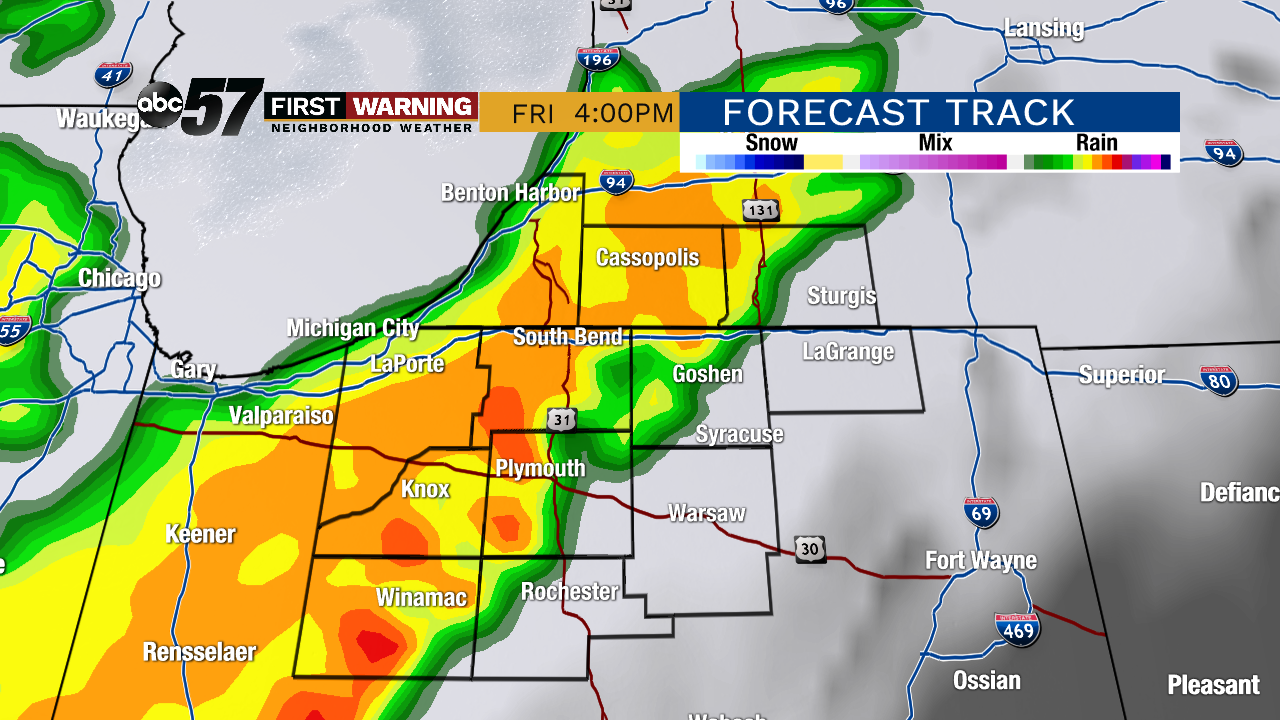 Round 1 of rain and storms is likely Friday afternoon. The severe risk is LOW, but the heavy rain threat is MODERATE.
The first will occur during the afternoon hours, likely between 1 p.m. and 6 p.m. or so. Most everyone will see some rain and perhaps a few storms with this activity. The threat for heavy rain will exist, but severe weather is unlikely.
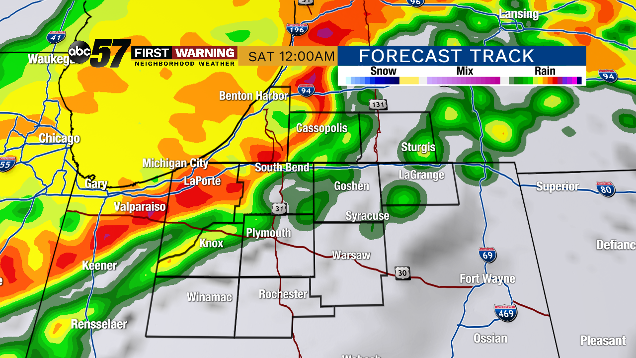 Potential radar at midnight Friday night shows the second round of storms. This could present both a heavy rain and low severe threat.
This round has the potential to not only drop heavy rain, but produce a few stronger thunderstorms as well.
Widespread severe weather is not expected, but we could have just enough ingredients in place for a few damaging wind gusts and/or hail reports.
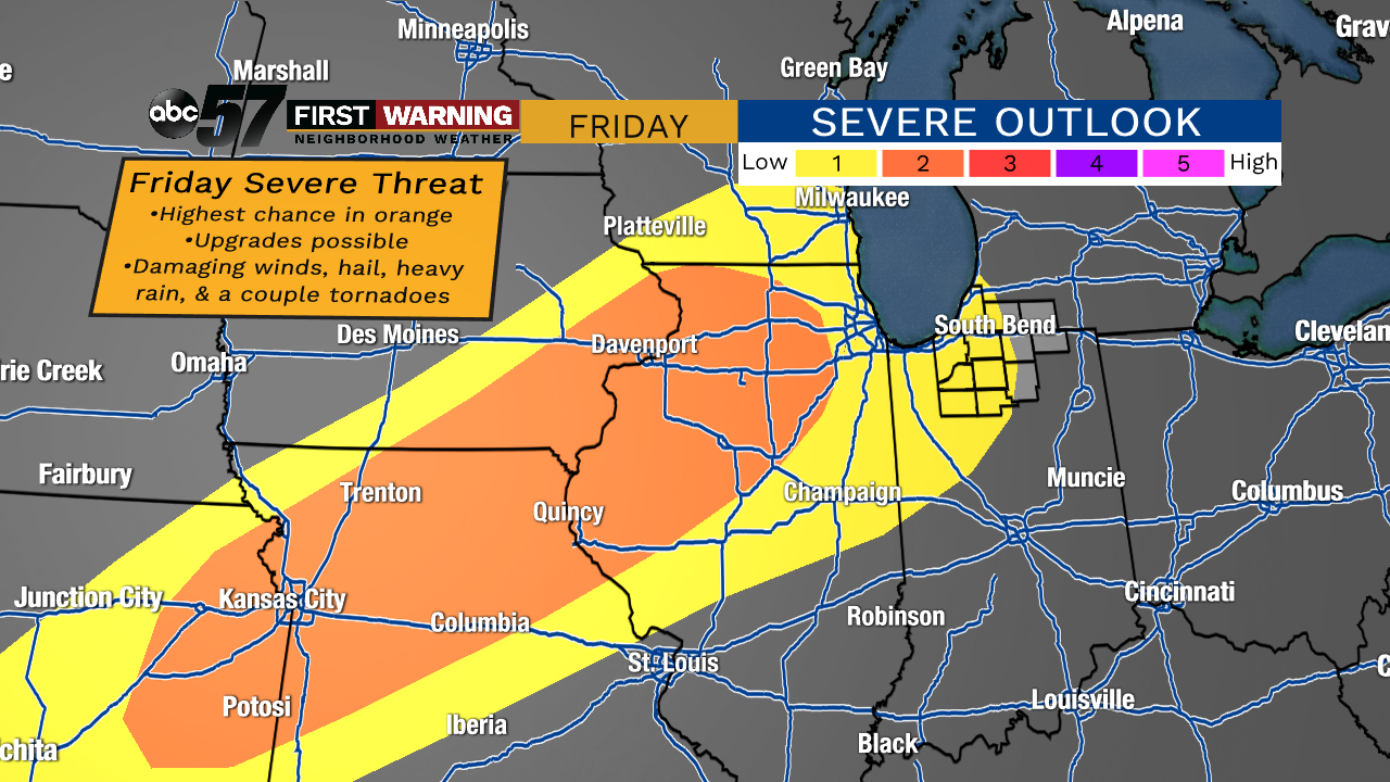 Severe weather outlook for Friday and Friday night.
That is the lowest of risk categories, but should not be ignored. A noticeably higher risk of severe weather exists just to our west across parts of Missouri, Iowa and Illinois.
Those areas could see their level 2-of-5 "slight risk" upgraded to a level 3-of-5 "enhanced risk," according to the SPC.
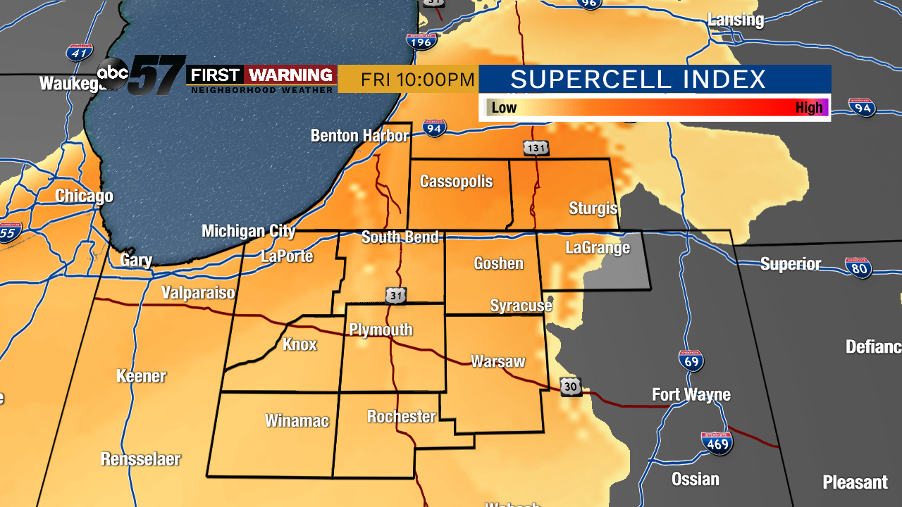 Severe weather ingredients are pretty decent for a few hours Friday evening across the area.
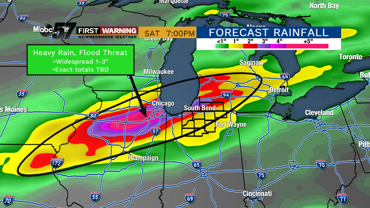
Not everyone will see that much rain, but most of us should record at least 1/2".
If the higher totals of 2-3" are realized, there would be at least a small threat of flooding and flash flooding even with our ground and soils being on the drier side.