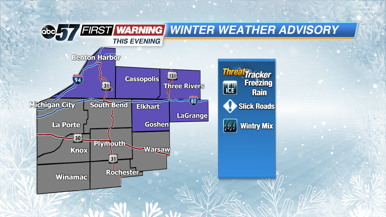
Freezing rain and mixed showers possible this evening

-
3:16

Public input on the proposal to restart the Palisades Nuclear...
-
1:35

Dari Fair opened Wednesday for 2024 season, temperatures cool...
-
1:22

Another round of rain, then a cool weekend
-
4:33

Should Indiana’s abortion records be public?
-
2:52

Trailblazing promotions at the South Bend Fire Department
-
1:30

Downtown South Bend and Notre Dame to see improved connectivity
-
1:44

Storm threat today holds relatively low severe risk
-
0:30

Officials share opioid settlement funding plan
-
1:04

Bonneyville Mill opens for the 2024 season
-
0:32

Increase in federal funding coming to improve local hiking and...
-
3:07

Gun violence on the decline in South Bend
-
1:18

Severe weather could visit Midwest again Wednesday

Slick roads are possible this morning from yesterday’s snowfall plus areas of freezing drizzle this morning. Give yourself an extra 10-15 minutes on the roads. For a live check of the roads, tune into ABC 57 Morning News. Freezing rain/mix is possible with the onset of the next system. It will move in from south to north and could create very slick roads through early tomorrow morning.
Freezing rain starts to turn to rain tomorrow morning with scattered rain showers on and off through the day. As the next round of rain moves in Tuesday evening, colder air moves in as well, turning rain to snow for Wednesday morning. Scattered snow showers will last through the morning commute. Very windy conditions on Wednesday could lead to isolated power outages.
Today: Cloudy with freezing rain/mix this evening, high of 33.
Tonight: Freezing rain early turning to rain overnight, low of 30.
Tuesday: Scattered rain showers turning snow late, breezy, high of 38.
Wednesday: AM scattered snow and mostly cloudy, windy, highs near 30.