First frost possible tonight!


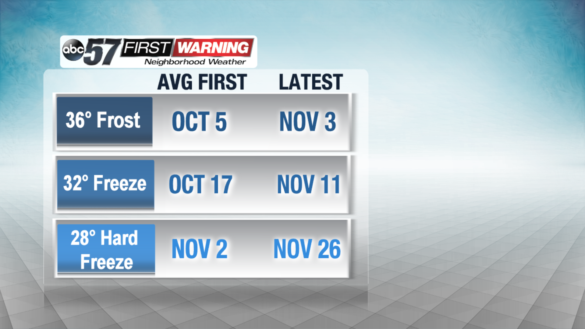
The average first frost is October 5th, which was about a week ago, and the latest first frost ever is November 3rd. We are right in this window, and could see our first frost in some spots Thursday and Friday night. Frost advisories are already in effect Thursday night for Starke, Pulaski and Fulton Counties.
For frost to form, the temperature need to be thirty-six degrees or cooler, but other factors can determine if frost forms or not. It depends where you live.
If you live in an urban area, for example, the South Bend, Elkhart or Goshen areas, these areas usually stay a bit warmer. Buildings, homes and concrete all hold heat, and if there are clouds overhead, temperatures also won't drop as much. If the skies are clear, there is a better chance for cooler temperatures and frost, but it likely will not be as thick as rural areas under the same weather conditions.
In rural areas, there are fewer buildings and concrete, so the area will cool down more. Also, with more plants, trees and grass, there is more moisture from transpiration. Of course, if temperatures are cooling and there is moisture, frost will more easily form.
Don't forget to bring in your cold sensitive plants to keep them alive in case your area does see frost tonight and tomorrow night.