Few rounds of snow and then extreme cold

-
7:27

Center for the Homeless hosting Dancing With Our Stars
-
2:10

More wet weather arriving later tonight, but sunnier skies after
-
3:16

Public input on the proposal to restart the Palisades Nuclear...
-
1:35

Dari Fair opened Wednesday for 2024 season, temperatures cool...
-
1:22

Another round of rain, then a cool weekend
-
4:33

Should Indiana’s abortion records be public?
-
2:52

Trailblazing promotions at the South Bend Fire Department
-
1:30

Downtown South Bend and Notre Dame to see improved connectivity
-
1:44

Storm threat today holds relatively low severe risk
-
0:30

Officials share opioid settlement funding plan
-
1:04

Bonneyville Mill opens for the 2024 season
-
0:32

Increase in federal funding coming to improve local hiking and...

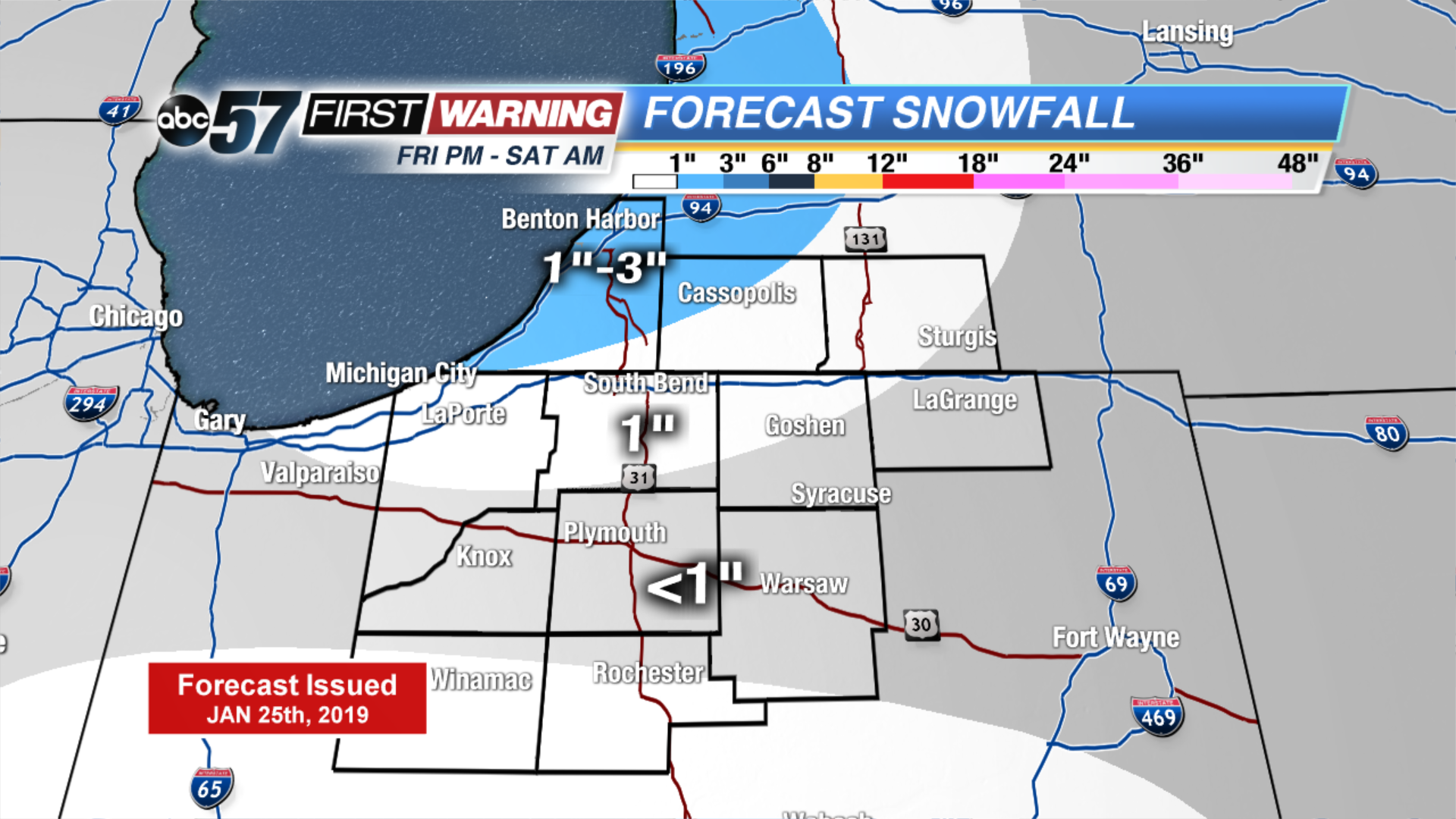
Lake effect snow showers have made roads slick this morning. Make sure you’re giving yourself an extra 5-10 minutes for your commute. It is bitterly cold so pack on the layers. Some schools have 2-hr delays, you can find that full list here. We’ll be tracking road conditions closely all morning on ABC 57 Morning News.
A few light snow showers move in later this evening lasting into Saturday morning, adding an additional 1-3” of snow. Daytime highs remain mainly in the teens but the true arctic air moves in after a snowy system on Monday. Daytime highs will likely be subzero by the middle of the week with overnight lows well below zero.
Today: Morning snow showers, mostly cloudy. High of 10.
Tonight: Few snow showers, low of 4.
Saturday: Morning flurries, mostly cloudy. High of 18.
Sunday: Chance of snow, mostly cloudy. High of 18.