Dry Friday, flood threat returns this weekend
Posted: Jun 20, 2019 4:37 PM EDT

-
1:44

Drier but cooler weather returns for Wednesday
-
2:32

County Council asks questions on 900-acre Granger rezoning and...
-
0:56

Notre Dame women’s basketball team holds end-of-season awards...
-
0:45

Idea Week kicks off with networking at launch party
-
2:59

SBPD officer takes in six puppies while SBARC remains on Parvo...
-
1:45

How rain is hampering planting progress
-
2:43

From classrooms to rental units in Chikaming Township
-
1:47

Cooler and drier midweek, milder and wetter weekend
-
2:36

Aspiring chefs are cultivating their dreams at Ivy Tech
-
1:40

Rainy and breezy Tuesday
-
0:58

Hockey team hosts ’Rally for Rudy’ car wash
-
1:06

South Bend School Board of Trustees reviewing the code of conduct

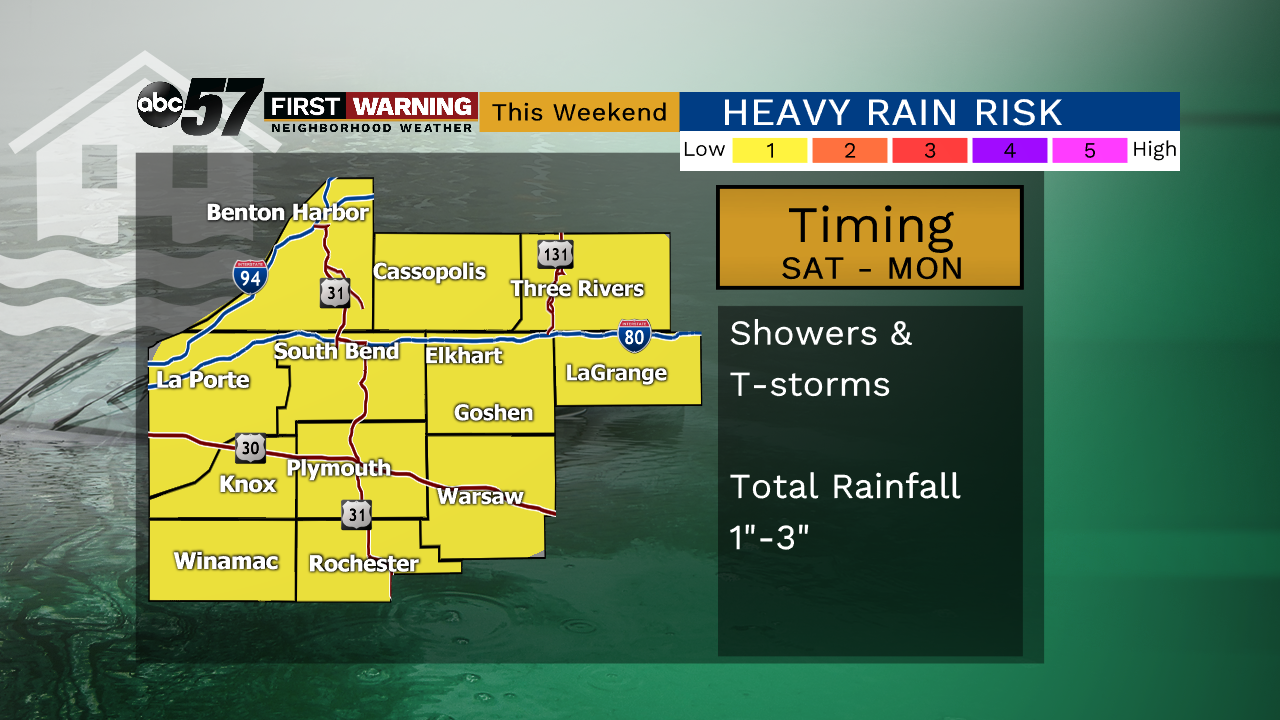
Areas of fog start the day Friday but the officially start to summer at 11:54 a.m. EDT will be sunny. This will be the one fair day before more showers and storms this weekend. Sunday and Monday have the highest probability of rain. The severe threat is low but heavy rain and flooding will remain a concern through the weekend. We could see an additional one to three inches through Monday.
Tonight: Clearing skies, fog possible, low of 52.
Friday: Mostly sunny, high of 76.
Saturday: Isolated showers/storms, mostly cloudy, high of 78.
Sunday: Scattered showers/storm, mostly cloudy, high of 82.
Sign up for the ABC 57Newsletter