Cold temperatures linger through Sunday

-
1:58

Rain returns tonight, storm chances picking up into tomorrow
-
2:20

Indiana Fever select Caitlin Clark #1 overall in WNBA Draft
-
5:31

Interview with Rep. Bill Huizenga over Israel-Iran conflict
-
1:05

Students perform in first-time joint concert event
-
2:31

Neighbors react after man barricaded himself in crashed vehicle
-
1:52

St. Joseph River at near-flood stage in Niles
-
1:03

Construction set to start on intersection at State Road 933 and...
-
1:54

Event honoring Vietnam War veterans to be held in New Carlisle
-
2:44

St. Joe marinas await completion of Bicentennial Bridge construction
-
2:05

The storm threat is shifting to Wednesday
-
1:24

WNBA Draft looking to impact the next generation of female athletes
-
2:31

One last quiet, pleasant day before storms return tomorrow

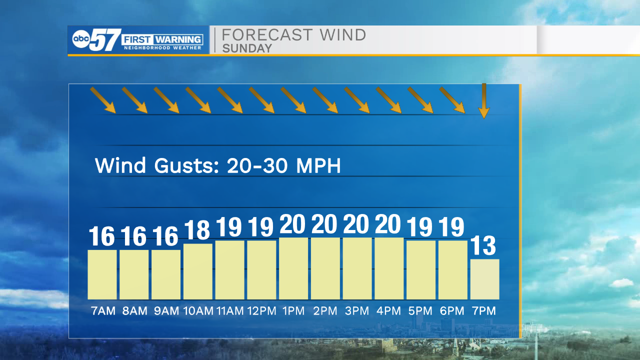
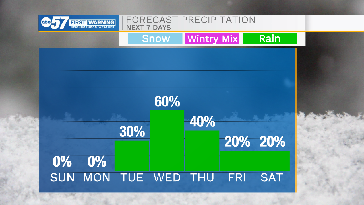
A few isolated lake effect snow flurries are possible for portions of Michiana this evening. Winds will stay on the breezy side as well keeping feel like temperatures in the teens and lower 20s. Bundle up if you head out for any Saturday evening plans! Tomorrow morning will be very cold with temperatures in the lower 20s and wind chills well into the teens. We will get some sunshine to return tomorrow after cloud cover clears out around mid-day. This will help to get temperatures back into the lower 30s. Monday looks dry with mostly sunny to partly cloudy skies and highs in the lower 40s. Temperatures will keep warming into Wednesday where highs hit the mid 60s. With the warmer weather rain chances increase as well. Scattered showers will arrive later in the day Tuesday, and linger all the way through Thursday. After the rain clears, temperatures start to drop back into the 40s next weekend.
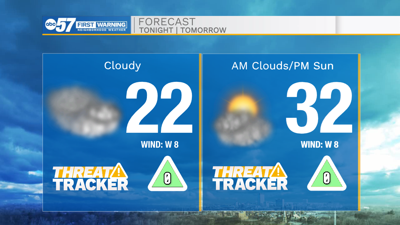
Tonight: Cloudy/cold. Low 22.
Tomorrow: AM clouds/PM sun. High 32.
Monday: Mostly sunny. High 40.
Tuesday: Mostly cloudy/PM rain. High 44.