Bitter cold and a chance of light lake effect snow

-
1:52

While the rain is over, the cooling temperatures are not
-
2:28

Public forum hosted by John Glenn High School students
-
3:34

Kickoff preview with ABC57’s Allison Hayes
-
0:57

Completion of Martin Luther King Jr. Dream Center one step closer
-
0:36

Niles High School students network with local professionals
-
3:59

Political group asks Indiana Democrats to vote in Republican...
-
3:01

New Buffalo Area Schools to build workforce housing
-
2:37

City seeks feedback for final Potawatomi Park plan
-
7:27

Center for the Homeless hosting Dancing With Our Stars
-
2:10

More wet weather arriving later tonight, but sunnier skies after
-
3:16

Public input on the proposal to restart the Palisades Nuclear...
-
1:35

Dari Fair opened Wednesday for 2024 season, temperatures cool...

Tuesday, December 10th, 2019
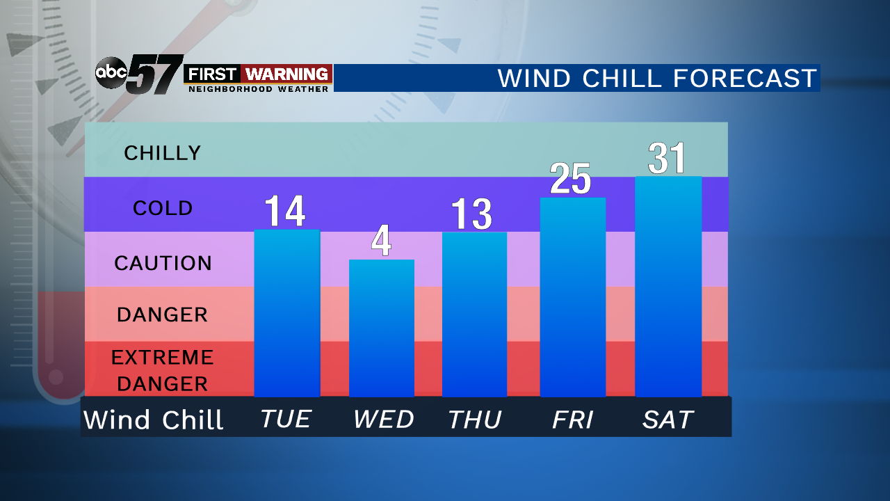
Temperatures have fallen below freezing this morning so a slick spot or two is possible during your commute. A couple of light lake effect snow showers will develop, but it won't add up to much. Up to 2" possible for a couple of Michigan counties. It stays cold Wednesday with a high only in the mid-20s. A couple of flurries are possible, otherwise it's just breezy. Temperatures begin to improve Thursday with a quiet end to the work week. There is a chance of snow Saturday evening with cloudier skies through the weekend.
Today: Mostly cloudy, light lake effect snow. Breezy. Temperatures hold in the mid-20s
Tonight: Few clouds, flurries possible. Low of 14.
Wednesday: Partly cloudy, breezy. Chance of a flurry. High of 25.
Thursday: Mix of sun and clouds. High of 36.