Big waves and big wind bring more erosion Friday

-
2:11

Students gearing up for local careers in Manufacturing
-
2:13

Sunny today, but expect a wetter and warmer weekend
-
0:54

Goodwill ’Little Black Dress’ event raises funds for community...
-
1:45

Cheers Bar and Grill liquor license renewed following controversy
-
2:40

Kyle Rudolph weighs in on fellow Irish, Joe Alt, ahead of NFL...
-
0:58

Contractors prepare bids for multi-million-dollar Four Winds...
-
3:11

Caleb Williams and Marvin Harrison Jr. weigh in on upcoming draft
-
3:18

New settlement with Indiana allows Landmark to apply for recertification
-
2:32

NFL Analysts break down Joe Alt’s stock
-
1:21

Fair Thursday wet / windy weekend
-
2:52

Union Township sues UNAS over ambulance stripped for parts
-
1:32

Bridging the healthcare gap in Michiana

There is a lakeshore flood warning and wind advisory for parts of the area, including Berrien and LaPorte Counties. Winds pick up Thursday evening, but they will be strongest from 4 a.m. until 1 p.m Friday.
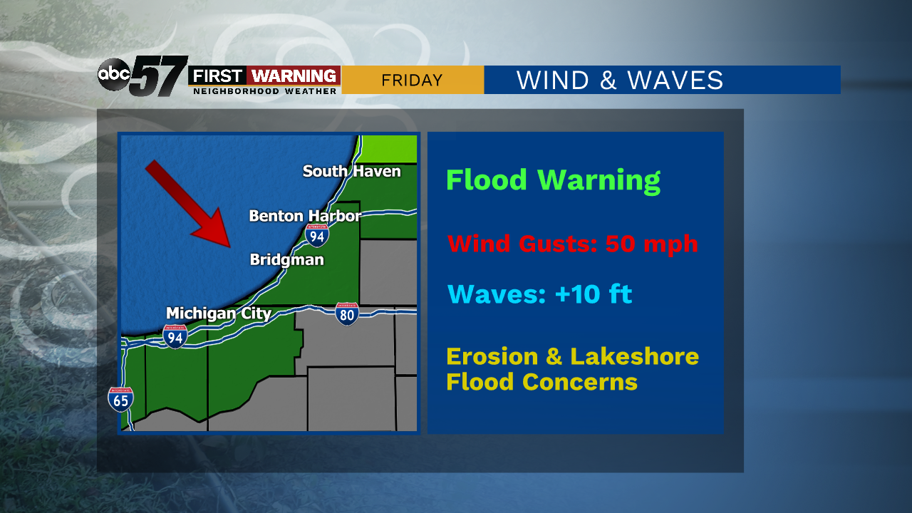
Winds could gust up to 50 miles per hour at times in areas near the lake. This will lead to tall waves on Lake Michigan. The wind direction is favorable to push these tall waves directly to our shores. Combining this with already high water levels, beach erosion and lakeshore flooding will be concerns Friday.
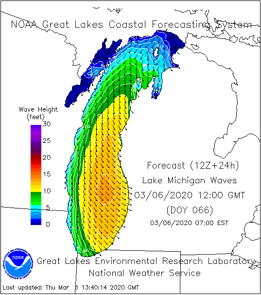
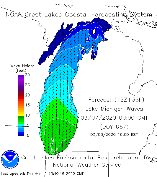
This map shows wave heights for 7 a.m. Friday. The tallest waves will be around 13 feet. These are shown in the yellow and orange colors.
By 4 p.m. Friday, winds slow down just a little. Waves could still be as tall as 10 feet by this time. This is the area in yellow.
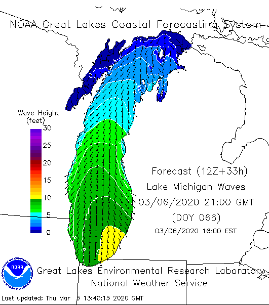
By 7 p.m. on Friday, there could still be wave heights around 8 feet. These are in the dark green contour.
Winds taper off by late Friday evening.