BIG changes this week

-
2:24

Suspect arrested for allegedly sexually assaulting two girls...
-
0:25

Humane Society of St. Joseph County holds microchip clinic
-
2:58

Pulaski County Community Foundation provides support for childcare...
-
3:14

Green wave of economic growth in Michigan from marijuana dispensaries
-
1:28

Brisk, breezy but beautiful weekend
-
0:48

University Park Mall holding parking-lot carnival this week
-
1:52

While the rain is over, the cooling temperatures are not
-
2:28

Public forum hosted by John Glenn High School students
-
3:34

Kickoff preview with ABC57’s Allison Hayes
-
0:57

Completion of Martin Luther King Jr. Dream Center one step closer
-
0:36

Niles High School students network with local professionals
-
3:59

Political group asks Indiana Democrats to vote in Republican...

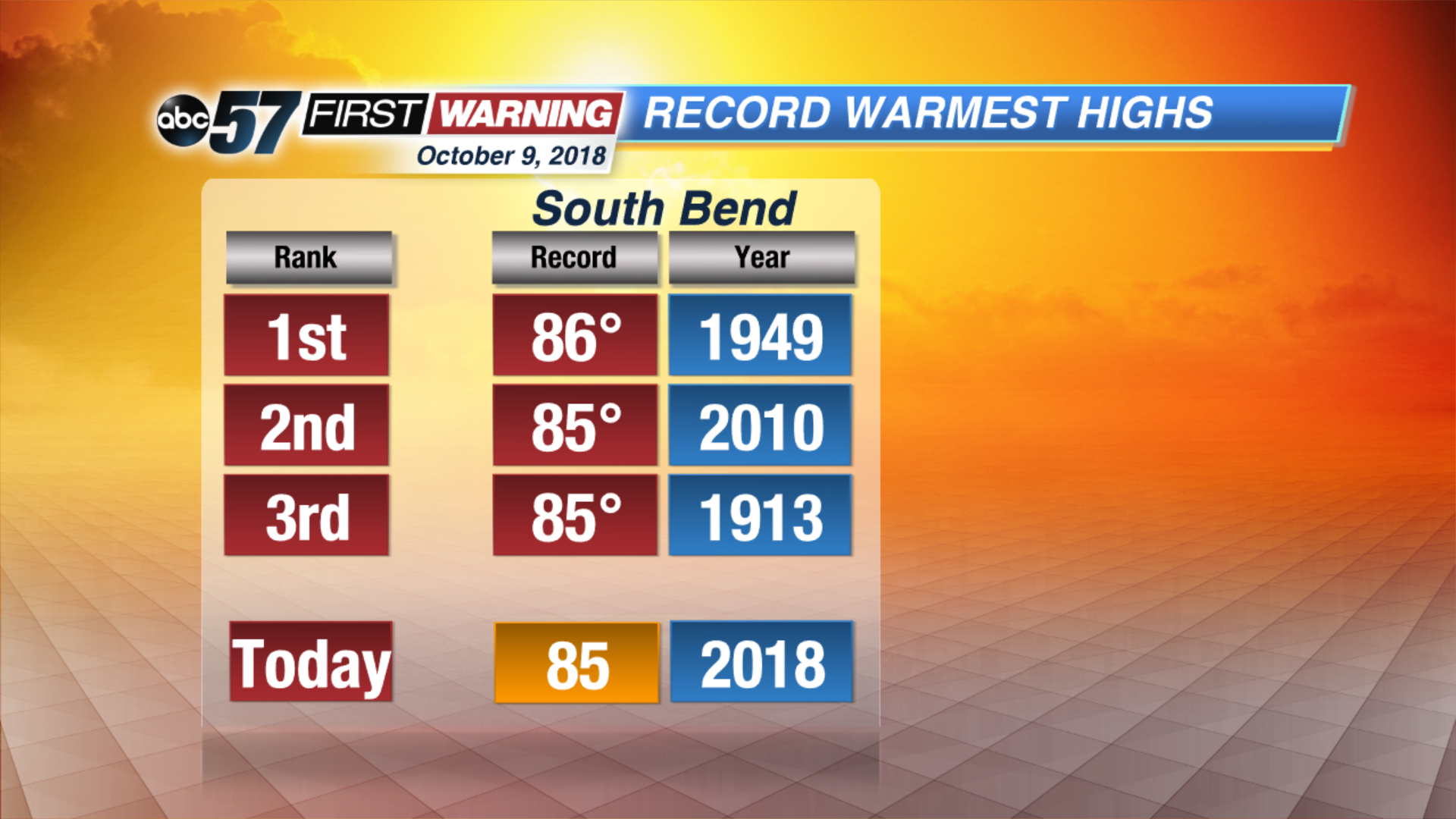
Big changes are coming our way in the next couple of days. We are near record highs for today with highs in the mid-80s with plenty of sunshine. By tomorrow, we see highs in the mid-70s with clouds quickly increasing and scattered showers and storms arriving near midday. Some storm could be strong with gusty winds and heavy rain and cannot rule out an isolated severe storm just yet. After the cold front brings the wet weather, much cooler air works its way into Michiana. Highs drop into the 50s through the rest of the week with our first frost possible Saturday morning.
Today: Partly cloudy, isolated storm possible. High of 84.
Tonight: Partly cloudy, low of 68.
Wednesday: Increasing clouds, PM showers and storms likely. Highs of 75.
Thursday: Mostly sunny, high of 55.