Big boundary keeps Michiana cool and rainy
Posted: May 10, 2018 4:45 PM EDT

-
1:26

Brisk but beautiful weekend
-
5:15

ABC57’s Arts and Acts: All-American Rejects comes to South...
-
2:08

Whirlpool and Lake Michigan College host second Girls Rock IT...
-
2:24

Suspect arrested for allegedly sexually assaulting two girls...
-
0:25

Humane Society of St. Joseph County holds microchip clinic
-
2:58

Pulaski County Community Foundation provides support for childcare...
-
3:14

Green wave of economic growth in Michigan from marijuana dispensaries
-
1:28

Brisk, breezy but beautiful weekend
-
0:48

University Park Mall holding parking-lot carnival this week
-
1:52

While the rain is over, the cooling temperatures are not
-
2:28

Public forum hosted by John Glenn High School students
-
3:34

Kickoff preview with ABC57’s Allison Hayes

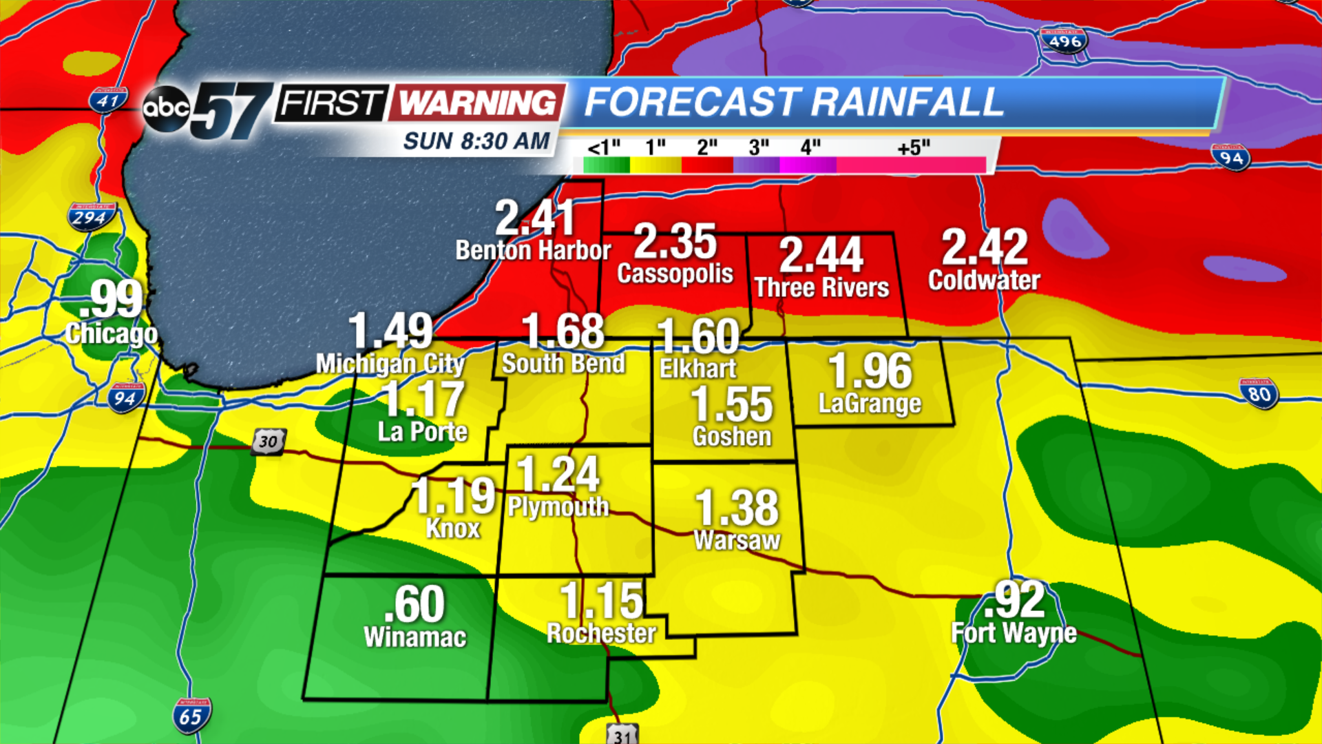
A stationary front will cut a sharp divide in temperatures across North Central Indiana. Most of Michiana will stay in the cool sector, meaning highs in the 50s and 60s but 70s and 80s will loom just to our south. Along that stalled boundary will form rounds of showers and thunderstorms that last through Saturday. These near stagnant systems can lead to excessive rainfall and flooding, more than two inches of rain could fall in the next 48 to 72 hours, minor flooding is possible.
Tonight: Mostly cloudy, chance of showers late, low of 46.
Friday: Mostly cloudy, chance of showers and storms, high of 62.
Saturday: Scattered thunderstorms, high of 62.
Sunday: Becoming partly cloudy, high of 70.
Sign up for the ABC 57Newsletter