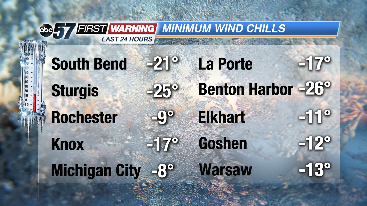
We had the coldest morning of the winter by far on Monday. Temperatures dropped well below 0° with wind chills as cold as -15° to -30°. South Bend actually had its 3rd-coldest January 21st temperature ever at -12°! Even more is that since 1897, only 118 mornings have featured temperatures below -10°. That's out of about 45,000 mornings! In other words, we rarely get as cold as we did Monday. Fortunately, there are no days in the forecast with temperatures quite that frigid, but the arctic air is going nowhere. It will temporarily retreat Tuesday afternoon into Wednesday morning as a low pressure system and strong southerly winds usher in "milder" air. Temps may push 40° by Tuesday night and Wednesday morning.
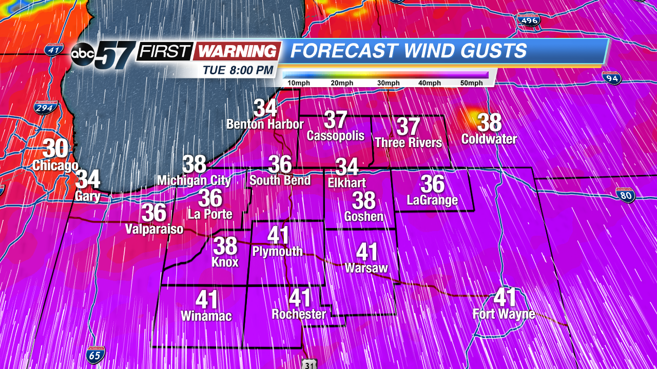
Strong winds will gust 35-45 mph at times Tuesday thru Wednesday morning.
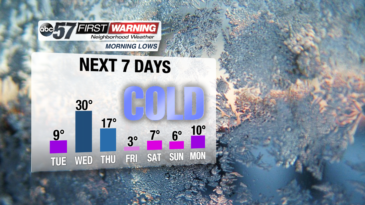
Enjoy that because a fresh shot of arctic air moves right in by later in the day Wednesday. We will not see highs eclipse 25° after Wednesday morning. There will be several days with highs in the teens and lows in the single digits, if not below zero.
So, unlike the current shot of arctic air, the next one will last for several days. It will be important to be cautious and dress in layers if spending lengthy periods of time outdoors beginning Wednesday night. If possible, avoid long duration exposure to the cold when temperatures are below 20°.
Probability of below-average temperatures between January 28th and February 3rd.NOAA
Other precautionary actions you can do when temps get this cold for several days in a row include:
•Let faucets drip slowly to avoid freezing pipes
•Open cabinets beneath sinks for better air flow
•Keep your home at a minimum temperature of 65°
•Clean gutters out to avoid ice formation on your roof
•Check tire pressure as lower-than-ideal psi values lower fuel mileage
•Top off fluids for your vehicle
•Keep your gas tank filled to at least 1/2-tank
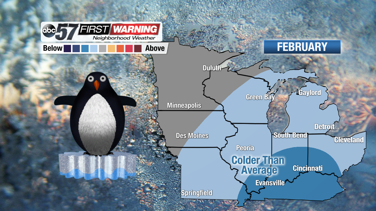
Probability of below-average temperatures during the month of February.NOAA
And, as always, take any other precautionary measures you typically take when it gets extremely cold. Unfortunately, as mentioned above, the frigid air will be in control for the foreseeable future beginning Wednesday night. A day here or there will feature highs in the 20s, but the trend for the next 2-3 weeks is colder-than-normal in the temperature department. According to the Climate Prediction Center, Michiana and surrounding areas have a 80-90% chance of seeing below normal temperatures from late this month into early February. We are even included in the colder-than-normal category in the latest February outlook as well as confidence continues to grow in a lengthier period of cold.


 Strong winds will gust 35-45 mph at times Tuesday thru Wednesday morning.
 Probability of below-average temperatures between January 28th and February 3rd.
 Probability of below-average temperatures during the month of February.