A wet start to the week and cooler air on the way

-
2:11

Students gearing up for local careers in Manufacturing
-
2:13

Sunny today, but expect a wetter and warmer weekend
-
0:54

Goodwill ’Little Black Dress’ event raises funds for community...
-
1:45

Cheers Bar and Grill liquor license renewed following controversy
-
2:40

Kyle Rudolph weighs in on fellow Irish, Joe Alt, ahead of NFL...
-
0:58

Contractors prepare bids for multi-million-dollar Four Winds...
-
3:11

Caleb Williams and Marvin Harrison Jr. weigh in on upcoming draft
-
3:18

New settlement with Indiana allows Landmark to apply for recertification
-
2:32

NFL Analysts break down Joe Alt’s stock
-
1:21

Fair Thursday wet / windy weekend
-
2:52

Union Township sues UNAS over ambulance stripped for parts
-
1:32

Bridging the healthcare gap in Michiana

ABC57 First Warning Neighborhood Weather Forecast
Monday, September 20th, 2021
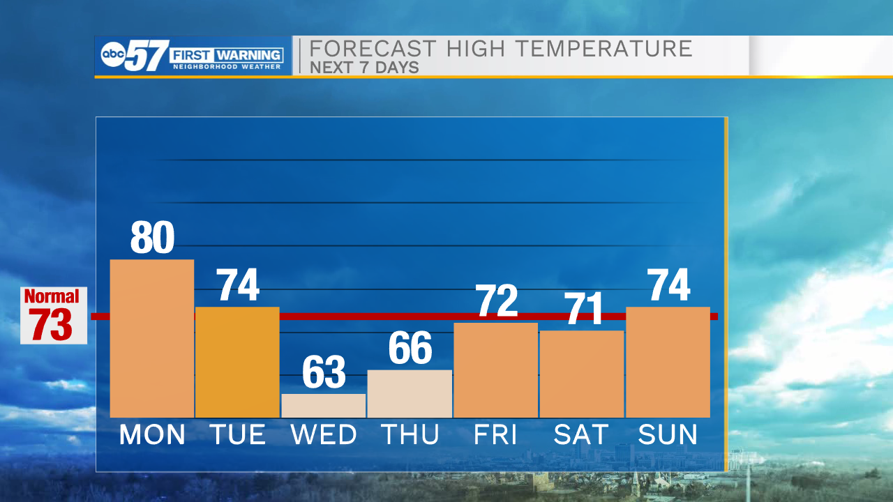
Scattered showers move through on and off today with a chance of a couple rumbles of thunder. A cold front moves through tomorrow, bringing a line of scattered showers and thunderstorms. A few showers could linger into early Wednesday morning but then clouds will start to break up during the afternoon. Temperatures fall into the mid 70s tomorrow, then mid to low 60s on Wednesday. Some true Fall weather settling in, just in time for the official start of Fall on Wednesday. The rest of the week is pleasant with highs making it into the low 70s again by Friday.
Today: Overcast with rain showers. Afternoon thunder possible. High 80.
Tonight: Scattered showers. Low 66.
Tuesday: Rain and thunderstorms. High 74.
Wednesday: Early AM showers, then partial clearing. High 63.