Wintry weather returns, slick start to Friday

-
1:52

While the rain is over, the cooling temperatures are not
-
2:28

Public forum hosted by John Glenn High School students
-
3:34

Kickoff preview with ABC57’s Allison Hayes
-
0:57

Completion of Martin Luther King Jr. Dream Center one step closer
-
0:36

Niles High School students network with local professionals
-
3:59

Political group asks Indiana Democrats to vote in Republican...
-
3:01

New Buffalo Area Schools to build workforce housing
-
2:37

City seeks feedback for final Potawatomi Park plan
-
7:27

Center for the Homeless hosting Dancing With Our Stars
-
2:10

More wet weather arriving later tonight, but sunnier skies after
-
3:16

Public input on the proposal to restart the Palisades Nuclear...
-
1:35

Dari Fair opened Wednesday for 2024 season, temperatures cool...

Winter weather comes roaring back to Michiana. Temperatures will drop sharply tonight as rain changes to sleet and snow. Slick roads are the top concern, overall snow accumulation may be at a minimum but don’t let your guard down as ice is the main concern, after previous salt treatments are washed away.
Snow showers come to an end by midday Friday but temperatures won’t get any warmer. Temperatures drop into the teens with light lake effect snow showers near the lake Friday night into Saturday. The cold last through the weekend with another round of snow Monday.
Tonight: Rain changing to wintry mix and snow, low of 26. 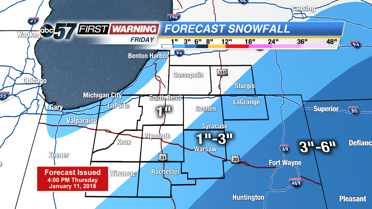 System snow Frday
Friday: Morning snow showers, high of 28.
Saturday: Mostly cloudy, lake effect snow showers, high of 20.
Sunday: Partly cloudy, high of 18.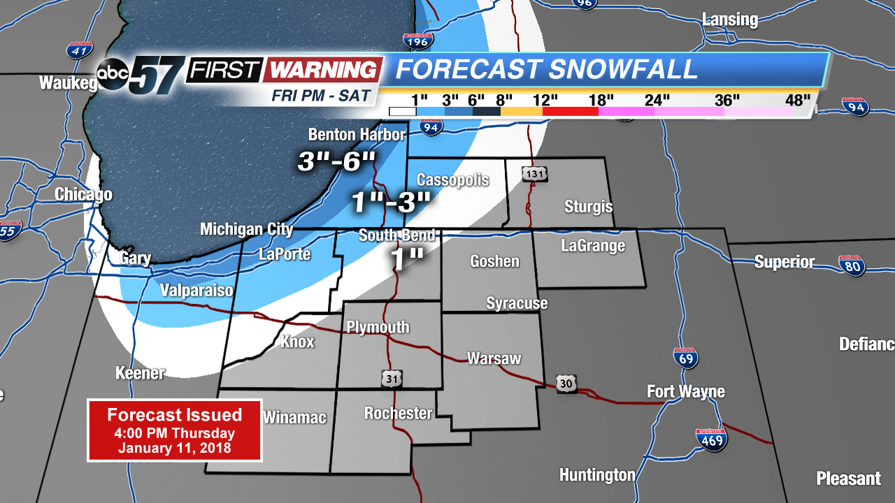 Lake effect snow Friday night through Saturday