Wintry mix Thursday night, still chilly Friday

-
0:54

Goodwill ’Little Black Dress’ event raises funds for community...
-
1:45

Cheers Bar and Grill liquor license renewed following controversy
-
2:40

Kyle Rudolph weighs in on fellow Irish, Joe Alt, ahead of NFL...
-
0:58

Contractors prepare bids for multi-million-dollar Four Winds...
-
3:11

Caleb Williams and Marvin Harrison Jr. weigh in on upcoming draft
-
3:18

New settlement with Indiana allows Landmark to apply for recertification
-
2:32

NFL Analysts break down Joe Alt’s stock
-
1:21

Fair Thursday wet / windy weekend
-
2:52

Union Township sues UNAS over ambulance stripped for parts
-
1:32

Bridging the healthcare gap in Michiana
-
1:44

Drier but cooler weather returns for Wednesday
-
2:32

County Council asks questions on 900-acre Granger rezoning and...

A messy mix of rain changing to snow overnight. As with any mixed precipitation situation, temperatures are key. Most precip will fall as rain through the evening, changing to snow around midnight. Milder ground temperatures will melt most of the snow but there could be grassy accumulation and slick or slushy spots on the roads.
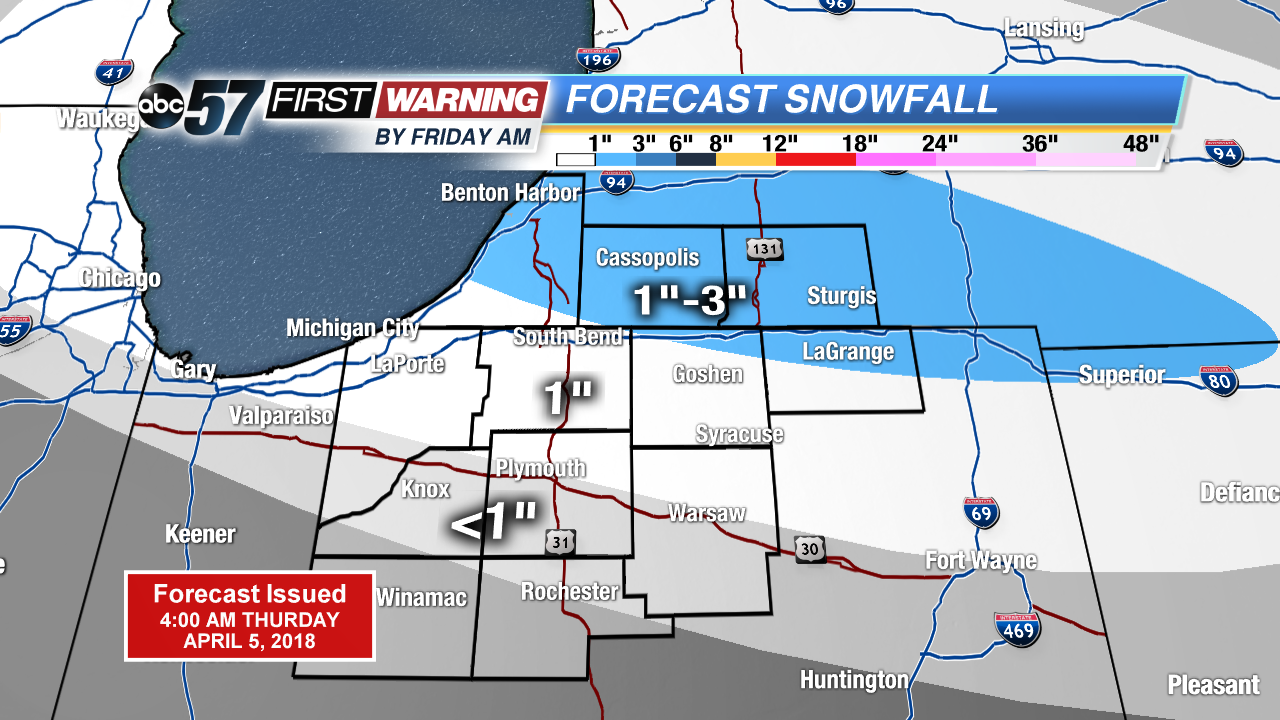
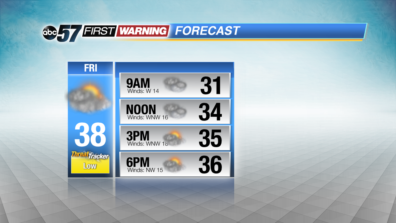
Friday, a few slick spots are possible, with a chance of morning snow or mix. The rest of the day stays chilly and mostly cloudy. The cold weather continues through the weekend, skies clear Saturday into Sunday but temperatures struggle to warm. There’s another chance of snow Sunday night, before we may see a real spring warm-up next week.
Tonight: Rain showers changing to snow, low of 30.
Friday: Mostly cloudy, chance of wintry mix early, high of 38.
Saturday: Partly cloudy to mostly sunny, high of 34.
Sunday: Partly cloudy, highs in the upper 30s.