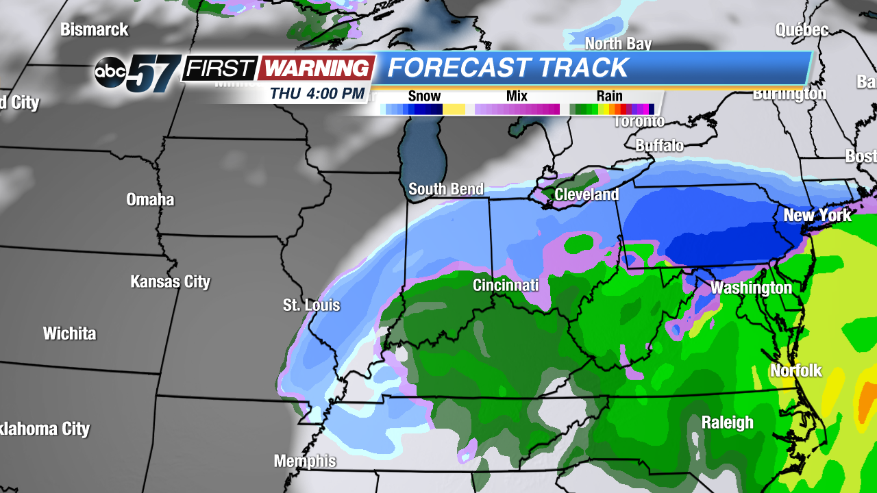
European model showing wintry precipitation at 4 p.m. Thursday.
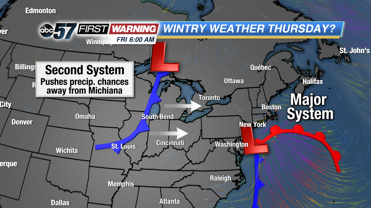
One system has departed the Great Lakes Tuesday afternoon, but another, more significant one, is hot on its heels. The absolute worst of the conditions will remain to our south and well to our east. However, some snow and even a wintry mix could fall across much of Michiana come Thursday afternoon and evening. The system itself is still in the act of developing in the Southeast. It will do so come Wednesday, and track northward by Thursday. The result will be an expansive area of precipitation, including rain, snow, sleet, and freezing rain.
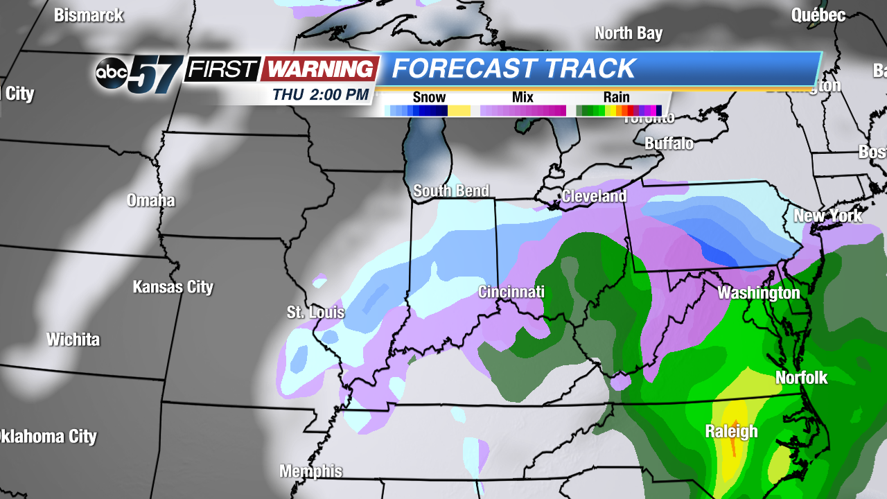
NAM model precipitation forecast at 2 p.m. Thursday.
Impacts from wintry weather will be felt from Missouri and Illinois to North Carolina, Virginia and Pennsylvania. What's a little odd with this particular system is that the greatest impacts will be felt in locations south of Michiana. Is there any chance the path of the storm could shift? Yes. As of now, though, it looks unlikely that it would shift far enough northwest to provide us with significant winter. As mentioned above, though, at least some affects will be seen here by Thursday.
Our impacts locally would likely be in the form of light snow and/or a wintry mix of snow, sleet and freezing rain. Whatever falls would likely be on the lighter side of things, but minor accumulations could occur. It's something worth keeping in mind for Thursday afternoon into Thursday night. If you live south of U.S. 30, your chances of seeing wintry weather are a little higher than those who live in Michigan. We can thank a secondary, weaker system set to move into the Great Lakes from the west by Friday morning for keeping local impacts relatively minor. That second system will effectively "push" the major system off to our east, keeping the heavier precipitation away from northern Indiana and southwestern Michigan.
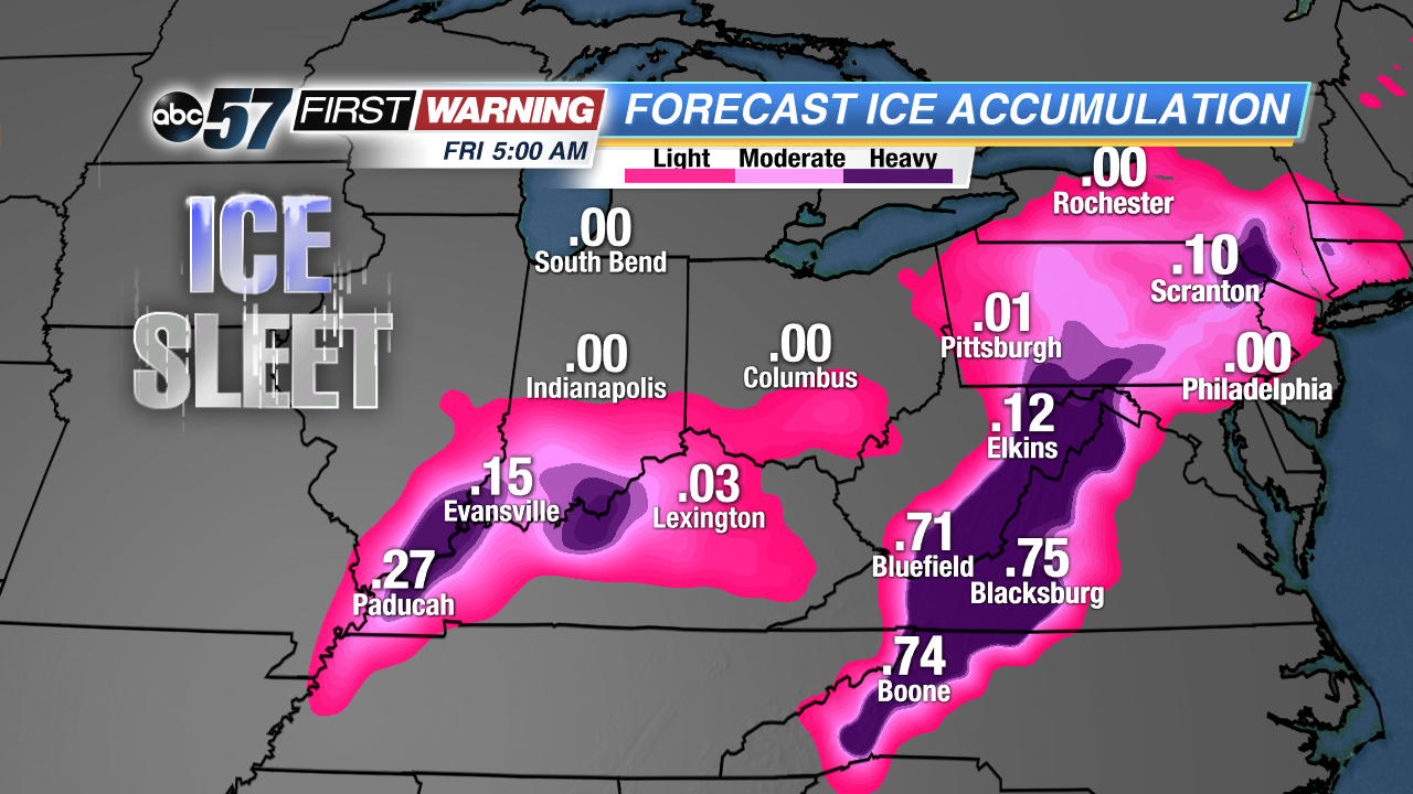
With this particular storm, it is a very good thing that we will be missing the brunt because hefty ice and snow totals are likely. Freezing rain accretion upwards of 1/4" to 1" is expected across parts of North Carolina, Virginia, West Virginia, Maryland, and Pennsylvania. Less, but potentially problematic ice totals are possible in southern Illinois, southern Indiana and northern Kentucky as well. Any amount of ice can lead to extensive problems, but the amount of ice currently being forecast could lead to widespread power outages, downed tree limbs and numerous accidents. In addition to ice, accumulating snow is likely from St. Louis to Paducah to Evansville, Terre Haute, and Indianapolis.


 European model showing wintry precipitation at 4 p.m. Thursday.
 NAM model precipitation forecast at 2 p.m. Thursday.