Storms clearing, cooler and calmer Thursday

-
2:24

Suspect arrested for allegedly sexually assaulting two girls...
-
0:25

Humane Society of St. Joseph County holds microchip clinic
-
2:58

Pulaski County Community Foundation provides support for childcare...
-
3:14

Green wave of economic growth in Michigan from marijuana dispensaries
-
1:28

Brisk, breezy but beautiful weekend
-
0:48

University Park Mall holding parking-lot carnival this week
-
1:52

While the rain is over, the cooling temperatures are not
-
2:28

Public forum hosted by John Glenn High School students
-
3:34

Kickoff preview with ABC57’s Allison Hayes
-
0:57

Completion of Martin Luther King Jr. Dream Center one step closer
-
0:36

Niles High School students network with local professionals
-
3:59

Political group asks Indiana Democrats to vote in Republican...

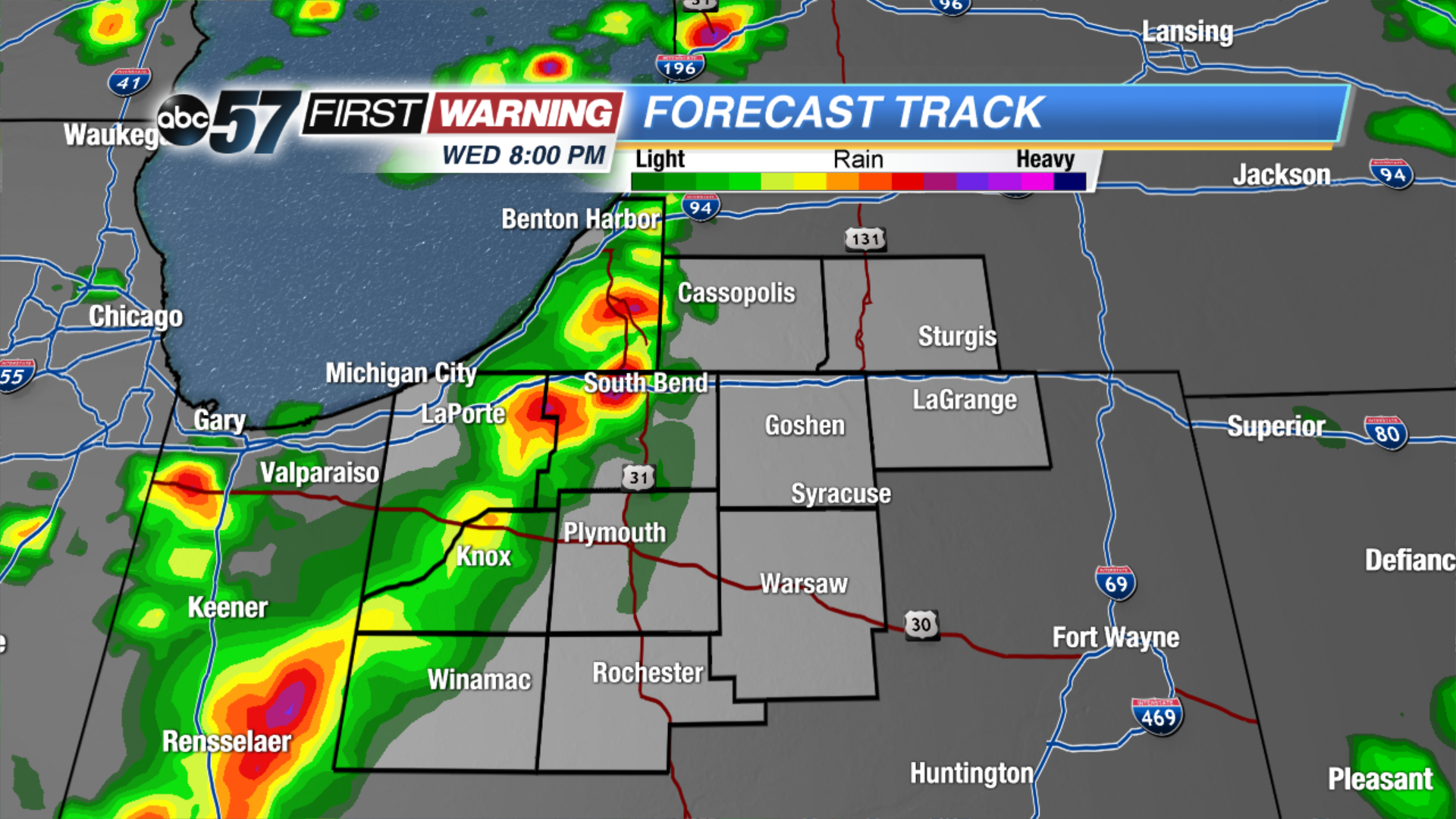
Update: Storms clearing Michiana through the 10:00 p.m hour, a few showers may linger into the early morning.
Storm threat through 10:00 p.m. Wednesday evening. Severe weather is possible, the greatest concern being strong wind gusts topping 60 mph and heavy rain. Storms develop west of Michiana around 5:00 p.m. and are likely to strengthen as they move east.
Thursday starts dreary with a few showers, clouds break by the afternoon. The pattern stays active with more showers and storms in the forecast Friday and Saturday. Saturday could be another severe weather threat. The forecast has changed greatly for Saturday as Michiana may hinge just north of a warm front that will split Indiana between the 60s and 70s in the north and 80s to the south.
Tonight: Evening thunderstorms, low 58.
Thursday: Morning showers then partly cloudy, high of 68.
Friday: Mostly cloudy, chance of showers and storms, high of 70.
Saturday: Scattered thunderstorms, high of 74.