
-
1:52

While the rain is over, the cooling temperatures are not
-
2:28

Public forum hosted by John Glenn High School students
-
3:34

Kickoff preview with ABC57’s Allison Hayes
-
0:57

Completion of Martin Luther King Jr. Dream Center one step closer
-
0:36

Niles High School students network with local professionals
-
3:59

Political group asks Indiana Democrats to vote in Republican...
-
3:01

New Buffalo Area Schools to build workforce housing
-
2:37

City seeks feedback for final Potawatomi Park plan
-
7:27

Center for the Homeless hosting Dancing With Our Stars
-
2:10

More wet weather arriving later tonight, but sunnier skies after
-
3:16

Public input on the proposal to restart the Palisades Nuclear...
-
1:35

Dari Fair opened Wednesday for 2024 season, temperatures cool...

Warm and very humid weather will be the forecast the rest of the week. The head index will be 90 or above each afternoon with dewpoints in the 70s. This will likely be the muggiest air so far this season. The extreme mugginess will fuel the day-night cycle of thunderstorms. Storms could once again produce heavy downpours along with the possibility of flooding. The patter does not break until next week.
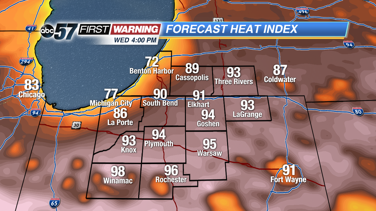 Heat index Wednesday afternoon well into the 90s for most the area.
Tonight: Mostly to partly cloudy, low 66.
Wednesday: Partly cloudy, high 87, isolated showers/storms.
Thursday: Very humid, partly cloudy, afternoon thunderstorms, high 90.
Friday: Very humid, partly cloudy, afternoon thunderstorms, high 88.
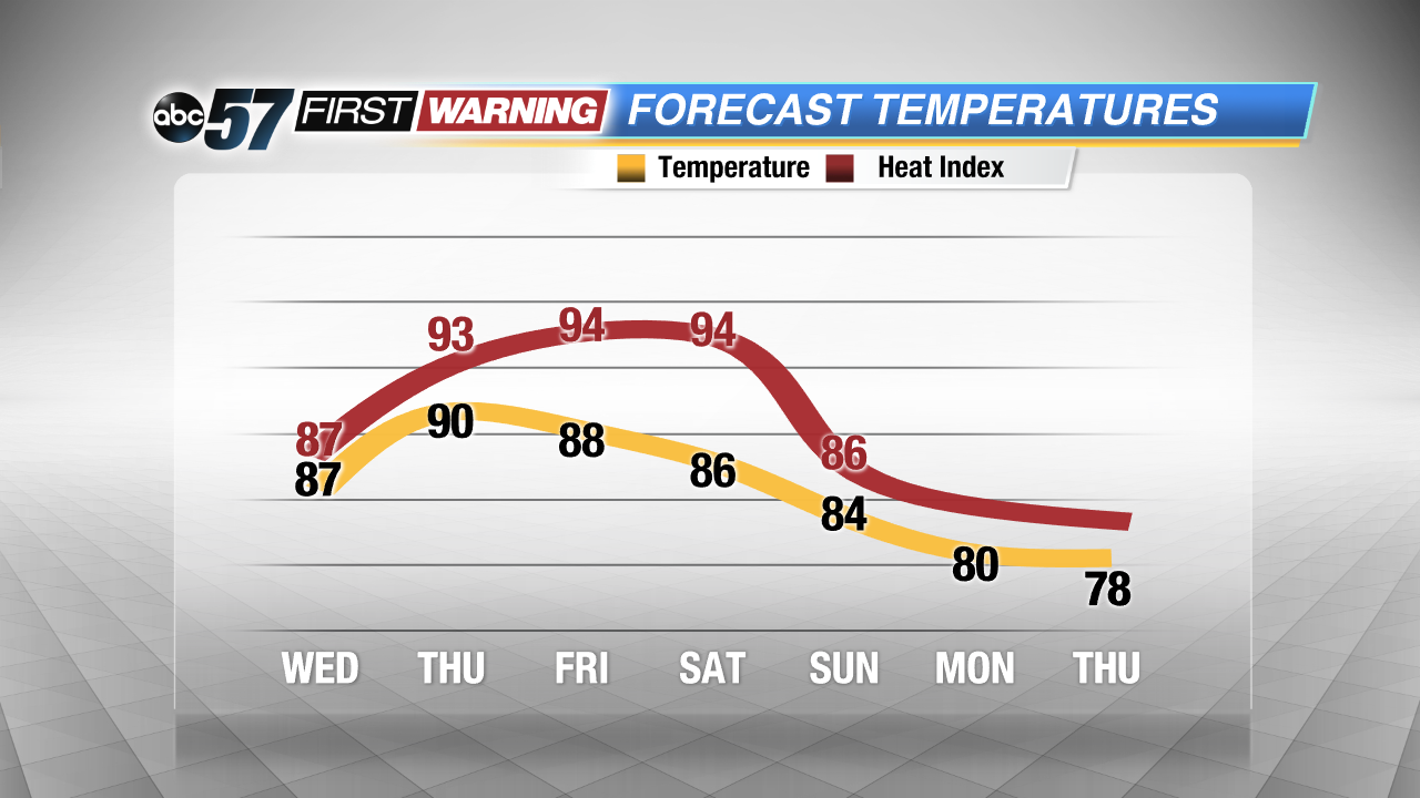 Extremely steamy through the weekend, no relief until early next week.
Sign up for the ABC 57Newsletter