
-
2:24

Suspect arrested for allegedly sexually assaulting two girls...
-
0:25

Humane Society of St. Joseph County holds microchip clinic
-
2:58

Pulaski County Community Foundation provides support for childcare...
-
3:14

Green wave of economic growth in Michigan from marijuana dispensaries
-
1:28

Brisk, breezy but beautiful weekend
-
0:48

University Park Mall holding parking-lot carnival this week
-
1:52

While the rain is over, the cooling temperatures are not
-
2:28

Public forum hosted by John Glenn High School students
-
3:34

Kickoff preview with ABC57’s Allison Hayes
-
0:57

Completion of Martin Luther King Jr. Dream Center one step closer
-
0:36

Niles High School students network with local professionals
-
3:59

Political group asks Indiana Democrats to vote in Republican...

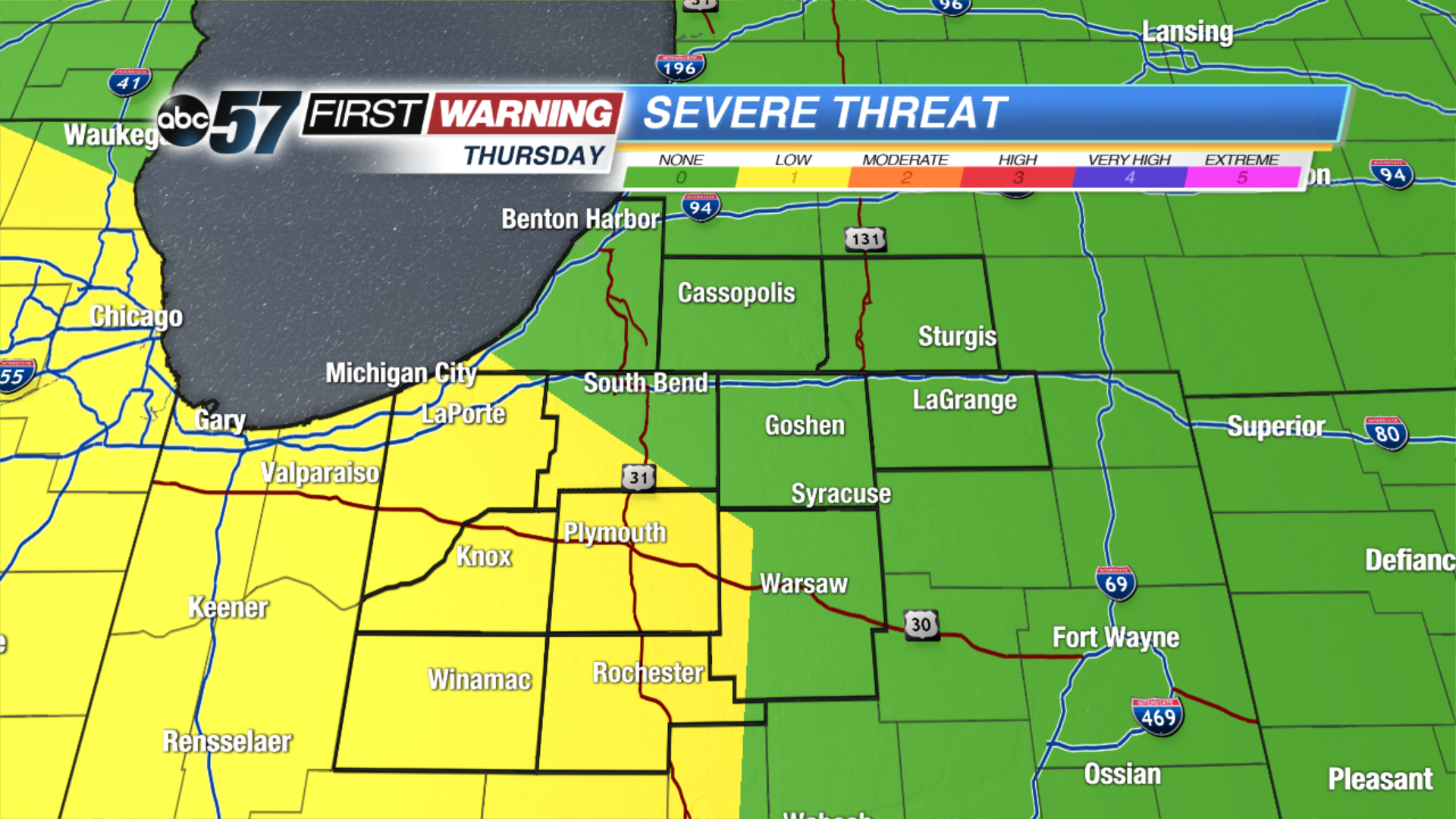
A very typical August pattern ahead. Warm sunny days produce afternoon clouds, some clouds develop into isolated thunderstorms. The pattern continues through the weekend. One thing to watch Thursday afternoon will be a line of storms that could develop to our west and bring a severe threat west of US-31.
Tonight: Partly to mostly clear, low of 64.
Thursday: Partly cloudy, isolated PM storms, high of 86.
Friday: Partly cloudy, isolated PM storms, high of 84.
Saturday: Partly cloudy, isolated PM storms, high of 82.
Sign up for the ABC 57Newsletter