Steamy and stormy through the weekend.

-
2:28

Public forum hosted by John Glenn High School students
-
3:34

Kickoff preview with ABC57’s Allison Hayes
-
0:57

Completion of Martin Luther King Jr. Dream Center one step closer
-
0:36

Niles High School students network with local professionals
-
3:59

Political group asks Indiana Democrats to vote in Republican...
-
3:01

New Buffalo Area Schools to build workforce housing
-
2:37

City seeks feedback for final Potawatomi Park plan
-
7:27

Center for the Homeless hosting Dancing With Our Stars
-
2:10

More wet weather arriving later tonight, but sunnier skies after
-
3:16

Public input on the proposal to restart the Palisades Nuclear...
-
1:35

Dari Fair opened Wednesday for 2024 season, temperatures cool...
-
1:22

Another round of rain, then a cool weekend

Update: Weakening showers and storms after midnight fade into the early morning. Another round of storms to start Thursday.
Steamy and stormy, those are the two words that will best describe the next three to four days. Thursday will be the hottest day with a heat index of 95 to 100. The mugginess will feed showers and thunderstorms, one round could start Thursday with heavy rain and the day/night stormy pattern continues through Saturday. The threat of heavy rain will continue a flood threat for the already soggy area through the weekend.
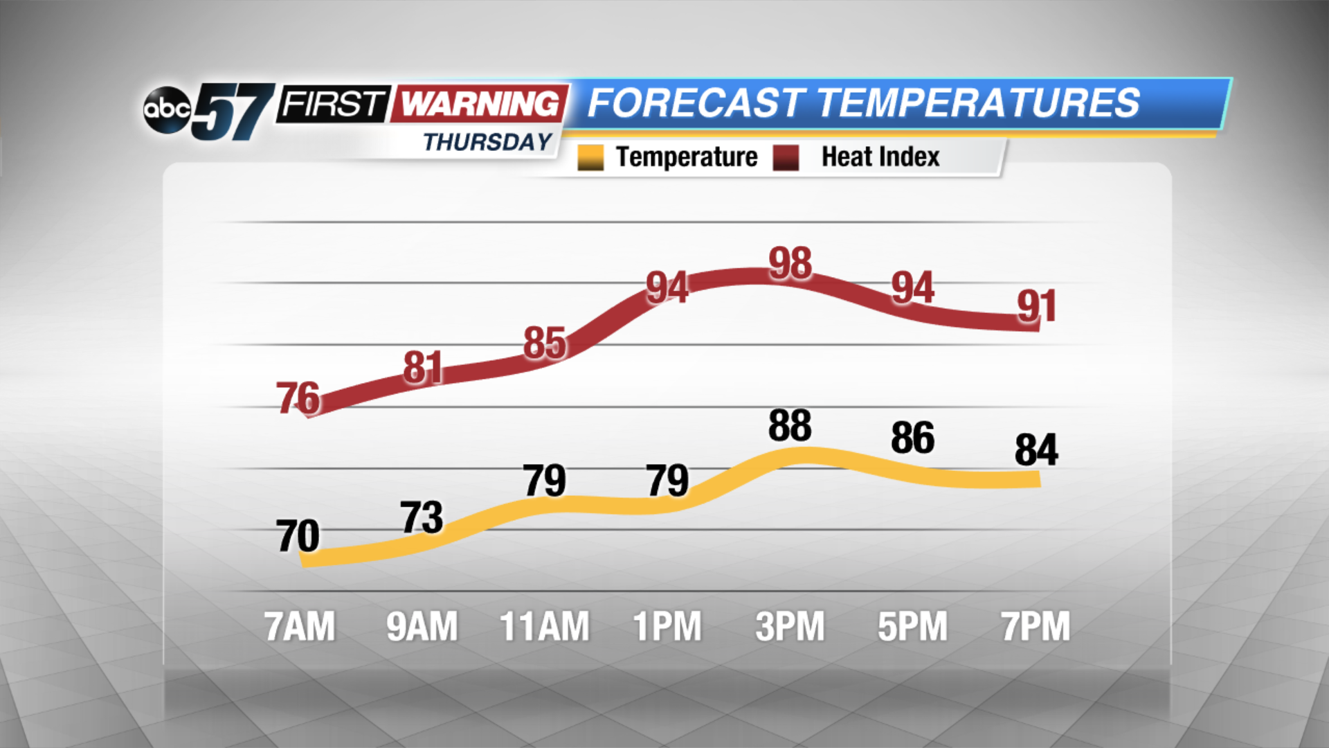 Heat index near 100 Thursday afternoon
Tonight: Partly to mostly cloudy, chance of storms by morning low 70.
Thursday: Very humid, scattered storms, high 90.
Friday: Very humid, scattered storms, high 88.
Saturday: Very humid, scattered storms, highs in the mid-80s.
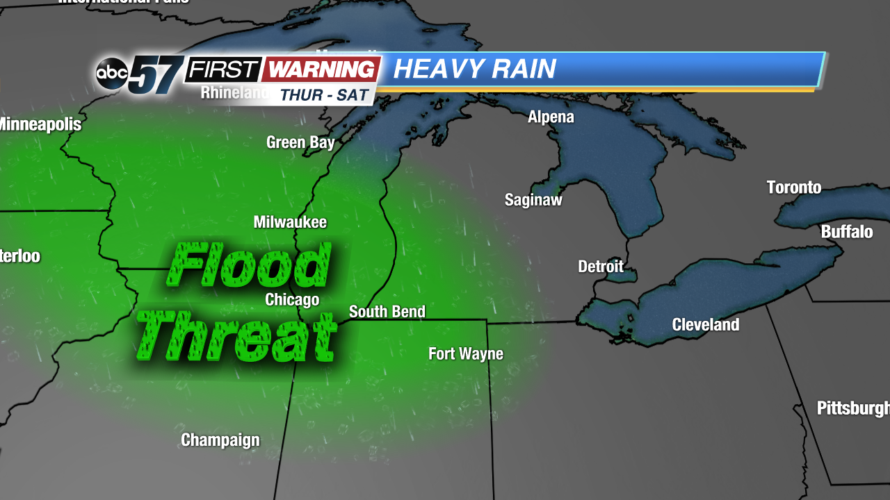 Heavy rain threat through Saturday could bring more flooding to the region.