Snowy Saturday, Michiana on the edge of a Midwest storm
Posted: Jan 11, 2019 4:41 PM EDT

-
0:54

Goodwill ’Little Black Dress’ event raises funds for community...
-
1:45

Cheers Bar and Grill liquor license renewed following controversy
-
2:40

Kyle Rudolph weighs in on fellow Irish, Joe Alt, ahead of NFL...
-
0:58

Contractors prepare bids for multi-million-dollar Four Winds...
-
3:11

Caleb Williams and Marvin Harrison Jr. weigh in on upcoming draft
-
3:18

New settlement with Indiana allows Landmark to apply for recertification
-
2:32

NFL Analysts break down Joe Alt’s stock
-
1:21

Fair Thursday wet / windy weekend
-
2:52

Union Township sues UNAS over ambulance stripped for parts
-
1:32

Bridging the healthcare gap in Michiana
-
1:44

Drier but cooler weather returns for Wednesday
-
2:32

County Council asks questions on 900-acre Granger rezoning and...

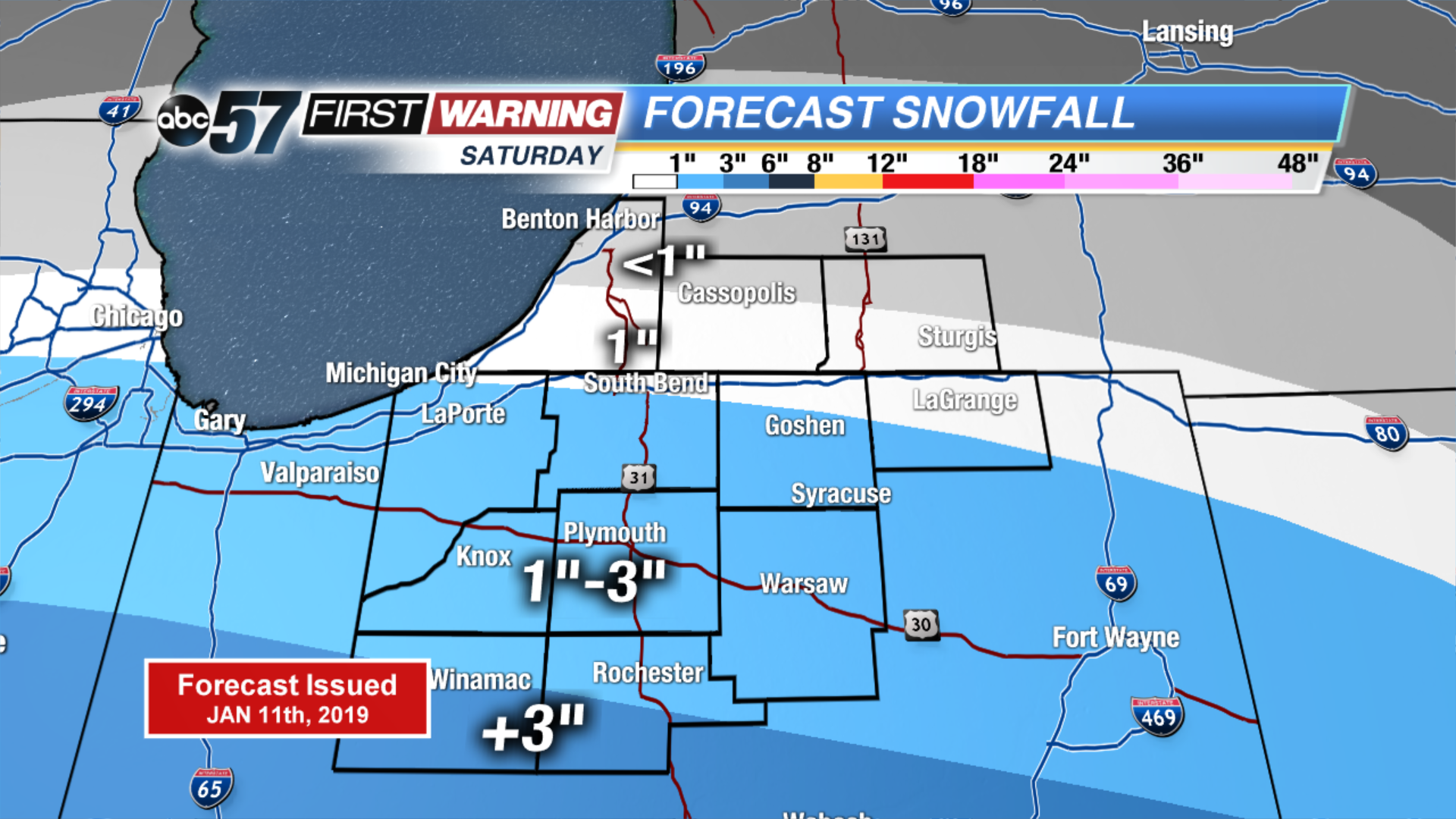
Snow starts for some Saturday morning, increasing northward with a peak of steady snow through the afternoon and evening, ending around midnight. Michiana remains on the edge of this headline Midwest storm with marginal amounts predicted mostly in the one to three inch range. Areas south of U.S. Highway 30 will see the most snow, with the likelihood of six inches towards Indianapolis. Skies clear into Sunday, fair weather to end the weekend and to start next week.
Tonight: Cloudy. Low of 24.
Saturday: Snow showers. High of 32.
Sunday: Mostly sunny. High of 32.
Monday: Mostly sunny. High of 34.
Sign up for the ABC 57Newsletter