Severe storm update Wednesday afternoon

-
3:01

New Buffalo Area Schools to build workforce housing
-
7:27

Center for the Homeless hosting Dancing With Our Stars
-
2:10

More wet weather arriving later tonight, but sunnier skies after
-
3:16

Public input on the proposal to restart the Palisades Nuclear...
-
1:35

Dari Fair opened Wednesday for 2024 season, temperatures cool...
-
1:22

Another round of rain, then a cool weekend
-
4:33

Should Indiana’s abortion records be public?
-
2:52

Trailblazing promotions at the South Bend Fire Department
-
1:30

Downtown South Bend and Notre Dame to see improved connectivity
-
1:44

Storm threat today holds relatively low severe risk
-
0:30

Officials share opioid settlement funding plan
-
1:04

Bonneyville Mill opens for the 2024 season

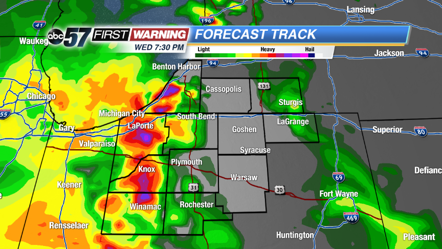 The same run of Forecast Track shows another round after 7 p.m.
The hot and humid weather will help to fuel scattered showers and storms this afternoon and evening. Some storms could become strong to severe with damaging winds, hail and heavy rain possible. A determining factor in storm strength will be development to our west and how much cloud cover we see ahead of storms. There could a an early round of scattered storms after 4 p.m. followed by a second round after 7 p.m.
We’ll dry out some during the overnight hours, but more morning rain is possible tomorrow. Skies become partly sunny for the second half of Thursday with more storms chances into the weekend.
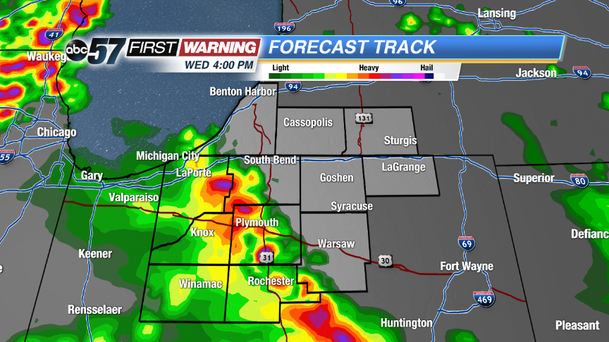 Hi-Res run of Forecast Track shows the first round of scattered storms around 4 p.m. moving in from the southwest.
Tonight: Scattered showers and storms. Some could be strong to severe. Lows near 70.
Thursday: Morning showers and storms then partly sunny, high in the upper 80s.
Friday: PM scattered storms, highs in the upper 80s.
Saturday: More scattered showers and storms, highs in the upper 80s.