Round Three: More heavy rain overnight

-
1:26

Brisk but beautiful weekend
-
5:15

ABC57’s Arts and Acts: All-American Rejects comes to South...
-
2:08

Whirlpool and Lake Michigan College host second Girls Rock IT...
-
2:24

Suspect arrested for allegedly sexually assaulting two girls...
-
0:25

Humane Society of St. Joseph County holds microchip clinic
-
2:58

Pulaski County Community Foundation provides support for childcare...
-
3:14

Green wave of economic growth in Michigan from marijuana dispensaries
-
1:28

Brisk, breezy but beautiful weekend
-
0:48

University Park Mall holding parking-lot carnival this week
-
1:52

While the rain is over, the cooling temperatures are not
-
2:28

Public forum hosted by John Glenn High School students
-
3:34

Kickoff preview with ABC57’s Allison Hayes

Update: Round three will bring another round of heavy rain after midnight, lightning and thunder. The severe threat remains low but flooded roads my persist into Tuesday morning.
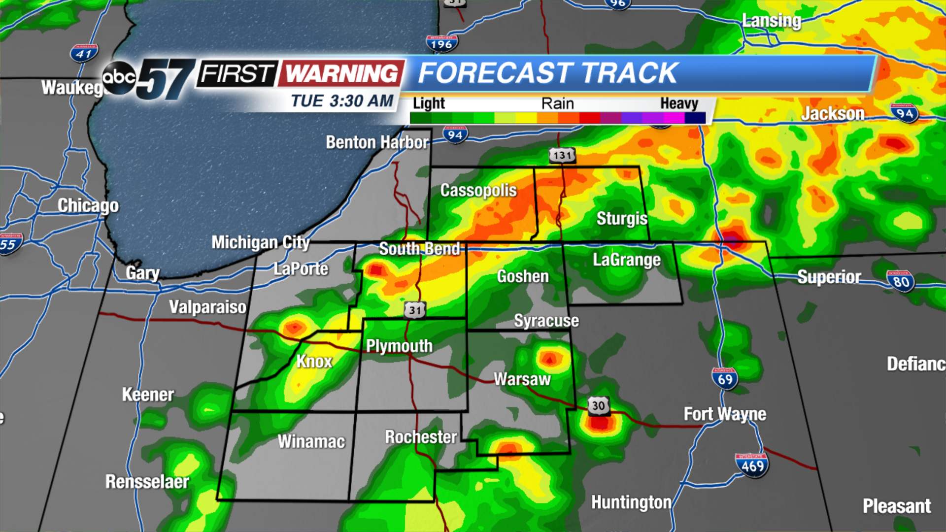
Another round of thunderstorms will roll through Michiana this evening. The window for possible severe weather and flooding will be between 7 PM and midnight. Threats include gusty wind, hail, lightning, heavy rain and flooding.
Showers start Tuesday, then clouds gradually break the rest of the day. A few much needed dry days return to the forecast midweek. Wednesday and Thursday will be drier and less humid with sunshine. The humidity build again to end the week along with the chance of showers and Thunderstorms.
Tonight: Thunderstorms are likely, showers linger into the morning, low 62.
Tuesday: Morning showers, gradually clearing, high 72.
Wednesday: Mostly sunny, highs in the mid-70s.
Thursday: Mostly sunny, highs in the mid-70s.